MyTopo
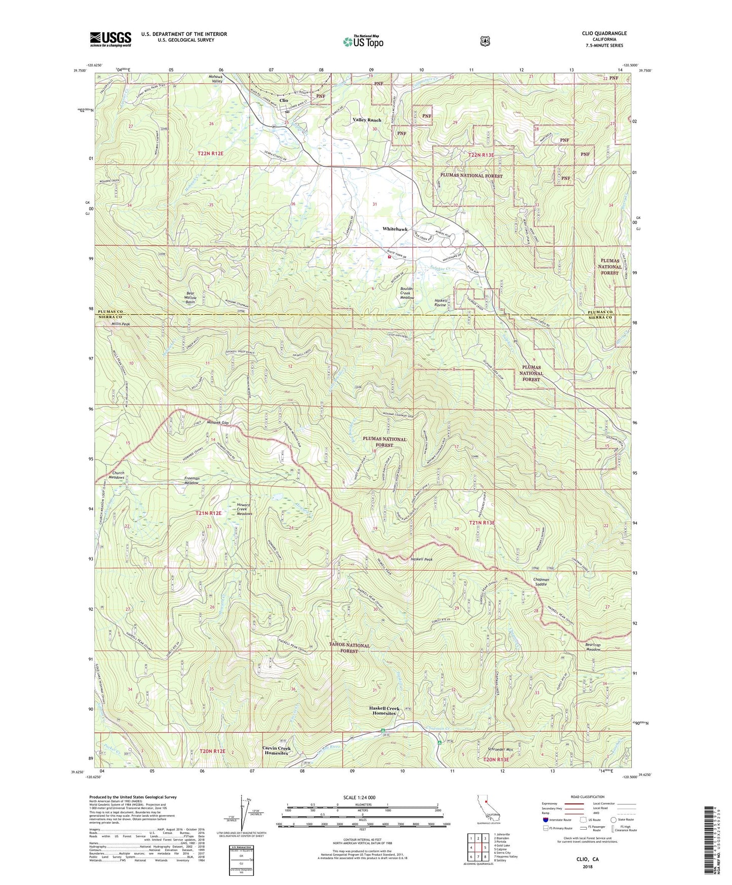
Clio California US Topo Map
Couldn't load pickup availability
Also explore the Clio Forest Service Topo of this same quad for updated USFS data
2021 topographic map quadrangle Clio in the state of California. Scale: 1:24000. Based on the newly updated USGS 7.5' US Topo map series, this map is in the following counties: Sierra, Plumas. The map contains contour data, water features, and other items you are used to seeing on USGS maps, but also has updated roads and other features. This is the next generation of topographic maps. Printed on high-quality waterproof paper with UV fade-resistant inks.
Quads adjacent to this one:
West: Gold Lake
Northwest: Johnsville
North: Blairsden
Northeast: Portola
East: Calpine
Southeast: Sattley
South: Haypress Valley
Southwest: Sierra City
This map covers the same area as the classic USGS quad with code o39120f5.
Contains the following named places: Antelope House, Arctic Mine, Barry Creek, Bear Wallow Basin, Beartrap Meadow, Big Boulder Creek, Boulder Creek Meadow, Calfpasture Creek, Campbell Sheep Camp, Carvin Creek, Carvin Creek Homesites, Chapman Creek, Chapman Creek Campground, Chapman Saddle, Church Meadows, Clio, Clio Forest Service Facility, Clio Post Office, Downieville Scout Camp, Freeman Meadow, Gold Lake Administration Cabin, Graeagle Fire Rescue White Hawk Ranch, Haskell Creek, Haskell Creek Homesites, Haskell Peak, Haskell Ravine, Hayes Mine, Howard Creek Meadows, Kelly Cabin, Leonard Creek, Little Boulder Creek, Locke Mine, Lodgepole Campground, McLear Resort, Millis Peak, Mohawk Creek, Mohawk Gap, Mohawk Valley Ranch, Packer Creek, Pioneer Campground, Pioneer Lodge, Placer Mine, Sacramento Boy Scout Camp, Salmon Creek Campground, Schroeder Mountain, Sierra Campground, Sulphur Creek, Sulphur Spring House, Valley Ranch, Valley Ranch Census Designated Place, Whitehawk, Whitehawk Census Designated Place, Willow Creek, Woodchuck Mine, Yolo County Boys Camp, ZIP Code: 96106