MyTopo
Blythe NE California US Topo Map
Couldn't load pickup availability
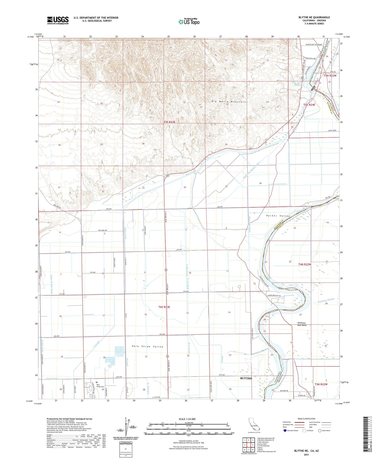
2021 topographic map quadrangle Blythe NE in the states of California, Arizona. Scale: 1:24000. Based on the newly updated USGS 7.5' US Topo map series, this map is in the following counties: Riverside, La Paz. The map contains contour data, water features, and other items you are used to seeing on USGS maps, but also has updated roads and other features. This is the next generation of topographic maps. Printed on high-quality waterproof paper with UV fade-resistant inks.
Quads adjacent to this one:
West: McCoy Wash
Northwest: Big Maria Mountains SW
North: Big Maria Mountains SE
Northeast: Moon Mountain
East: La Paz Mountain
Southeast: Dome Rock Mountains SW
South: Blythe
Southwest: Ripley
This map covers the same area as the classic USGS quad with code o33114f5.
Contains the following named places: A Canal, Collis Mayflower County Park, D- 08 Canal, Duplicate Main Canal, F- 02 Canal, Fertilla, Goodman Slough, Granite Point, Long Shoals, Main Canal, Olive Lake Drain, Palo Verde Cemetery, Palo Verde Dam, Palo Verde Intake, Swallows Nest Bend, Tosco, Upper West Side Drain