MyTopo
Bonsall California US Topo Map
Couldn't load pickup availability
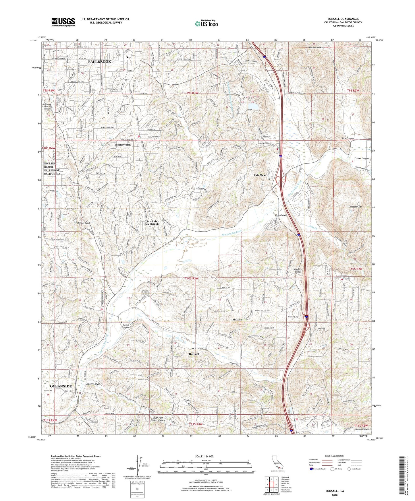
2022 topographic map quadrangle Bonsall in the state of California. Scale: 1:24000. Based on the newly updated USGS 7.5' US Topo map series, this map is in the following counties: San Diego. The map contains contour data, water features, and other items you are used to seeing on USGS maps, but also has updated roads and other features. This is the next generation of topographic maps. Printed on high-quality waterproof paper with UV fade-resistant inks.
Quads adjacent to this one:
West: Morro Hill
Northwest: Fallbrook
North: Temecula
Northeast: Pechanga
East: Pala
Southeast: Valley Center
South: San Marcos
Southwest: San Luis Rey
This map covers the same area as the classic USGS quad with code o33117c2.
Contains the following named places: Adler Creek, All Seasons Recreational Vehicle Park and Campground, Beck Grove, Bonsall, Bonsall Census Designated Place, Bonsall Chamber of Commerce, Bonsall Middle School, Bonsall Post Office, Bonsall Preserve, Bonsall Primary Elementary School, CAL FIRE Miller Station 15, Christ the King Lutheran Church, Circle R Golf Resort, Circle R Ranch, Community Baptist Church, Couser Canyon, Deer Springs Fire Protection District Station 1, Dinwiddie Preserve, Duffy Ranch, Dulin Ranch, Fallbrook Assembly of God Church, Fallbrook Census Designated Place, Fallbrook Country Club, Fallbrook High School, Fallbrook Presbyterian Church, Fallbrook Tennis Club, Gird Pumping Station, Gopher Canyon, Hellers Bend, Ivy High School, John Culbertson Winery, Keys Canyon, Keys Creek, Lancaster Mountain, Live Oak Elementary School, Live Oak Park, Los Jilgueros Preserve, McManigle Grove, Monserate, Monserate Mountain, Moosa Canyon, Mount Ararat, North County Fire Protection District Station 2, North County Fire Protection District Station 4, North County Fire Protection District Station 5, Pala Mesa, Pala Mesa Golf Club, Palomar School, Palomares House and Park, Potter Junior High School, Rancho Monserate Country Club, Rancho Viejo, Rawhide Christian School, Rice Canyon, River Village San Luis Rey Shopping Center, San Diego County Sheriff's Department Bonsall Storefront Office, San Luis Rey Down Thoroughbred Training Center, San Luis Rey Downs Country Club, San Luis Rey Downs Golf Resort, San Luis Rey Heights, San Luis Rey Race Track, South Fork Gopher Canyon, Sullivan Middle School, The Church of Jesus Christ of Latter Day Saints, United Methodist Church of Fallbrook, Vista Paloma Riders Rodeo Arena, West Lilac Bridge, Winterwarm, ZIP Code: 92003