MyTopo
Fallbrook California US Topo Map
Couldn't load pickup availability
Also explore the Fallbrook Forest Service Topo of this same quad for updated USFS data
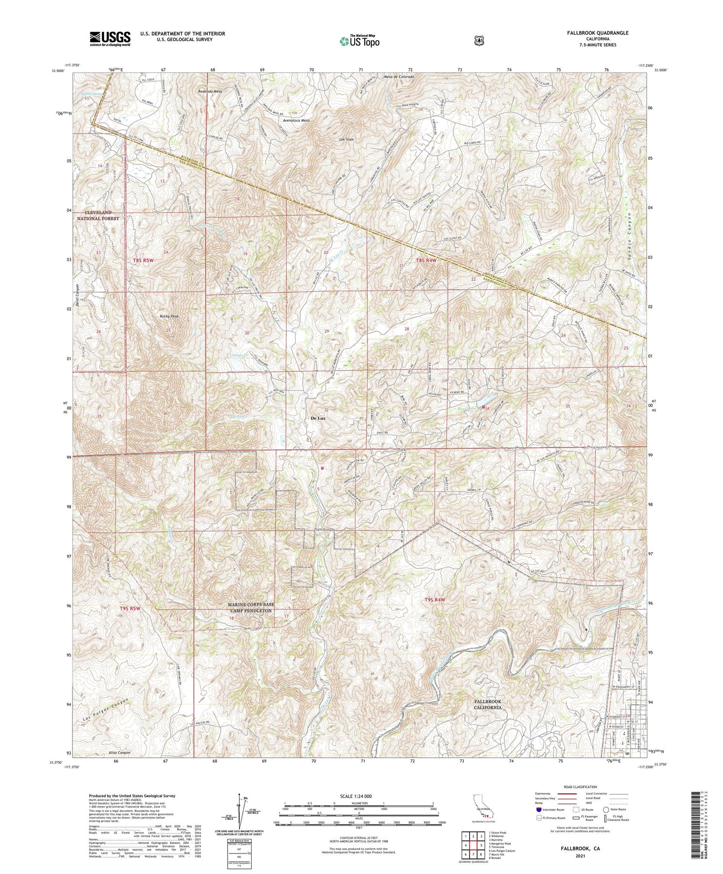
2021 topographic map quadrangle Fallbrook in the state of California. Scale: 1:24000. Based on the newly updated USGS 7.5' US Topo map series, this map is in the following counties: San Diego, Riverside. The map contains contour data, water features, and other items you are used to seeing on USGS maps, but also has updated roads and other features. This is the next generation of topographic maps. Printed on high-quality waterproof paper with UV fade-resistant inks.
Quads adjacent to this one:
West: Margarita Peak
Northwest: Sitton Peak
North: Wildomar
Northeast: Murrieta
East: Temecula
Southeast: Bonsall
South: Morro Hill
Southwest: Las Pulgas Canyon
This map covers the same area as the classic USGS quad with code o33117d3.
Contains the following named places: Apostolic Assembly of the Faith in Christ Church, Avenaloca Mesa, California Department of Forestry and Fire Protection De Luz Fire Station 16, Camps Creek, Chapel of the Hill Foursquare Church, Church of Christ, Cottonwood Creek, De Luz, De Luz Elementary School, De Luz Heights, De Luz Volunteer Fire Department, Dittermore Ranch, Doville Ranch, Fallbrook, Fallbrook Branch San Diego County Library, Fallbrook Church of Christ, Fallbrook Division, Fallbrook First Baptist Church, Fallbrook Mercantile Shopping Center, Fallbrook Post Office, Fallbrook Street Elementary School, Fern Creek, Ferndale Ranch, First Christian Church, First Church of God, Garnsay Ranch, Jave Ranch, Johnson Ranch, Maie Ellis Elementary School, Marchant Ranch, Matthews 858 Dam, Oak Slope, Redonda Mesa, Richman Ranch, Roblar Creek, Rocky Peak, Ross Lake, Santa Margarita Groves, Sky Ranch, Village Park, Village Square Park, Willow Spring