MyTopo
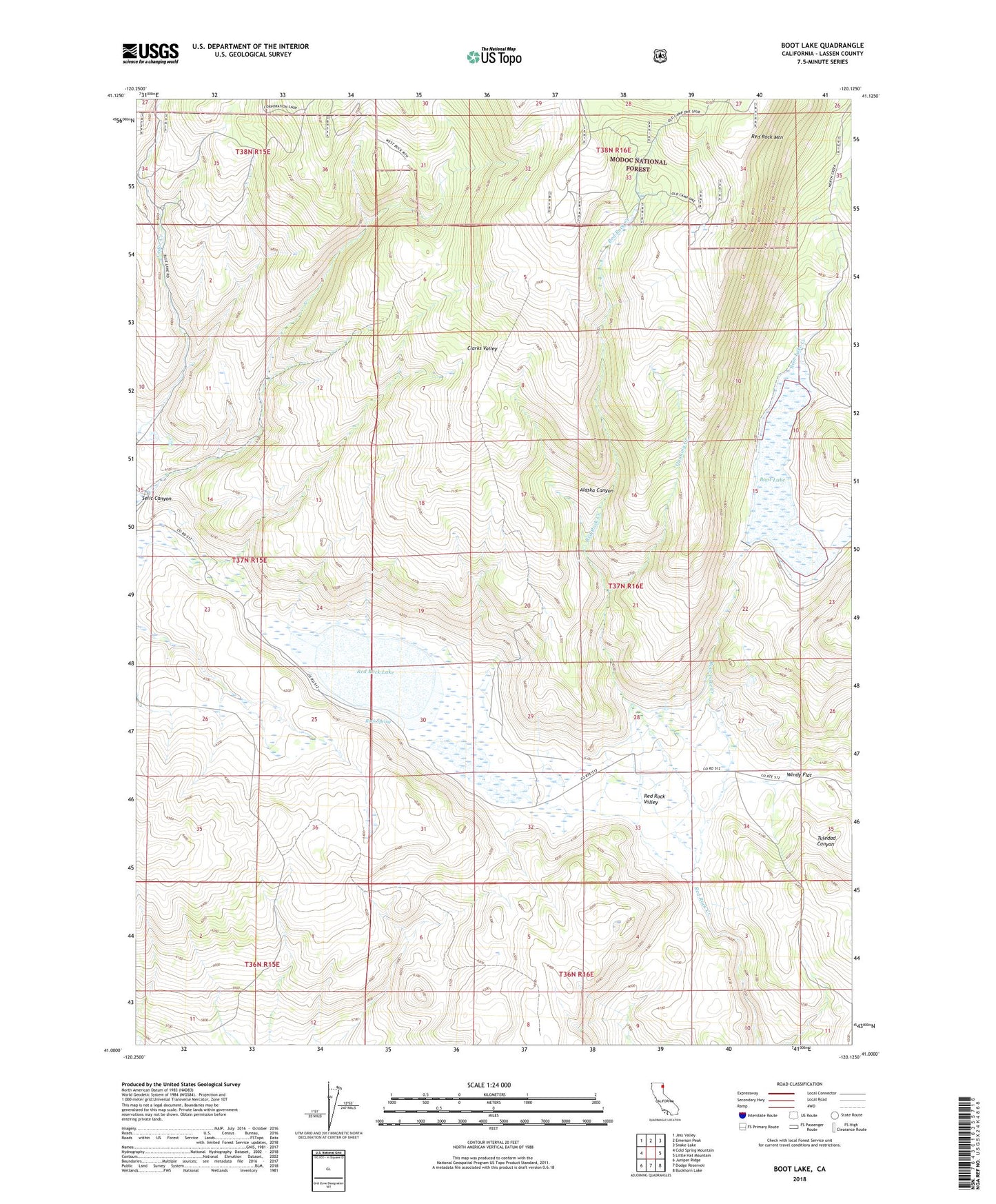
Boot Lake California US Topo Map
Couldn't load pickup availability
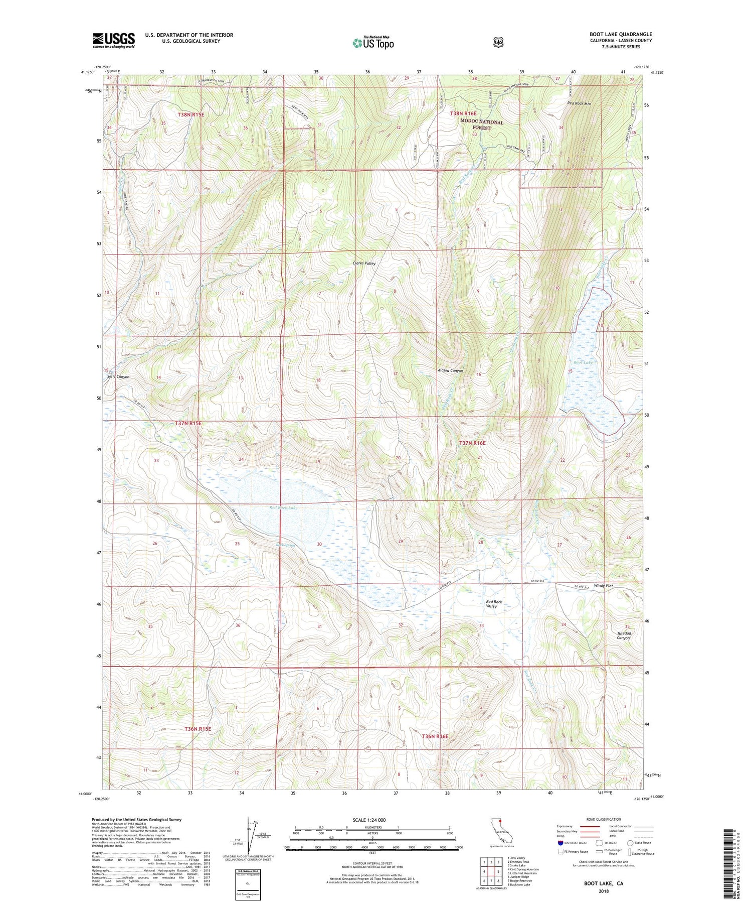
Also explore the Boot Lake Forest Service Topo of this same quad for updated USFS data
2021 topographic map quadrangle Boot Lake in the state of California. Scale: 1:24000. Based on the newly updated USGS 7.5' US Topo map series, this map is in the following counties: Lassen. The map contains contour data, water features, and other items you are used to seeing on USGS maps, but also has updated roads and other features. This is the next generation of topographic maps. Printed on high-quality waterproof paper with UV fade-resistant inks.
Quads adjacent to this one:
West: Cold Spring Mountain
Northwest: Jess Valley
North: Emerson Peak
Northeast: Snake Lake
East: Little Hat Mountain
Southeast: Buckhorn Lake
South: Dodge Reservoir
Southwest: Juniper Ridge
This map covers the same area as the classic USGS quad with code o41120a2.
Contains the following named places: Alaska Canyon, Boot Lake, Boot Lake Creek, Clarks Valley Ranch, Evans Place, Hornback Ranch, Quaking Creek, Red Rock Lake, Red Rock Ranch, Red Rock Valley, Rock Spring, Selic Canyon, Windy Flat