
MyTopo
Snake Lake California US Topo Map
Couldn't load pickup availability
Also explore the Snake Lake Forest Service Topo of this same quad for updated USFS data
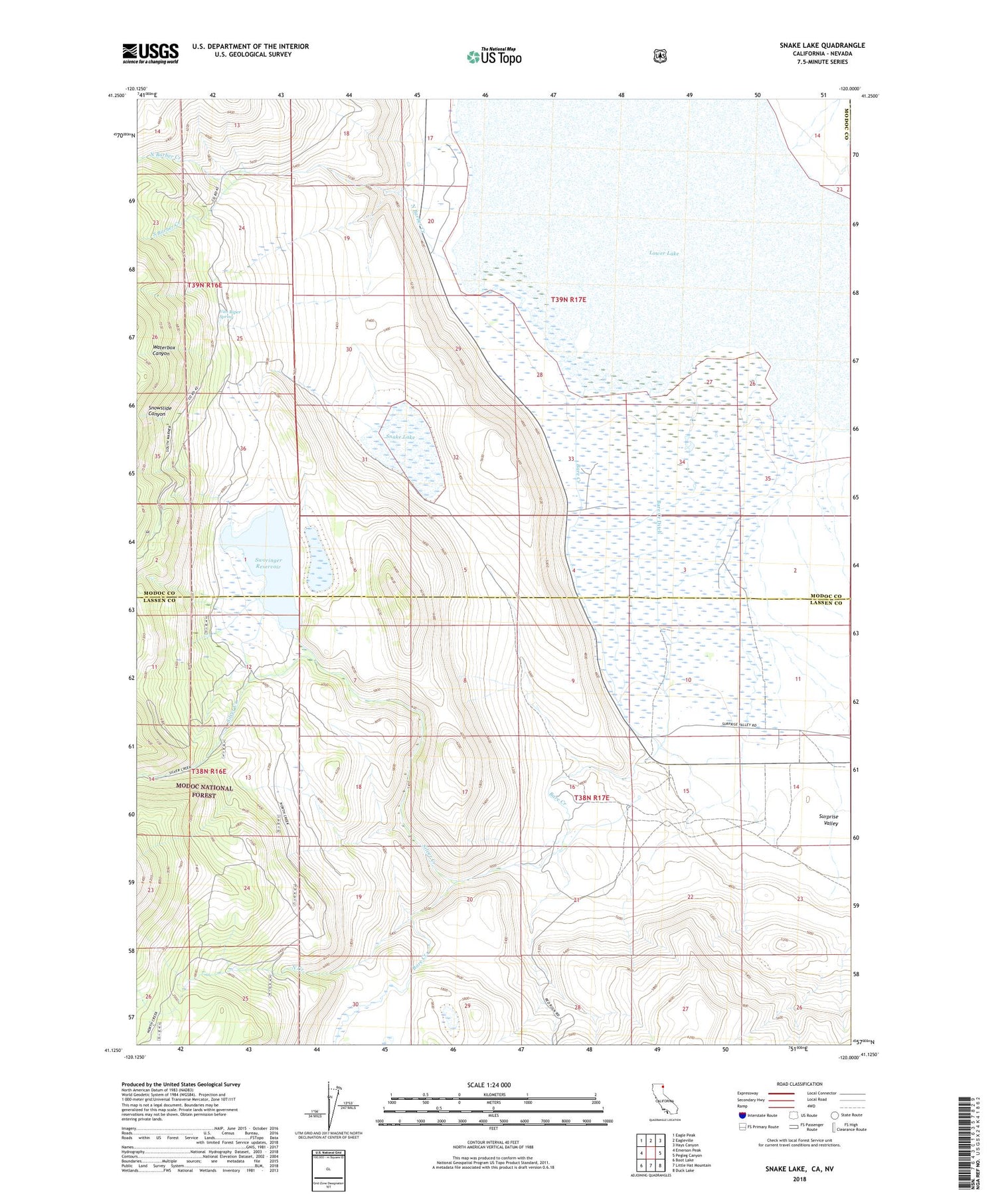
2022 topographic map quadrangle Snake Lake in the state of California. Scale: 1:24000. Based on the newly updated USGS 7.5' US Topo map series, this map is in the following counties: Modoc, Lassen, Washoe. The map contains contour data, water features, and other items you are used to seeing on USGS maps, but also has updated roads and other features. This is the next generation of topographic maps. Printed on high-quality waterproof paper with UV fade-resistant inks.
Quads adjacent to this one:
West: Emerson Peak
Northwest: Eagle Peak
North: Eagleville
Northeast: Hays Canyon
East: Pegleg Canyon
Southeast: Duck Lake
South: Little Hat Mountain
Southwest: Boot Lake
This map covers the same area as the classic USGS quad with code o41120b1.
Contains the following named places: Bare Creek, Bare Creek Ditch, Bare Ranch, Bare Ranch Airport, Lower Lake, North Barber Creek, North Creek, Silver Creek, Snake Lake, Snowslide Canyon, South Barber Creek, Sworinger 1257 Dam, Sworinger Reservoir, Van Riper Spring, Waterbox Canyon


