MyTopo
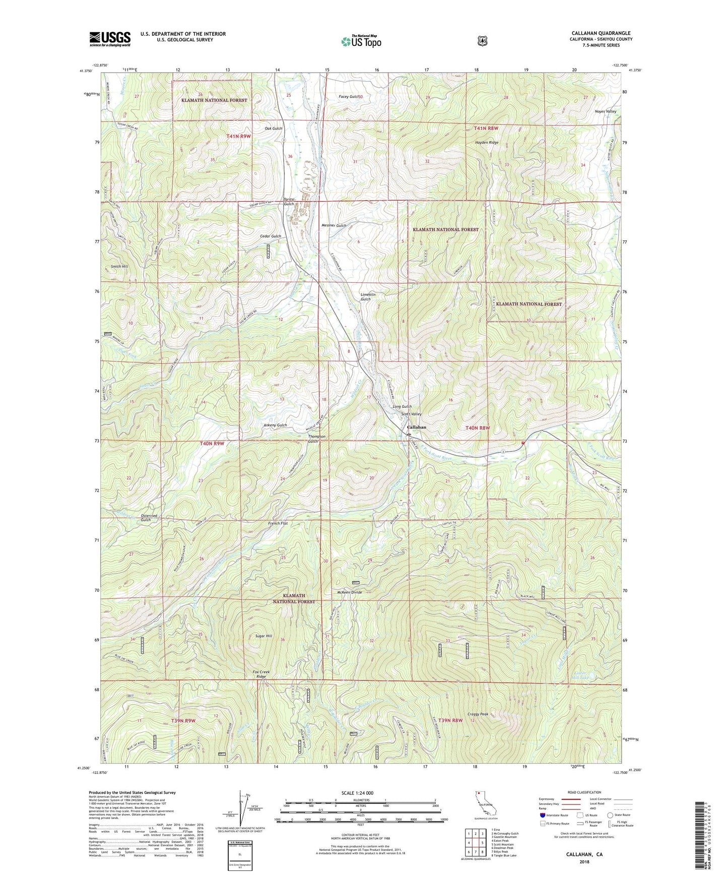
Callahan California US Topo Map
Couldn't load pickup availability
Also explore the Callahan Forest Service Topo of this same quad for updated USFS data
2023 topographic map quadrangle Callahan in the state of California. Scale: 1:24000. Based on the newly updated USGS 7.5' US Topo map series, this map is in the following counties: Siskiyou. The map contains contour data, water features, and other items you are used to seeing on USGS maps, but also has updated roads and other features. This is the next generation of topographic maps. Printed on high-quality waterproof paper with UV fade-resistant inks.
Quads adjacent to this one:
West: Eaton Peak
Northwest: Etna
North: McConaughy Gulch
Northeast: Gazelle Mountain
East: Scott Mountain
Southeast: Tangle Blue Lake
South: Billys Peak
Southwest: Deadman Peak
This map covers the same area as the classic USGS quad with code o41122c7.
Contains the following named places: Ankeny Gulch, Big Mill Creek, Blue Jay Creek, Blue Mine, Bolivar Lookout, Boulder Creek, Callahan, Callahan Camp, Callahan Catholic Cemetery, Callahan Hayden Cemetery, Callahan Post Office, Callahan Work Center, Cedar Gulch, Craggy Peak, East Boulder Creek, East Fork Scott River, Eton Mine, Facey Gulch, Fox Creek, French Flat, Hayden Ridge, Hjertager Mill, Limekiln Gulch, Little Mill Creek, Long Gulch, Lower Mill Lake, McKeen Divide, McKeen Mine, Messner Gulch, Noyes Valley, Noyes Valley Creek, Oak Gulch, Osterried Gulch, Rodney's Mobile Park, Scott Valley Fire Protection District Callahan, Slide Creek, Smith Hill, Society Girl Mine, South Fork Scott River, Sugar Creek, Sugar Hill, Sugar Hill Mine, Taritsi Gulch, Taylor Creek, Thompson Gulch, Tiger Fork, Vanderpoole Mill, West Boulder Creek, Wildcat Creek, Wolf Creek, ZIP Code: 96014