MyTopo
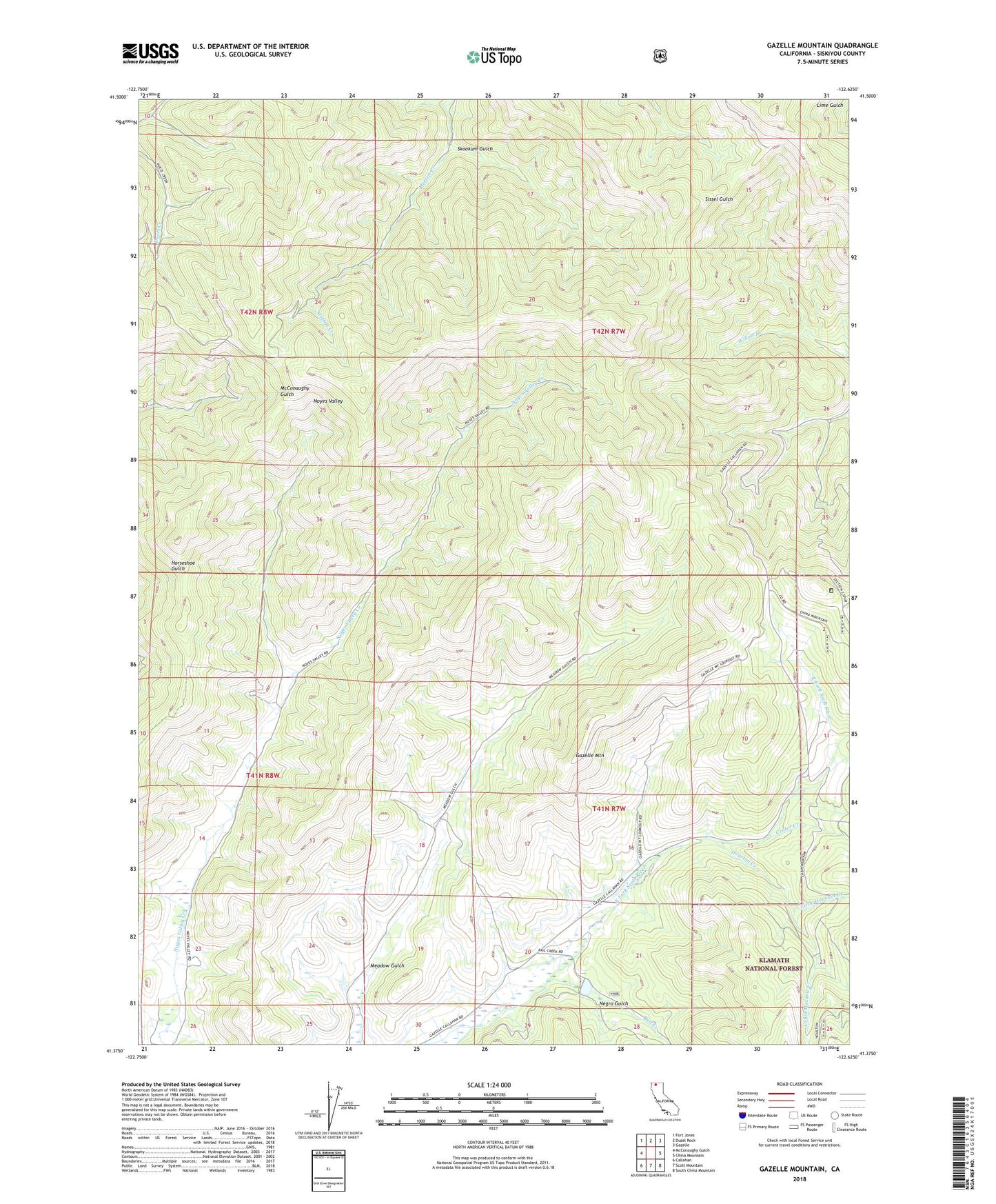
Gazelle Mountain California US Topo Map
Couldn't load pickup availability
Also explore the Gazelle Mountain Forest Service Topo of this same quad for updated USFS data
2021 topographic map quadrangle Gazelle Mountain in the state of California. Scale: 1:24000. Based on the newly updated USGS 7.5' US Topo map series, this map is in the following counties: Siskiyou. The map contains contour data, water features, and other items you are used to seeing on USGS maps, but also has updated roads and other features. This is the next generation of topographic maps. Printed on high-quality waterproof paper with UV fade-resistant inks.
Quads adjacent to this one:
West: McConaughy Gulch
Northwest: Fort Jones
North: Duzel Rock
Northeast: Gazelle
East: China Mountain
Southeast: South China Mountain
South: Scott Mountain
Southwest: Callahan
This map covers the same area as the classic USGS quad with code o41122d6.
Contains the following named places: Cabin Meadow Creek, Crater Creek, Gazelle Mountain, Houston Creek, Little Houston Creek, Mountain House, Mountain House Creek, Negro Gulch, Parker Ranch, Pedro Cabin, Rail Creek, Scarface Ridge, Schmitt Mill, Skookum Gulch