MyTopo
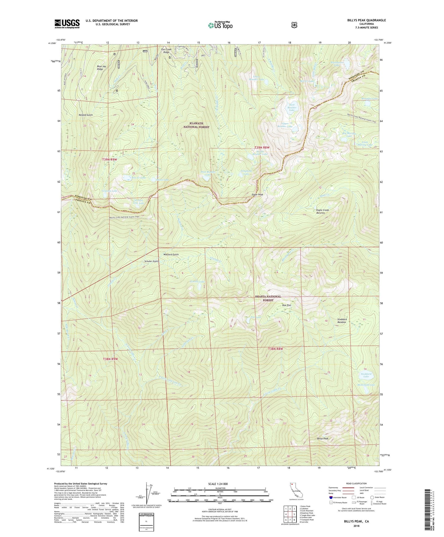
Billys Peak California US Topo Map
Couldn't load pickup availability
Also explore the Billys Peak Forest Service Topo of this same quad for updated USFS data
2022 topographic map quadrangle Billys Peak in the state of California. Scale: 1:24000. Based on the newly updated USGS 7.5' US Topo map series, this map is in the following counties: Trinity, Siskiyou. The map contains contour data, water features, and other items you are used to seeing on USGS maps, but also has updated roads and other features. This is the next generation of topographic maps. Printed on high-quality waterproof paper with UV fade-resistant inks.
Quads adjacent to this one:
West: Deadman Peak
Northwest: Eaton Peak
North: Callahan
Northeast: Scott Mountain
East: Tangle Blue Lake
Southeast: Carrville
South: Ycatapom Peak
Southwest: Caribou Lake
This map covers the same area as the classic USGS quad with code o41122b7.
Contains the following named places: Big Marshy Lake, Billys Peak, Bloody Run Creek, Blue Jay Ridge, Cement Banks, Cement Creek, Doe Flat, Doe Lake, Eagle Creek Benches, Eagle Peak, East Boulder Lake, Engle Mine, Fox Creek Lake, Fox Creek Ridge, Francis Cabin, Granite Creek, Granite Lake, Gypsy Queen Mine, Hodges Cabin, Holland Mine, Klatt Mine, Lick Creek, Little Lick Creek, Little Marshy Lake, Loftus Mine, Lower Boulder Lake, Mary Queen Mine, Mavis Lake, McDonald Lake, Middle Boulder Lake, Milk Ranch Creek, Mill Creek Lake, Mosquito Lake, Saloon Creek, Schuler Gulch, Section Line Lake, South Fork Little Lick Creek, Stoddard Cabin, Stoddard Lake, Stoddard Meadow, Telephone Lake, Upper Boulder Lake, Virginia Lake, Washbasin Lake, West Boulder Lake, Wolford Cabin, Wolford Creek, Wolford Gulch