MyTopo
Cape Mendocino California US Topo Map
Couldn't load pickup availability
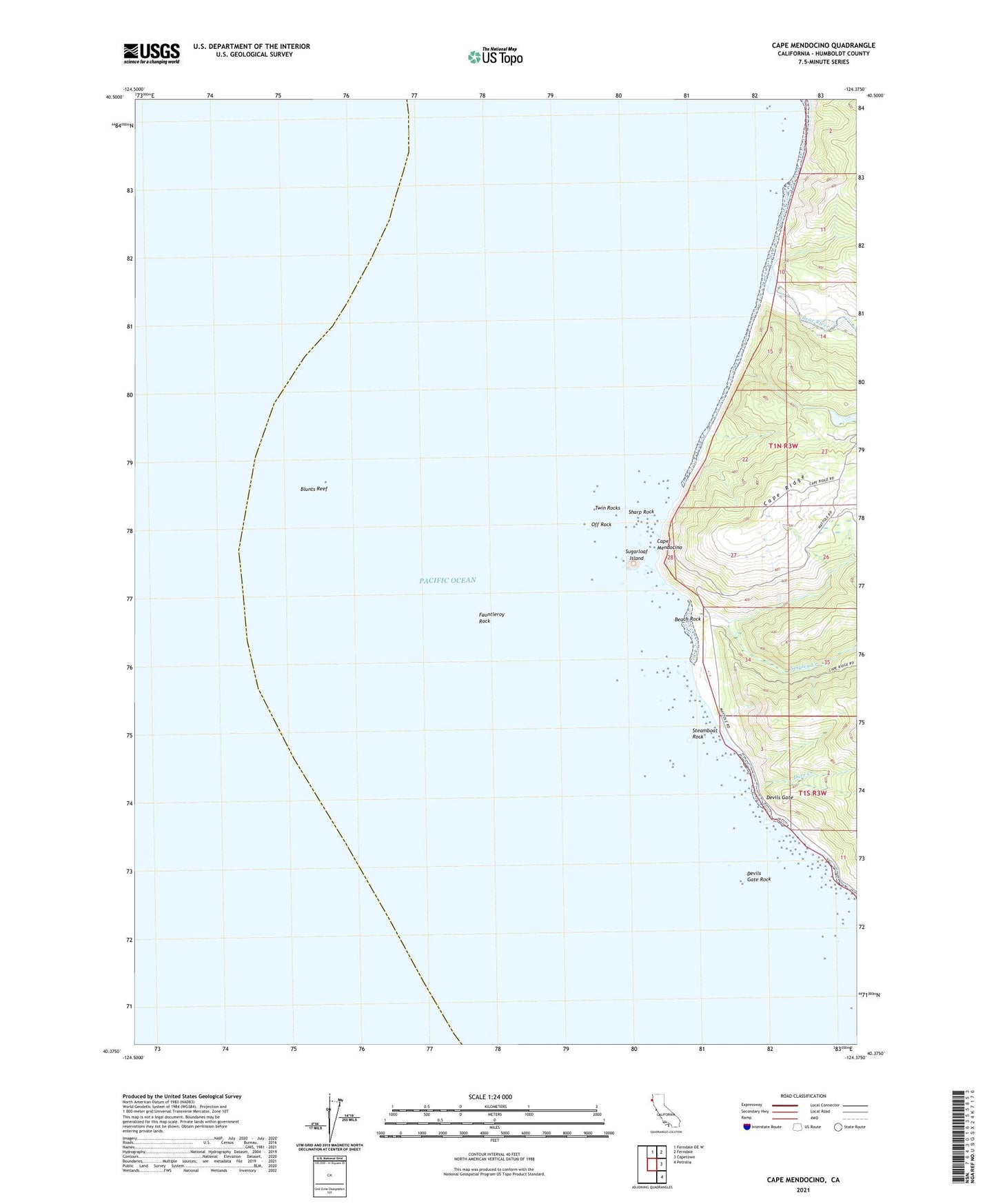
2021 topographic map quadrangle Cape Mendocino in the state of California. Scale: 1:24000. Based on the newly updated USGS 7.5' US Topo map series, this map is in the following counties: Humboldt. The map contains contour data, water features, and other items you are used to seeing on USGS maps, but also has updated roads and other features. This is the next generation of topographic maps. Printed on high-quality waterproof paper with UV fade-resistant inks.
Quads adjacent to this one:
North: Ferndale OE W
Northeast: Ferndale
East: Capetown
Southeast: Petrolia
This map covers the same area as the classic USGS quad with code o40124d4.
Contains the following named places: Beach Rock, Bear River, Blunts Reef, Cape Mendocino, Cape Mendocino Lighthouse, Cape Ranch, Devils Gate, Devils Gate Rock, Durr Creek, Fauntleroy Rock, Ocean House, Off Rock, Outer Break, Sharp Rock, Singley Creek, Steamboat Rock, Sugarloaf Island, The Great Break, Twin Rocks