MyTopo
Capetown California US Topo Map
Couldn't load pickup availability
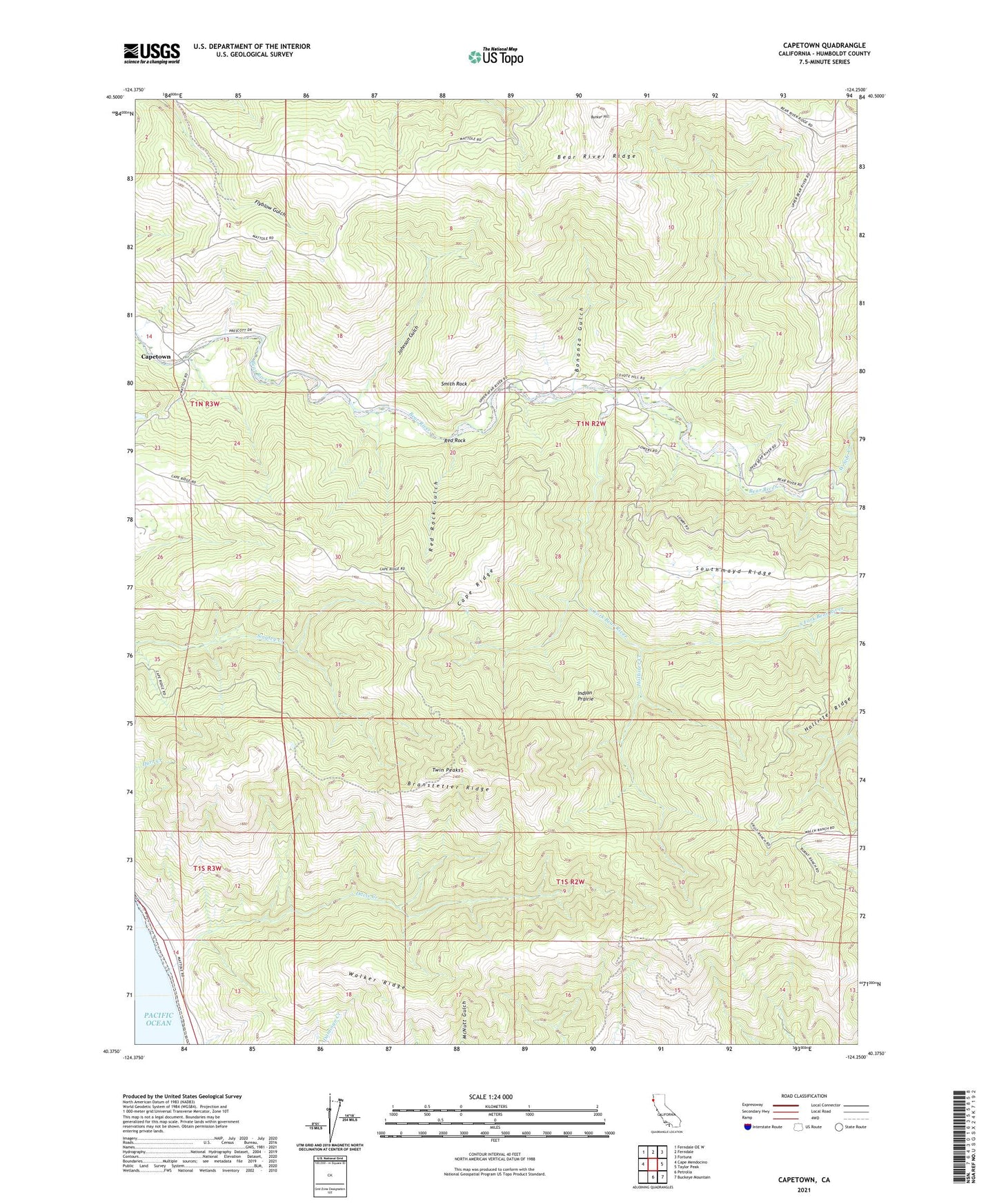
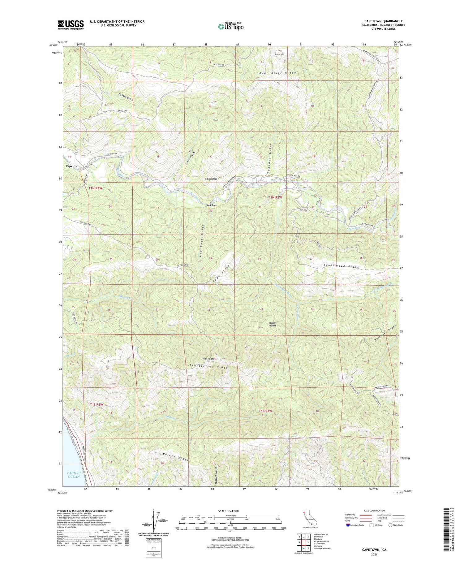
2021 topographic map quadrangle Capetown in the state of California. Scale: 1:24000. Based on the newly updated USGS 7.5' US Topo map series, this map is in the following counties: Humboldt. The map contains contour data, water features, and other items you are used to seeing on USGS maps, but also has updated roads and other features. This is the next generation of topographic maps. Printed on high-quality waterproof paper with UV fade-resistant inks.
Quads adjacent to this one:
West: Cape Mendocino
Northwest: Ferndale OE W
North: Ferndale
Northeast: Fortuna
East: Taylor Peak
Southeast: Buckeye Mountain
South: Petrolia
This map covers the same area as the classic USGS quad with code o40124d3.
Contains the following named places: Bonanza Gulch, Bonanza Ranch, Branstetter Ridge, Bunker Hill, Cape Ridge, Capetown, Davis Creek, Ferndale Division, Green Pond Ranch, Hollister Creek, Hollister Ridge, Indian Prairie, Johnson Gulch, Red Rock, Red Rock Gulch, Smith Rock, South Fork Bear River, Twin Peaks, Walker Ridge, West Side Creek