MyTopo
Mixie Flat Nevada US Topo Map
Couldn't load pickup availability
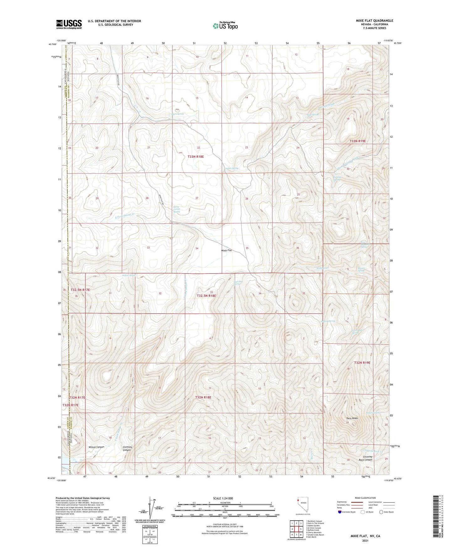
2021 topographic map quadrangle Mixie Flat in the states of Nevada, California. Scale: 1:24000. Based on the newly updated USGS 7.5' US Topo map series, this map is in the following counties: Washoe, Lassen. The map contains contour data, water features, and other items you are used to seeing on USGS maps, but also has updated roads and other features. This is the next generation of topographic maps. Printed on high-quality waterproof paper with UV fade-resistant inks.
Quads adjacent to this one:
West: Al Shinn Canyon
Northwest: Buckhorn Canyon
North: Hole In The Ground
Northeast: Eddies Garden
East: Buffalo Creek
Southeast: Salt Marsh
South: Smoke Creek Ranch
Southwest: Cherry Mountain
This map covers the same area as the classic USGS quad with code o40119f8.
Contains the following named places: Bernice Spring, Byers Spring, Chimney Canyon, East Fork Smoke Creek, Horse Corral Spring, Indian Spring, Lone Mountain Spring, Mixie Flat, Parsnip Spring, Rogers Spring, Sage Hen Spring, Sage Spring, Smoke Creek 1236 Dam, Summit Spring, Twin Peaks, Twin Peaks Spring, Wilcox Canyon, Wilcox Spring