MyTopo
Chocolate Mountain California US Topo Map
Couldn't load pickup availability
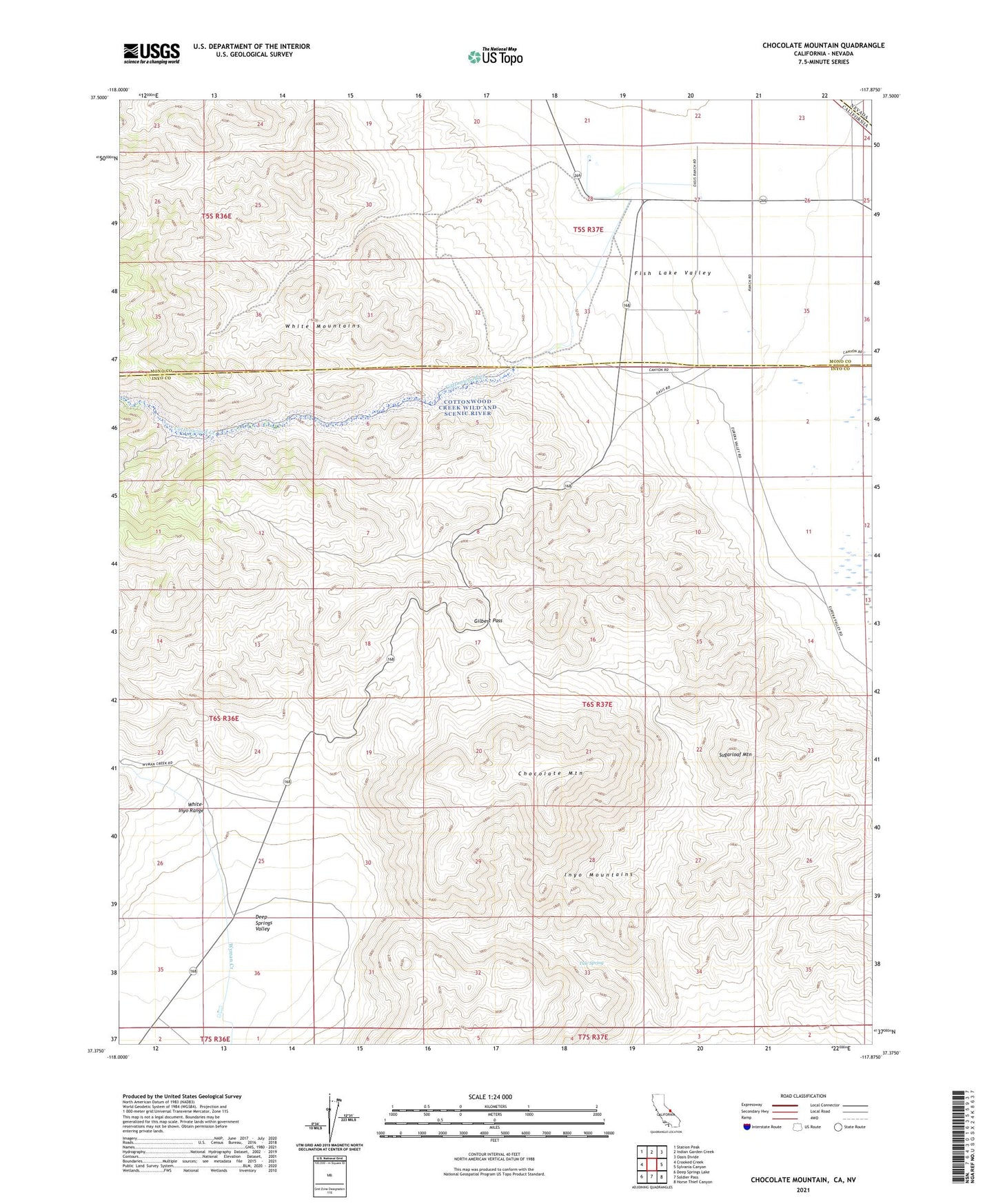
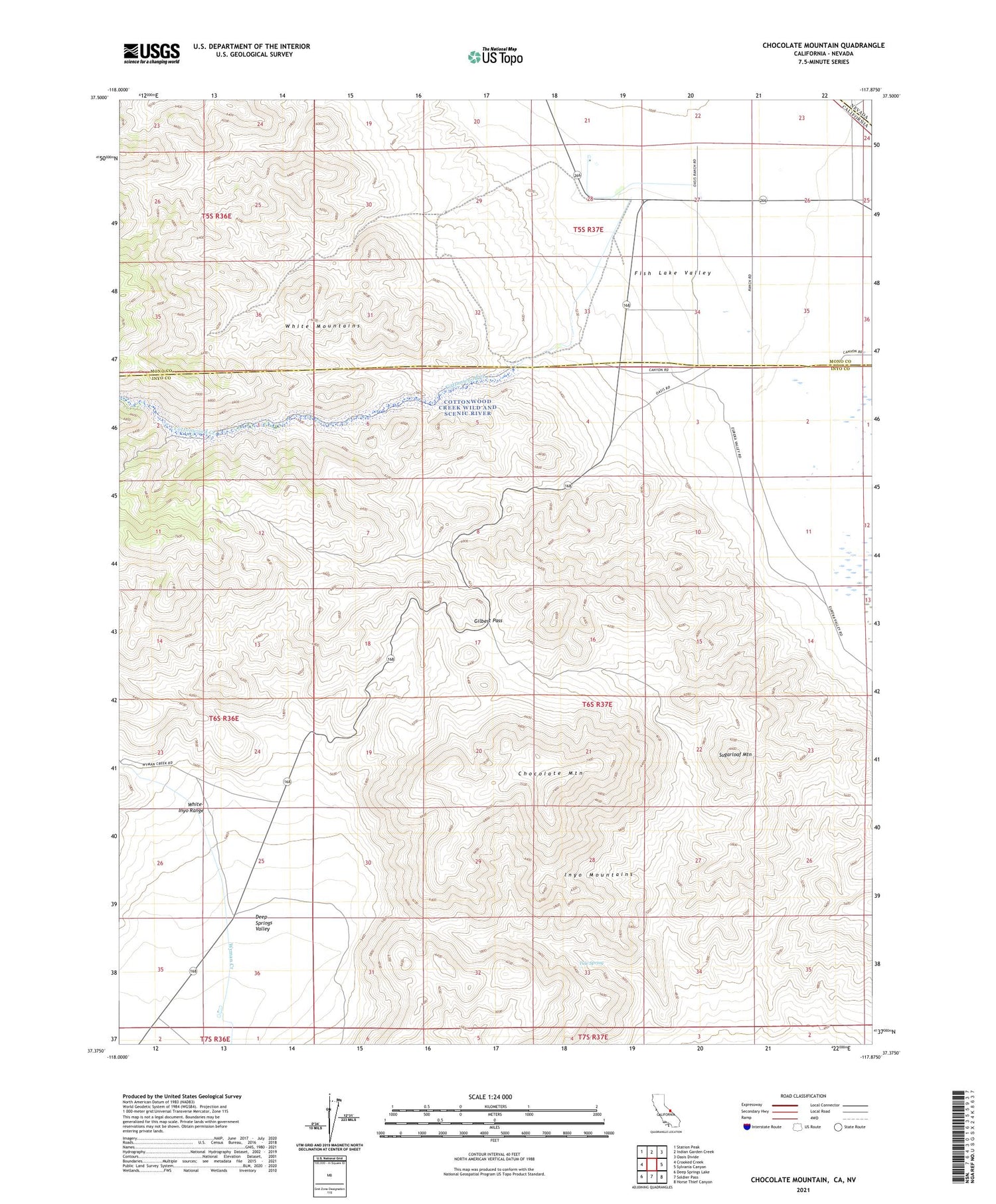
2021 topographic map quadrangle Chocolate Mountain in the state of California. Scale: 1:24000. Based on the newly updated USGS 7.5' US Topo map series, this map is in the following counties: Mono, Inyo, Esmeralda. The map contains contour data, water features, and other items you are used to seeing on USGS maps, but also has updated roads and other features. This is the next generation of topographic maps. Printed on high-quality waterproof paper with UV fade-resistant inks.
Quads adjacent to this one:
West: Crooked Creek
Northwest: Station Peak
North: Indian Garden Creek
Northeast: Oasis Divide
East: Sylvania Canyon
Southeast: Horse Thief Canyon
South: Soldier Pass
Southwest: Deep Springs Lake
Contains the following named places: Buck Mine, Chocolate Mountain, Copper Queen Mine, Cottonwood Creek, Deep Spring Highway Maintenace Station, Gilbert Pass, Oasis, Sugarloaf Mountain, Tule Spring, White Mountain City