MyTopo
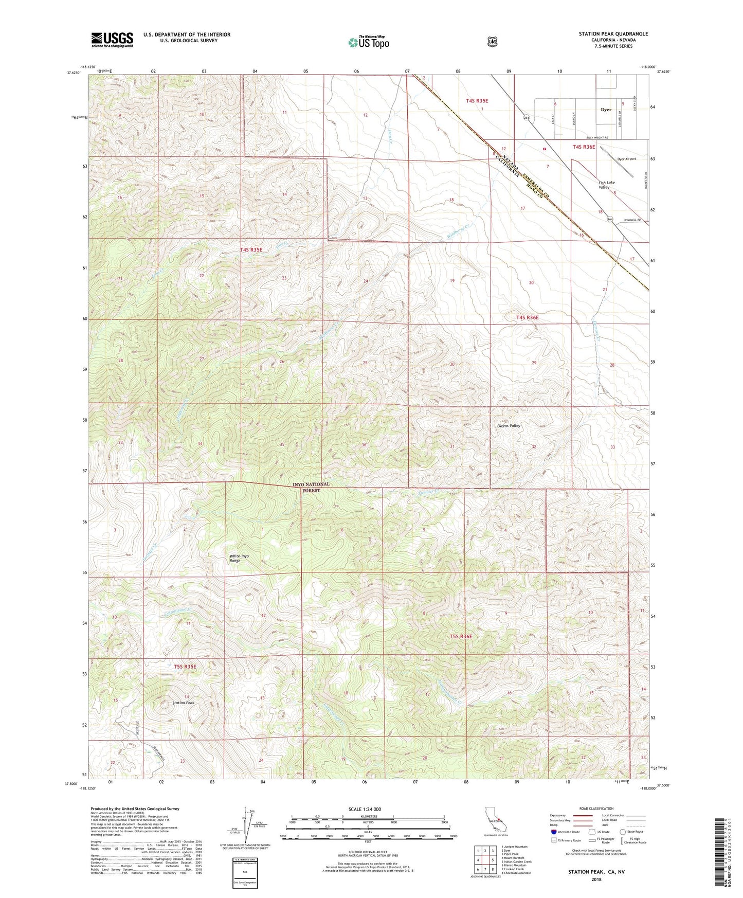
Station Peak California US Topo Map
Couldn't load pickup availability
Also explore the Station Peak Forest Service Topo of this same quad for updated USFS data
2021 topographic map quadrangle Station Peak in the states of California, Nevada. Scale: 1:24000. Based on the newly updated USGS 7.5' US Topo map series, this map is in the following counties: Mono, Esmeralda. The map contains contour data, water features, and other items you are used to seeing on USGS maps, but also has updated roads and other features. This is the next generation of topographic maps. Printed on high-quality waterproof paper with UV fade-resistant inks.
Quads adjacent to this one:
West: Mount Barcroft
Northwest: Juniper Mountain
North: Dyer
Northeast: Piper Peak
East: Indian Garden Creek
Southeast: Chocolate Mountain
South: Crooked Creek
Southwest: Blanco Mountain
Contains the following named places: Cottonwood Creek Wild and Scenic River, Deep Springs Cow Camp, Dyer Airport, Fish Lake Valley Fire Protection District, Furnace Creek, Red Mountain, Station Peak, Wildhorse Creek