MyTopo
Clarksburg California US Topo Map
Couldn't load pickup availability
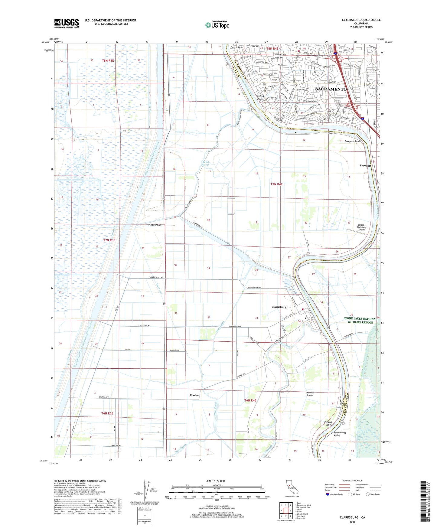
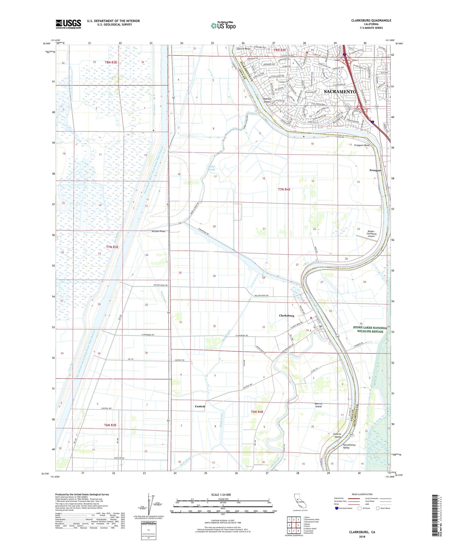
2022 topographic map quadrangle Clarksburg in the state of California. Scale: 1:24000. Based on the newly updated USGS 7.5' US Topo map series, this map is in the following counties: Yolo, Sacramento. The map contains contour data, water features, and other items you are used to seeing on USGS maps, but also has updated roads and other features. This is the next generation of topographic maps. Printed on high-quality waterproof paper with UV fade-resistant inks.
Quads adjacent to this one:
West: Saxon
Northwest: Davis
North: Sacramento West
Northeast: Sacramento East
East: Florin
Southeast: Bruceville
South: Courtland
Southwest: Liberty Island
This map covers the same area as the classic USGS quad with code o38121d5.
Contains the following named places: Arcade, Babel Slough, Big Lake, Borges - Clarksburg Airport, Calvary Temple, Central, Charter Point Park, Clarksburg, Clarksburg Census Designated Place, Clarksburg Division, Clarksburg Elementary School, Clarksburg Fire Protection District, Clarksburg Marina, Clarksburg Post Office, Coniston, Delta High School, Dippenbrock Landing, Eagle Point Landing One Hundred Thirty-eight, Freeport, Freeport Bend, Freeport Census Designated Place, Garcia Bend, Garcia Bend Park, Goaters Landing Number One Hundred Fifteen and a Half, Haycock Shoals, Heavenside Park, John D Sloat Elementary School, KJAY-AM (Sacramento), Landing One Hundred Twenty-Eight, Learning Repertoire Charter Academy, Main Canal, Marriott Park, Martin Luther King Junior School, Matsuyama Elementary School, Merryhill Elementary and Middle School, Merryhill School - Pocket Road, Moores Landing Number One Hundred Forty, Morrison Creek, Nathans Landing Number One Hundred Fifteen and a Fourth, Nichols Landing, Parkway Oak Park, Plymans Landing Number One Hundred Fifteen, Portuguese Community Park, Renfree Park, Riverlake Park, Rosebud Landing, S Smith Landing One Hundred Seventeen, Sacramento Christian Reformed Church, Sacramento City Fire Department Station 11, Scribners Lower Lanign Number One Hundred Thirty-six and a Half, Seymour Park, Toe Drain, Tule Canal, Willow Point, Willow Rancho Park, Winchester Lake, Yolo By-Pass, ZIP Codes: 95612, 95639, 95831