MyTopo
Cleghorn Flat California US Topo Map
Couldn't load pickup availability
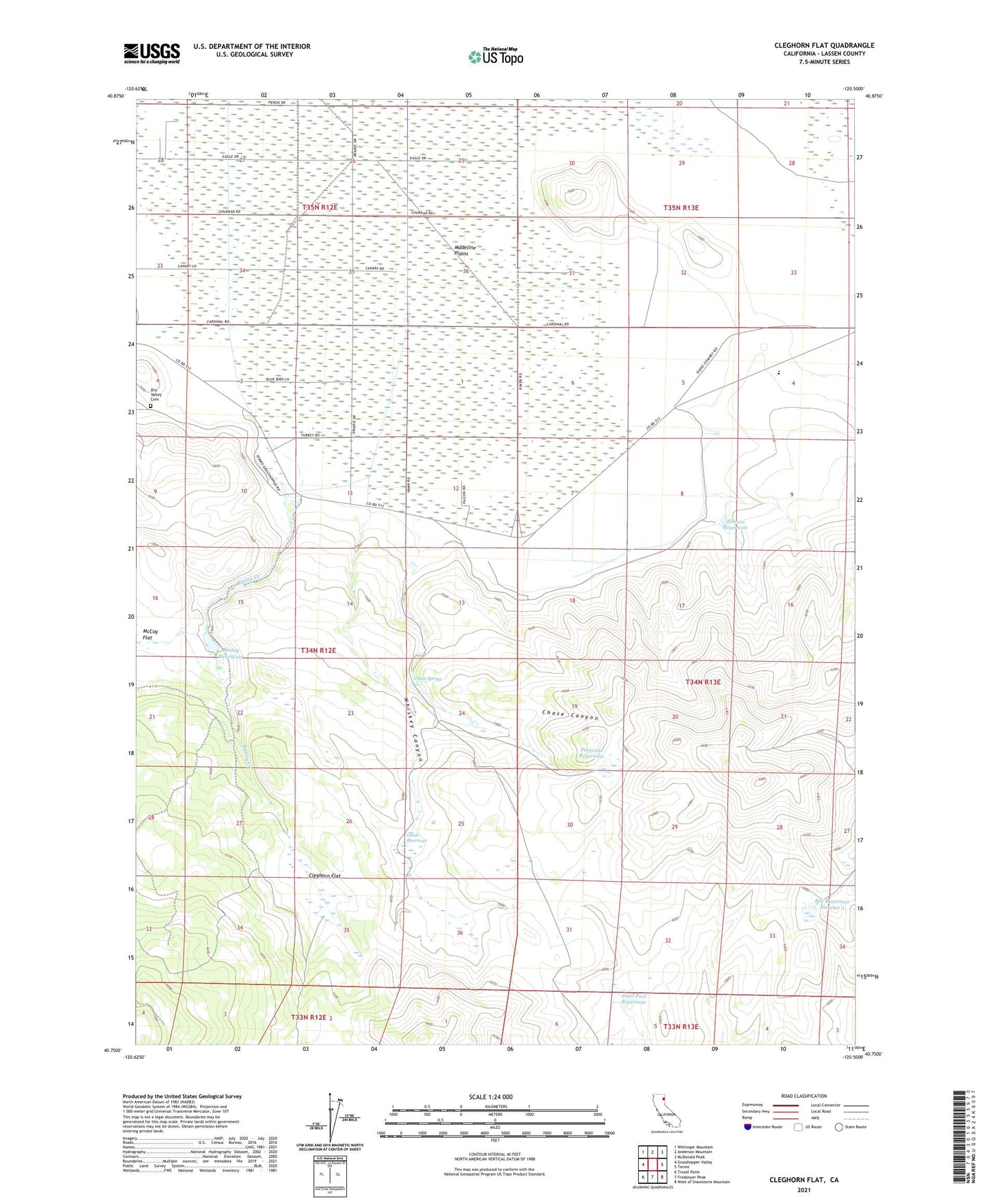
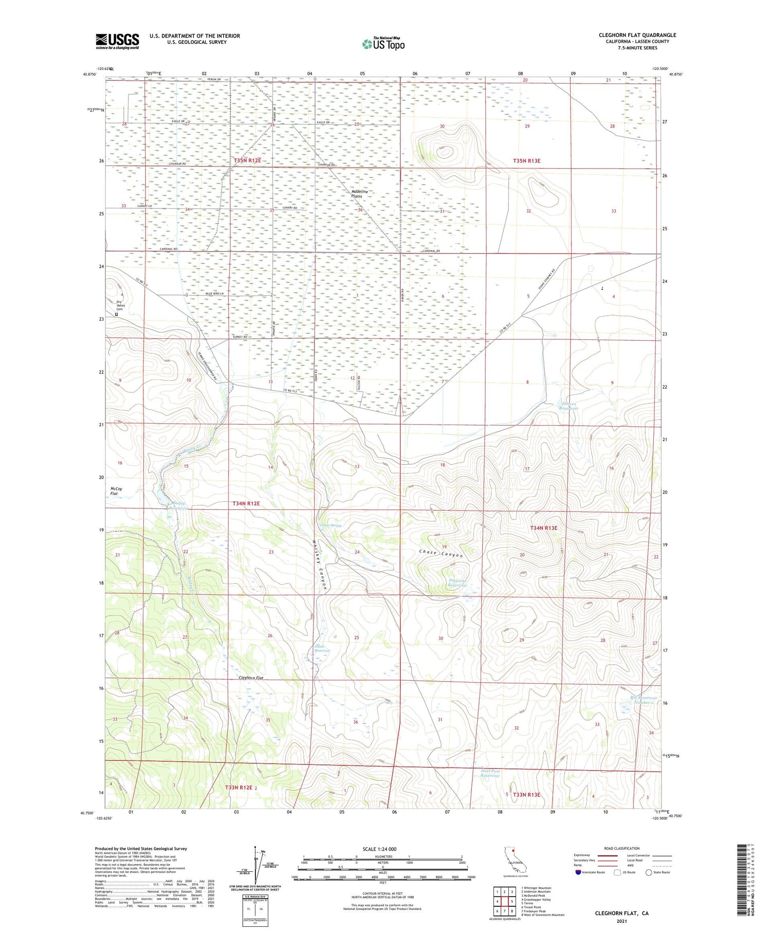
2021 topographic map quadrangle Cleghorn Flat in the state of California. Scale: 1:24000. Based on the newly updated USGS 7.5' US Topo map series, this map is in the following counties: Lassen. The map contains contour data, water features, and other items you are used to seeing on USGS maps, but also has updated roads and other features. This is the next generation of topographic maps. Printed on high-quality waterproof paper with UV fade-resistant inks.
Quads adjacent to this one:
West: Grasshopper Valley
Northwest: Whitinger Mountain
North: Anderson Mountain
Northeast: McDonald Peak
East: Termo
Southeast: West of Snowstorm Mountain
South: Fredonyer Peak
Southwest: Troxel Point
This map covers the same area as the classic USGS quad with code o40120g5.
Contains the following named places: Bailey Creek, Bailey Reservoir, Bill Reservoir Number 1, Chase Canyon, Chase Spring, Cleghorn Flat, Dry Valley Cemetery, Elmers Reservoir, Glade Reservoir, McCoy Flat, Pinecone Reservoir, Steel Post Reservoir, Whiskey Canyon