MyTopo
Anderson Mountain California US Topo Map
Couldn't load pickup availability
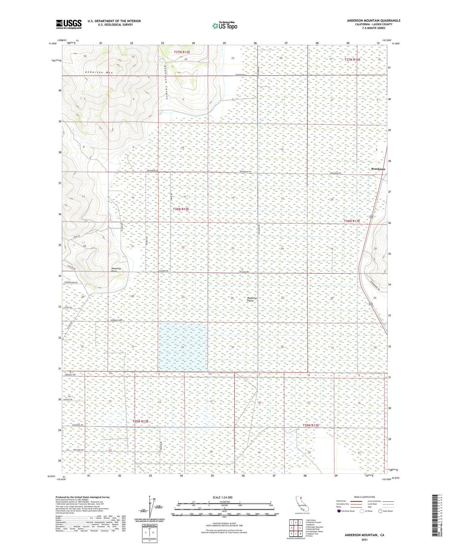
2021 topographic map quadrangle Anderson Mountain in the state of California. Scale: 1:24000. Based on the newly updated USGS 7.5' US Topo map series, this map is in the following counties: Lassen. The map contains contour data, water features, and other items you are used to seeing on USGS maps, but also has updated roads and other features. This is the next generation of topographic maps. Printed on high-quality waterproof paper with UV fade-resistant inks.
Quads adjacent to this one:
West: Whitinger Mountain
Northwest: Ash Valley
North: Holbrook Canyon
Northeast: Madeline
East: McDonald Peak
Southeast: Termo
South: Cleghorn Flat
Southwest: Grasshopper Valley
Contains the following named places: Anderson Canyon, Anderson Mountain, Madeline Plains Waterfowl Management Area, Monroe Corrals, Ninemile Point