MyTopo
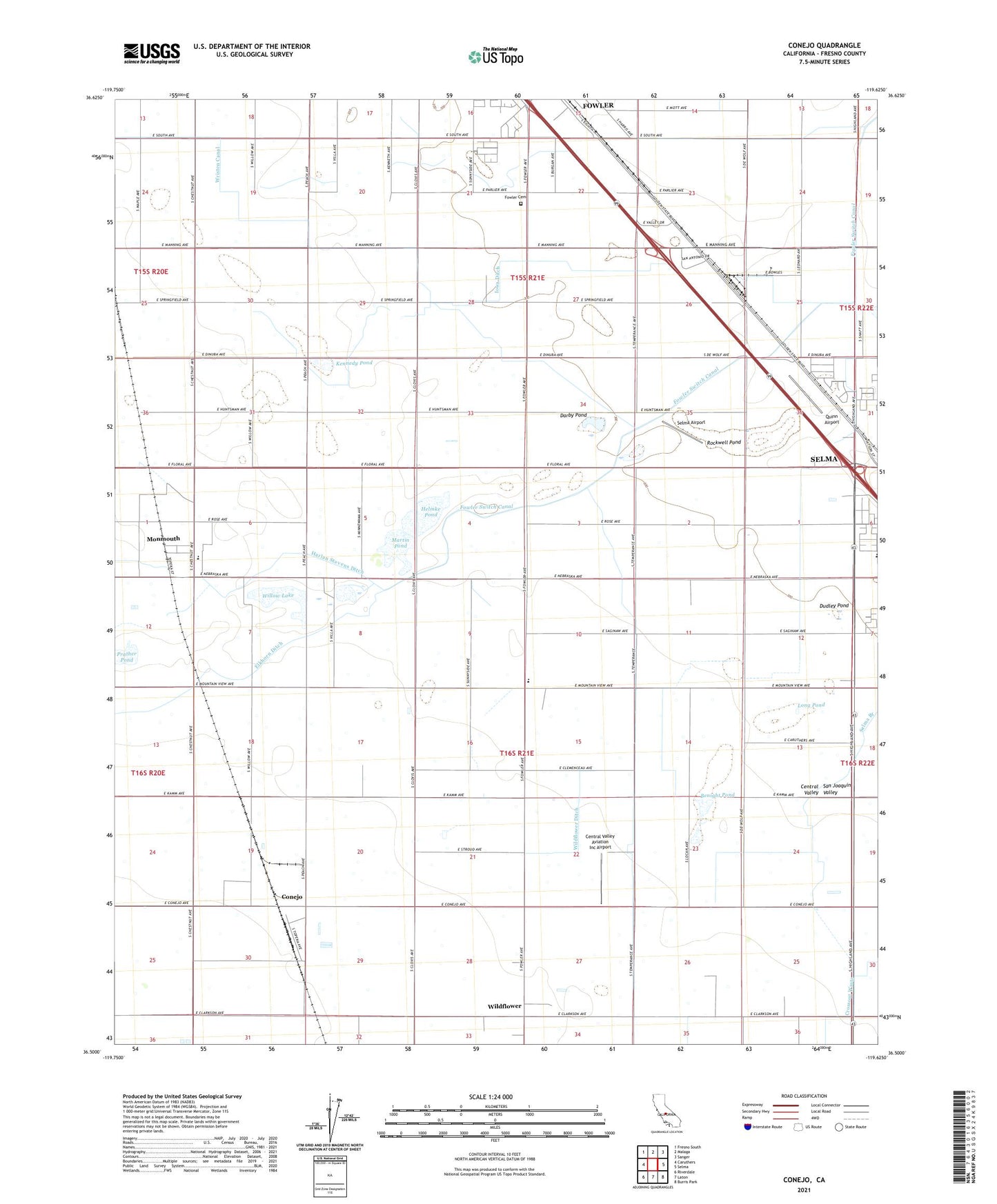
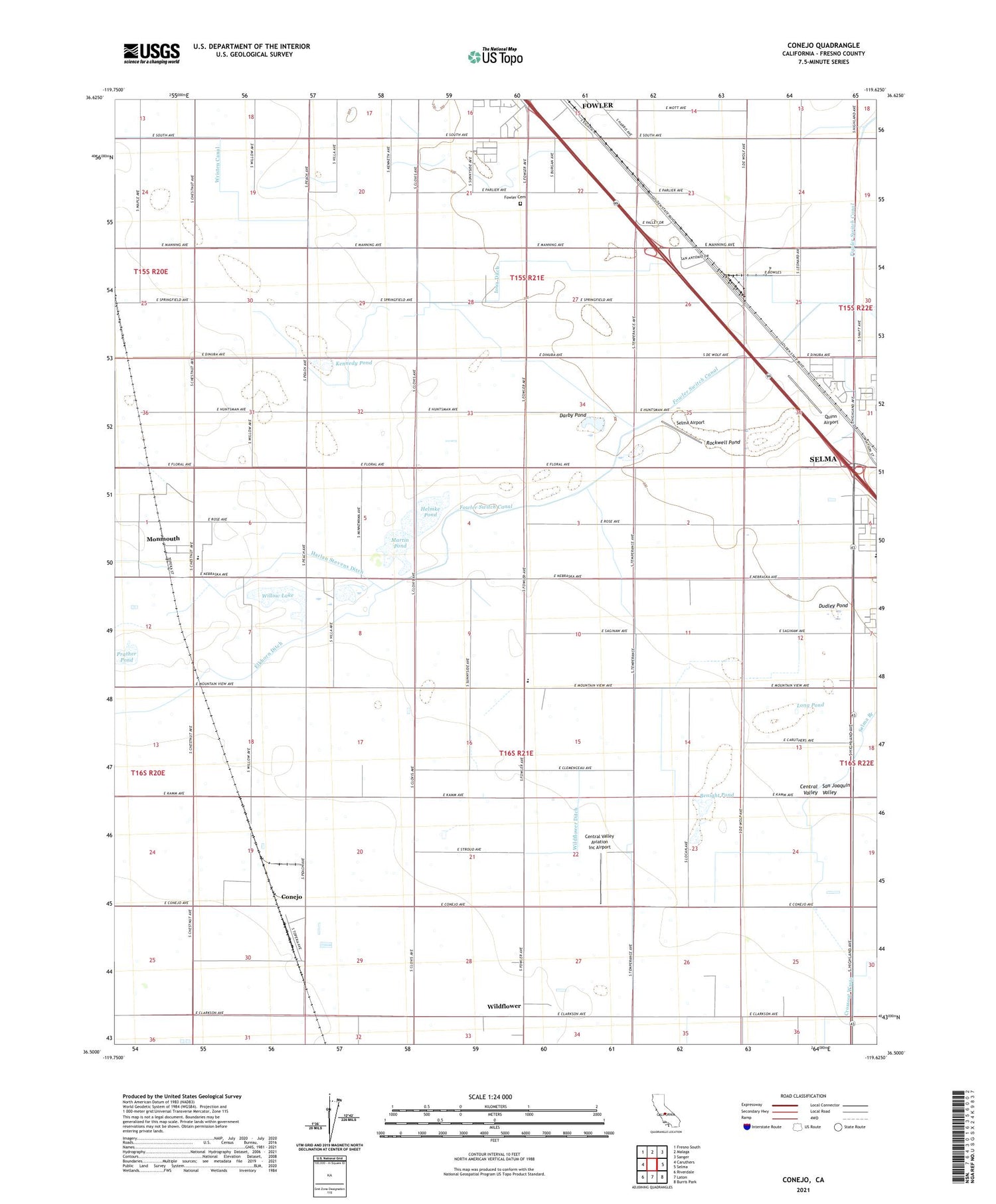
Conejo California US Topo Map
Couldn't load pickup availability
2021 topographic map quadrangle Conejo in the state of California. Scale: 1:24000. Based on the newly updated USGS 7.5' US Topo map series, this map is in the following counties: Fresno. The map contains contour data, water features, and other items you are used to seeing on USGS maps, but also has updated roads and other features. This is the next generation of topographic maps. Printed on high-quality waterproof paper with UV fade-resistant inks.
Quads adjacent to this one:
West: Caruthers
Northwest: Fresno South
North: Malaga
Northeast: Sanger
East: Selma
Southeast: Burris Park
South: Laton
Southwest: Riverdale
This map covers the same area as the classic USGS quad with code o36119e6.
Contains the following named places: A-G Sod Farms, Art Gonzales Museum, Benight Pond, Central School, Central Valley Aviation Inc Airport, Circle K Ranch, City of Fowler, Conejo, Conejo Middle School, Crosscut Canal, Darby Pond, Desert Acres Ranch, Dudley Pond, Duke School, Elkhorn Ditch, Eric White Elementary School, First Friendship Baptist Church, Fowler Cemetery, Helmke Pond, Iowa Ditch, Iowa School, Kennedy Pond, Kirby Canal, Langstraat Farm, Leyland Farms, Long Pond, M And K Farms, Martin Pond, McCall Substation, Monmouth, Monmouth Census Designated Place, Monmouth Community Presbyterian Church, Monroe Elementary School, Nash Farms, Nash Farms Dairy, One Thousand Eight Hundred Eighty One Ditch, Pioneer Village Museum, Prather Pond, Quinn Airport, Ringo Park, Rockwell Pond, Selma Airport, Selma Branch, Selma Division, Selma Plaza Shopping Center, Terry Elementary School, Weber Ditch, Wildflower, Wildflower Ditch, Willow Lake, Young Pond, ZIP Codes: 93625, 93662