MyTopo
Cooskie Creek California US Topo Map
Couldn't load pickup availability
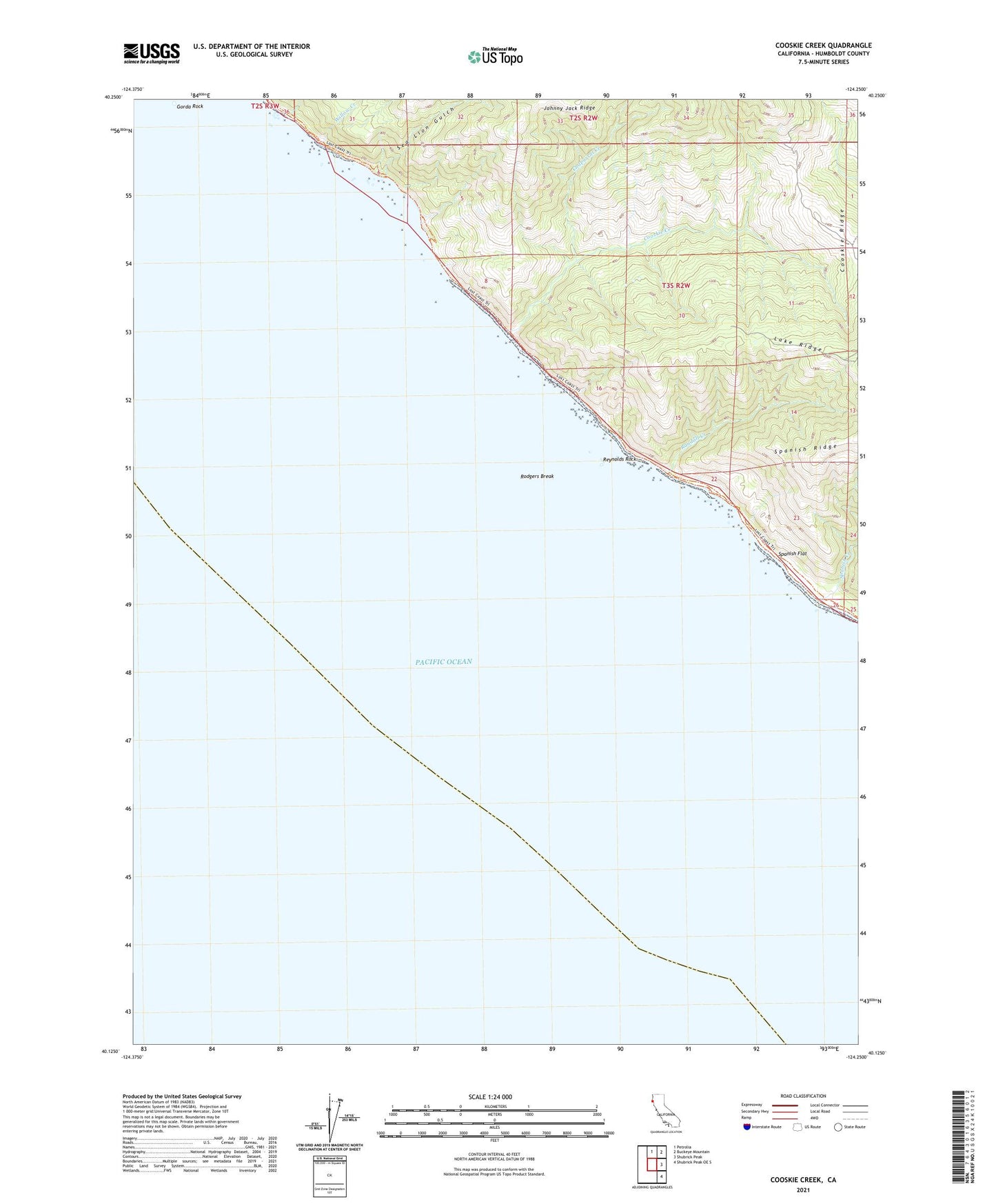
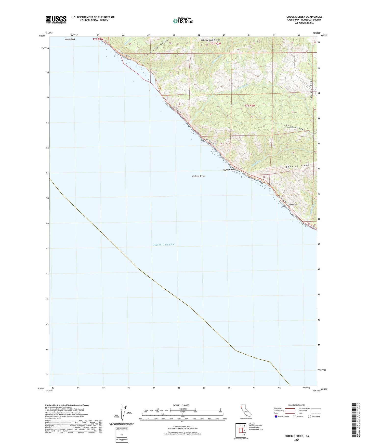
2021 topographic map quadrangle Cooskie Creek in the state of California. Scale: 1:24000. Based on the newly updated USGS 7.5' US Topo map series, this map is in the following counties: Humboldt. The map contains contour data, water features, and other items you are used to seeing on USGS maps, but also has updated roads and other features. This is the next generation of topographic maps. Printed on high-quality waterproof paper with UV fade-resistant inks.
Quads adjacent to this one:
North: Petrolia
Northeast: Buckeye Mountain
East: Shubrick Peak
Southeast: Shubrick Peak OE S
This map covers the same area as the classic USGS quad with code o40124b3.
Contains the following named places: Chaparral Creek, Cooskie Creek, Gorda Rock, Lake Ridge, Punta Gorda Lighthouse, Randall Creek, Reynolds Rock, Rodgers Break, Sea Lion Gulch, Spanish Creek, Spanish Flat, Willow Creek