
MyTopo
Shubrick Peak California US Topo Map
Couldn't load pickup availability
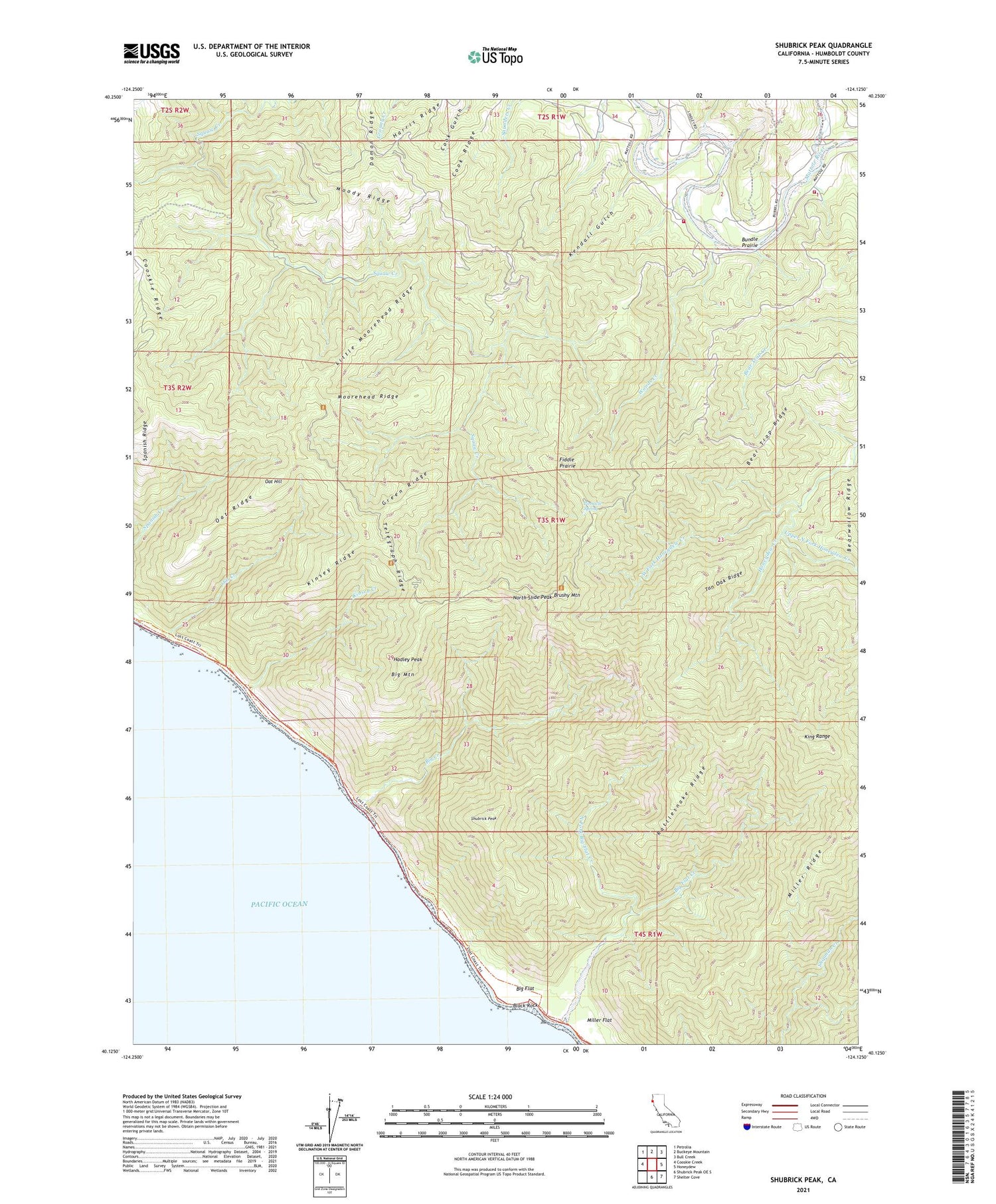
2023 topographic map quadrangle Shubrick Peak in the state of California. Scale: 1:24000. Based on the newly updated USGS 7.5' US Topo map series, this map is in the following counties: Humboldt. The map contains contour data, water features, and other items you are used to seeing on USGS maps, but also has updated roads and other features. This is the next generation of topographic maps. Printed on high-quality waterproof paper with UV fade-resistant inks.
Quads adjacent to this one:
West: Cooskie Creek
Northwest: Petrolia
North: Buckeye Mountain
Northeast: Bull Creek
East: Honeydew
Southeast: Shelter Cove
South: Shubrick Peak OE S
This map covers the same area as the classic USGS quad with code o40124b2.
Contains the following named places: Bear Trap Ridge, Big Creek, Big Flat, Big Flat Creek, Big Mountain, Black Rock, Brushy Mountain, Bundle Prairie, California Department of Forestry and Fire Protection Mattole Station, Cook Ridge, Damon Ridge, Fiddle Prairie, Green Ridge, Hadley Peak, Harris Ridge, Honeydew Volunteer Fire Company, Kendall Gulch, King Crest Trail, King Range, King Range Wilderness, Kinsey Creek, Kinsey Ridge, Little Moorehead Ridge, Miller Flat, Miller Ridge, Moody Ridge, Moorehead Ridge, North Fork Big Flat Creek, North Slide Peak, Oat Creek, Oat Hill, Oat Ridge, Pinnacle Spring, Rattlesnake Ridge, Shubrick Peak, Spanish Ridge, Tan Oak Ridge, Telegraph Ridge, Upper North Fork Honeydew Creek, Upper North Fork Mattole River, West Fork Honeydew Creek, Woods Creek


