MyTopo
Buckeye Mountain California US Topo Map
Couldn't load pickup availability
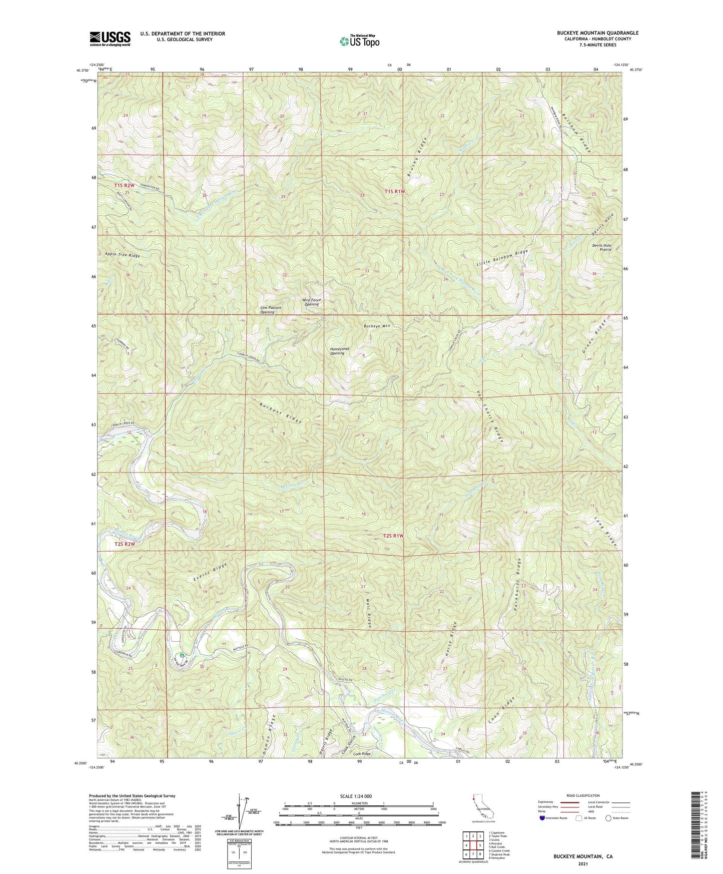
2023 topographic map quadrangle Buckeye Mountain in the state of California. Scale: 1:24000. Based on the newly updated USGS 7.5' US Topo map series, this map is in the following counties: Humboldt. The map contains contour data, water features, and other items you are used to seeing on USGS maps, but also has updated roads and other features. This is the next generation of topographic maps. Printed on high-quality waterproof paper with UV fade-resistant inks.
Quads adjacent to this one:
West: Petrolia
Northwest: Capetown
North: Taylor Peak
Northeast: Scotia
East: Bull Creek
Southeast: Honeydew
South: Shubrick Peak
Southwest: Cooskie Creek
Contains the following named places: Arthur W Way County Memorial Park, Buckeye Mountain, Burgess Ridge, Camp Mattole, Conklin Creek, Cook Gulch, Coon Ridge, Cow Pasture Opening, Devils Creek, Devils Hole, Devils Hole Prairie, Everts Ridge, Granny Creek, Homestead Opening, Horse Ridge, Indian Creek, Little Rainbow Ridge, Long Ridge, Long Ridge Creek, Mail Ridge, McGinnis Creek, Parkhurst Ridge, Pritchard Creek, Saunders Creek, Squaw Creek, Sulphur Creek, Upper Mattole School, Van Choick Ridge, Wire Fence Opening, ZIP Code: 95558