
MyTopo
Copper Queen Canyon California US Topo Map
Couldn't load pickup availability
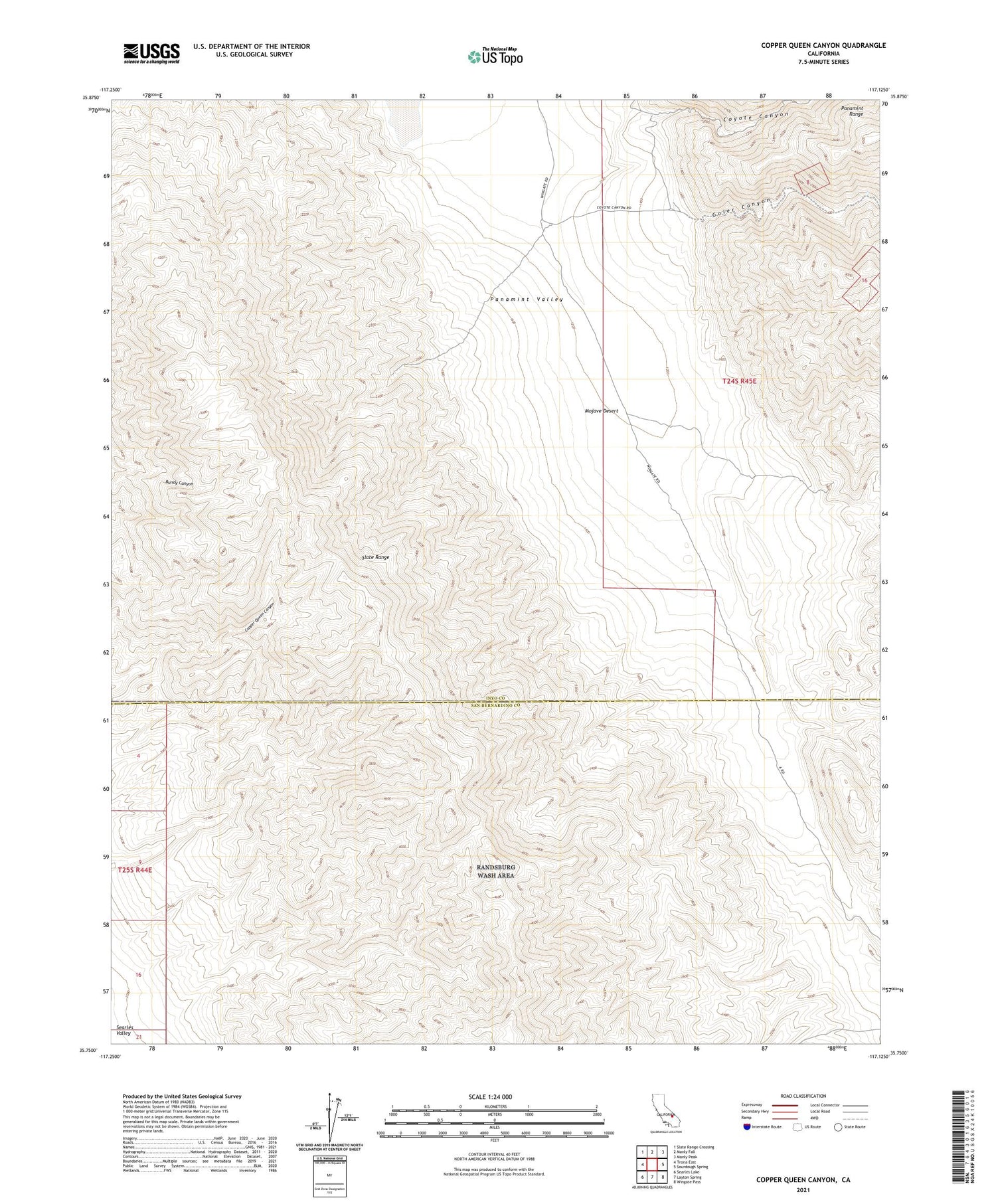
2021 topographic map quadrangle Copper Queen Canyon in the state of California. Scale: 1:24000. Based on the newly updated USGS 7.5' US Topo map series, this map is in the following counties: Inyo, San Bernardino. The map contains contour data, water features, and other items you are used to seeing on USGS maps, but also has updated roads and other features. This is the next generation of topographic maps. Printed on high-quality waterproof paper with UV fade-resistant inks.
Quads adjacent to this one:
West: Trona East
Northwest: Slate Range Crossing
North: Manly Fall
Northeast: Manly Peak
East: Sourdough Spring
Southeast: Wingate Pass
South: Layton Spring
Southwest: Searles Lake
This map covers the same area as the classic USGS quad with code o35117g2.
Contains the following named places: Coyote Canyon, Crescent Mines, Goler Canyon, January Jones Mine, Standard Mine Number Two, ZIP Code: 93592


