MyTopo
Trona East California US Topo Map
Couldn't load pickup availability
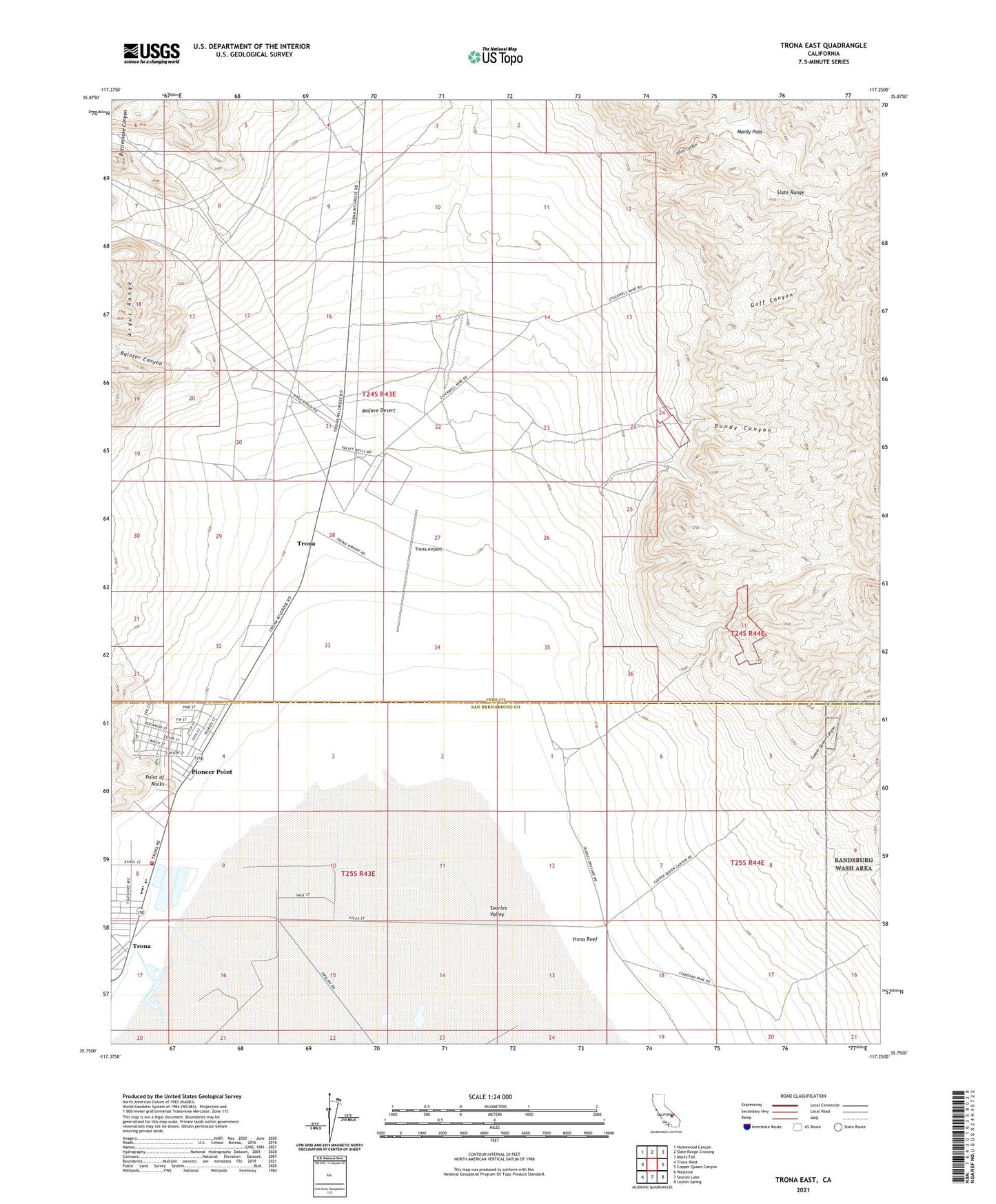
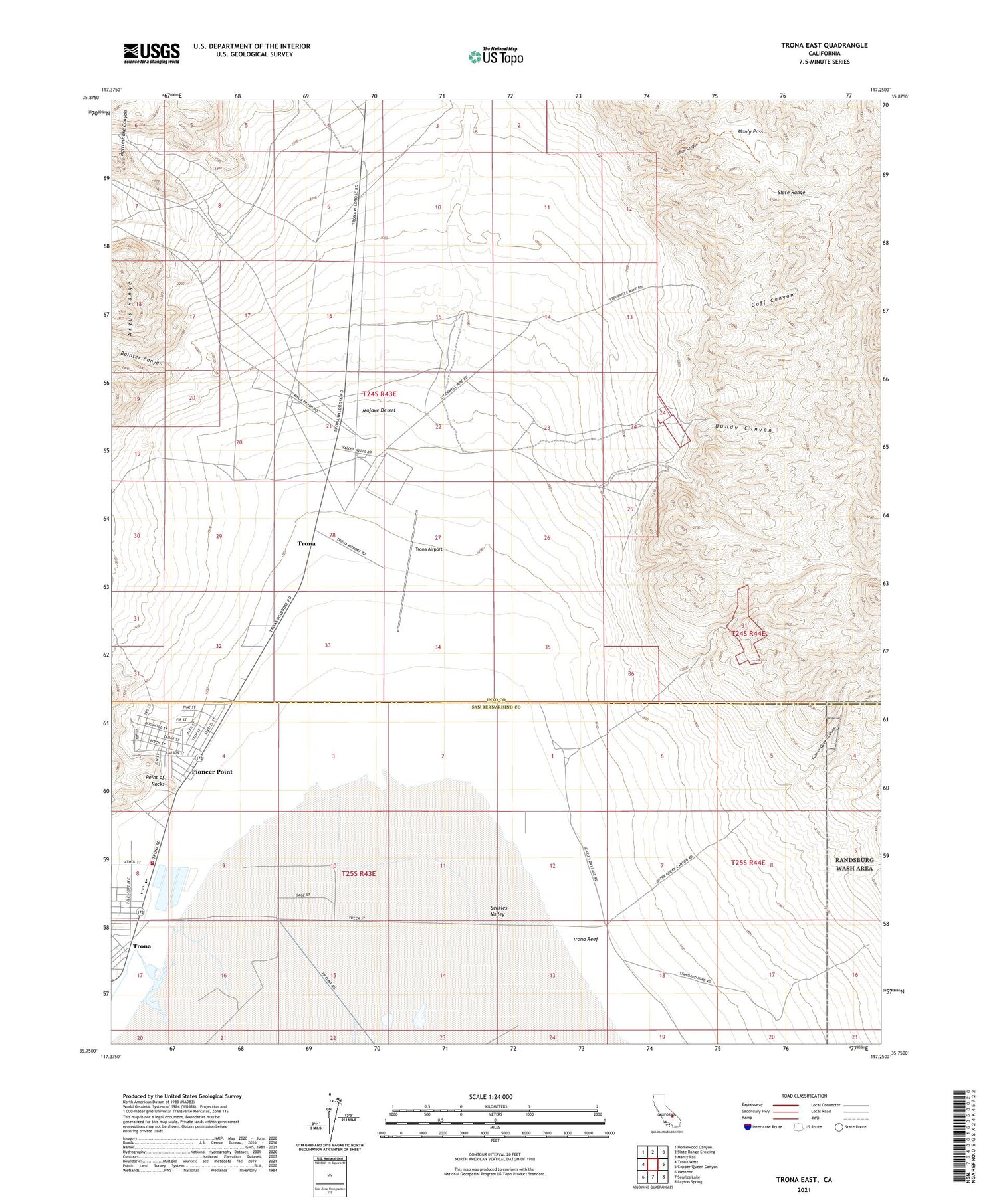
2021 topographic map quadrangle Trona East in the state of California. Scale: 1:24000. Based on the newly updated USGS 7.5' US Topo map series, this map is in the following counties: Inyo, San Bernardino. The map contains contour data, water features, and other items you are used to seeing on USGS maps, but also has updated roads and other features. This is the next generation of topographic maps. Printed on high-quality waterproof paper with UV fade-resistant inks.
Quads adjacent to this one:
West: Trona West
Northwest: Homewood Canyon
North: Slate Range Crossing
Northeast: Manly Fall
East: Copper Queen Canyon
Southeast: Layton Spring
South: Searles Lake
Southwest: Westend
This map covers the same area as the classic USGS quad with code o35117g3.
Contains the following named places: Bainter Canyon, Borax Flat, Bundy Canyon, Copper Queen Canyon, Goff Canyon, Gold Bottom Mine, Isham Canyon, Manly Pass, Ophir Mine, Pioneer Point, Point of Rocks, Rattlesnake Canyon, San Bernardino County Fire Department Station 57 Trona, Stockwell Mine, The Tanks, Trona, Trona Airport, Trona Census Designated Place, Trona Elementary School, Trona High School, Trona Reef, Valley Wells