MyTopo
Corcoran California US Topo Map
Couldn't load pickup availability
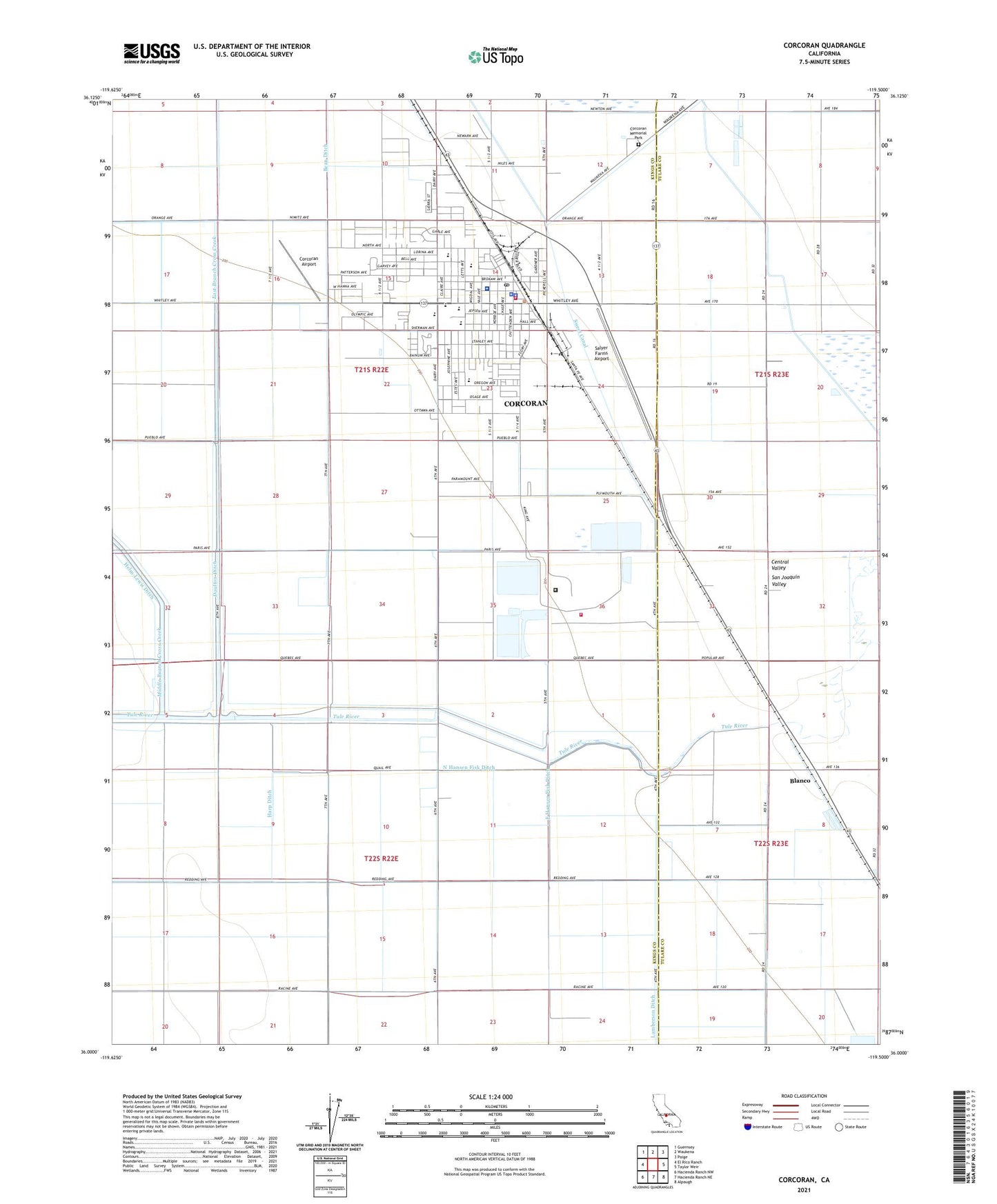
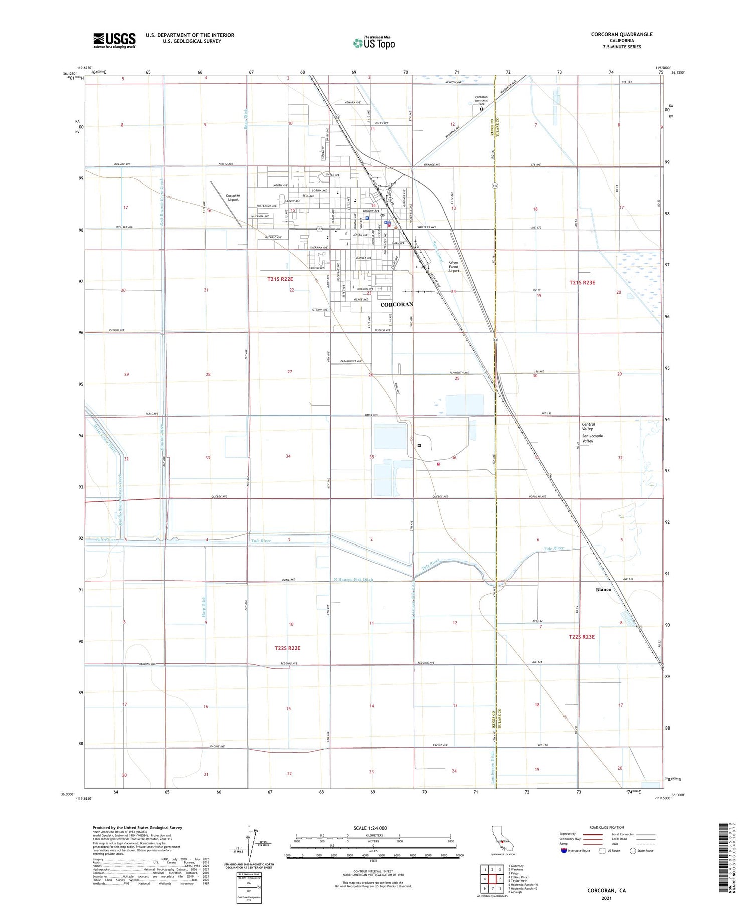
2021 topographic map quadrangle Corcoran in the state of California. Scale: 1:24000. Based on the newly updated USGS 7.5' US Topo map series, this map is in the following counties: Kings, Tulare. The map contains contour data, water features, and other items you are used to seeing on USGS maps, but also has updated roads and other features. This is the next generation of topographic maps. Printed on high-quality waterproof paper with UV fade-resistant inks.
Quads adjacent to this one:
West: El Rico Ranch
Northwest: Guernsey
North: Waukena
Northeast: Paige
East: Taylor Weir
Southeast: Alpaugh
South: Hacienda Ranch NE
Southwest: Hacienda Ranch NW
This map covers the same area as the classic USGS quad with code o36119a5.
Contains the following named places: American Ambulance, Artesia Dairy, Ax Canal, Bean Ditch, Blanco, Boswell Camp One, Boswell Levee, Bret Harte Elementary School, Burnham Smith Park, California State Prison - Corcoran, California State Prison - Corcoran - Fire Department, Church of Christ, Church of the Nazarene, City of Corcoran, Corcoran, Corcoran Airport, Corcoran Branch Kings County Library, Corcoran City Hall, Corcoran City Swimming Pool, Corcoran District Hospital, Corcoran Division, Corcoran Family YMCA, Corcoran High School, Corcoran High School Agricultural Farm, Corcoran Memorial Park, Corcoran Police Department, Corcoran Post Office, Corcoran Prison Dairy, Corcoran Substation, Corcoran Unified School District Office, Crockett and Gambogy Labor Camp, Daulton Ditch, Deep Creek, East Branch Cross Creek, East Hansen Fisk Ditch, Episcopal Church of the Epiphany, Father Wyatt Park, First Baptist Church, First Missionary Baptist Church, First Presbyterian Church, First United Methodist Church, First United Presbyterian Church, Harp Ditch, John C Fremont Elementary School, John Maroot Park, John Muir Junior High School, Kate H Boswell Seniors Center, Kingdom Hall of Jehovahs Witnesses, Kings County Fire Department Station 11 Corcoran, Kings County Health Clinic, Kings County Sheriff's Office Corcoran Substation, Kings Lake High School, Lamberson Ditch, Mark Twain Elementary School, Middle Branch Cross Creek, North Corcoran Ditch, North Hansen Fisk Ditch, Our Lady of Lourdes Catholic Church, Riley Camp, Riverdale School, Salyer Farms Airport, Salyer Farms Camp One, South Corcoran, Sperry Lateral, Sweet Canal, Tensmuir School, Turnbull, Veterans Memorial Hall, West Corcoran Ditch, West Side Union School, Wheat Camp, Whitley Manor Mobile Home Park, ZIP Code: 93212