
MyTopo
Guernsey California US Topo Map
Couldn't load pickup availability
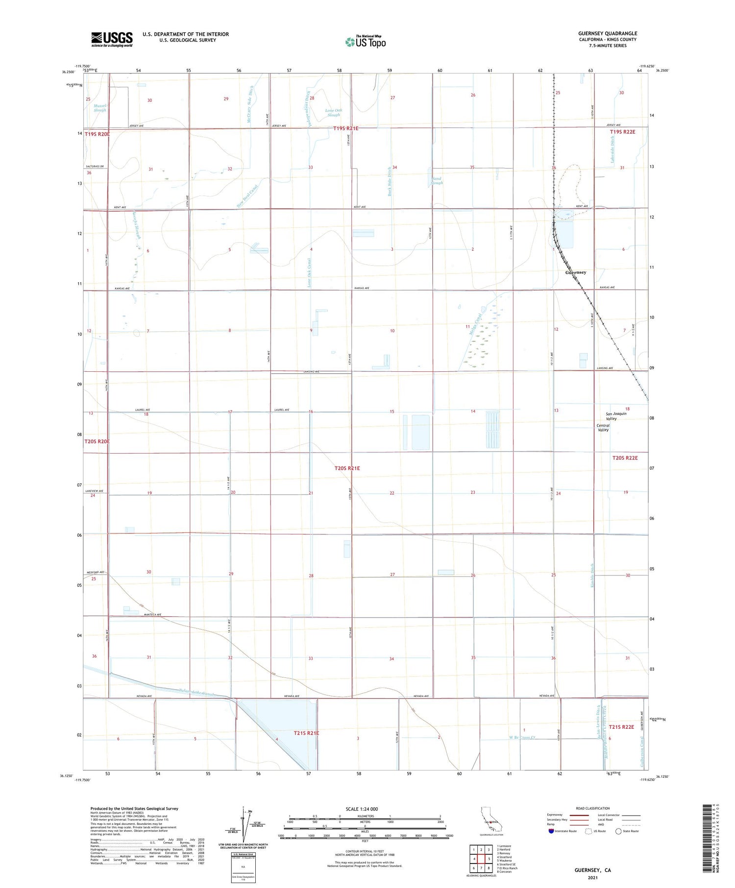
2021 topographic map quadrangle Guernsey in the state of California. Scale: 1:24000. Based on the newly updated USGS 7.5' US Topo map series, this map is in the following counties: Kings. The map contains contour data, water features, and other items you are used to seeing on USGS maps, but also has updated roads and other features. This is the next generation of topographic maps. Printed on high-quality waterproof paper with UV fade-resistant inks.
Quads adjacent to this one:
West: Stratford
Northwest: Lemoore
North: Hanford
Northeast: Remnoy
East: Waukena
Southeast: Corcoran
South: El Rico Ranch
Southwest: Stratford SE
This map covers the same area as the classic USGS quad with code o36119b6.
Contains the following named places: Burk Side Ditch, Cloverdale Dairy, Cross Creek, Dallas School, Fernandes Dairy, Frazer School, Guernsey, Guernsey Slough, Guiberson Canal, Hanford Division, Jacobs Ditch, Jacobs Slough, Kimble Ditch, King's Ranch, Lakeside Ditch, Last Chance Ditch, Lewis Ditch, Lone Oak Canal, Melga Canal, Mussel Slough, New Deal Canal, New Home School, Paddock School, Sand Slough, Sozinho Dairy Number 2, Tulare Lake Canal, Valadao Dairy


