
MyTopo
Waukena California US Topo Map
Couldn't load pickup availability
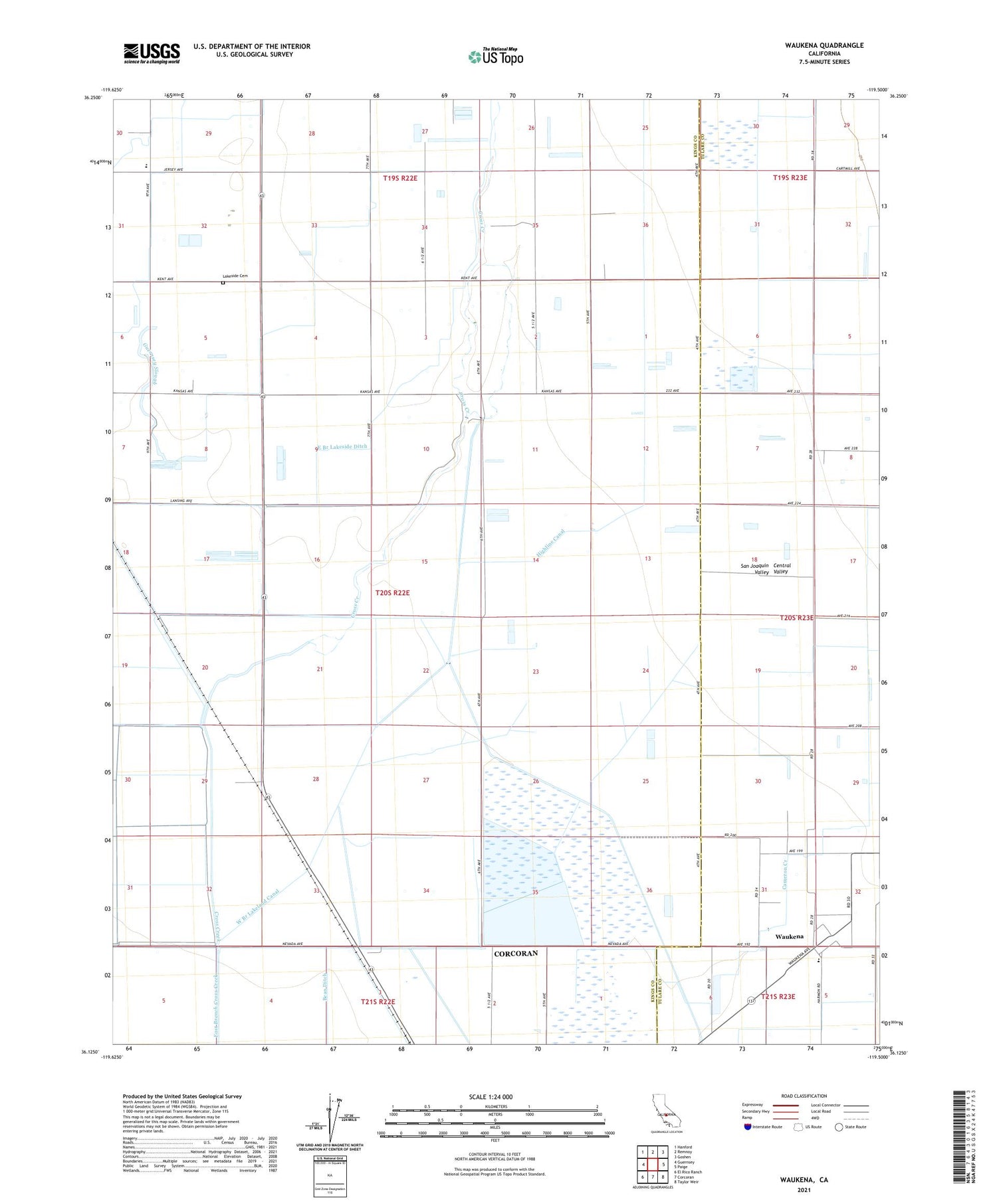
2021 topographic map quadrangle Waukena in the state of California. Scale: 1:24000. Based on the newly updated USGS 7.5' US Topo map series, this map is in the following counties: Kings, Tulare. The map contains contour data, water features, and other items you are used to seeing on USGS maps, but also has updated roads and other features. This is the next generation of topographic maps. Printed on high-quality waterproof paper with UV fade-resistant inks.
Quads adjacent to this one:
West: Guernsey
Northwest: Hanford
North: Remnoy
Northeast: Goshen
East: Paige
Southeast: Taylor Weir
South: Corcoran
Southwest: El Rico Ranch
This map covers the same area as the classic USGS quad with code o36119b5.
Contains the following named places: Adriano Nunes Dairy, Aurora School, Bean, Cadillac Ranch Dairy, Caetano Dairy, Cameron Creek, Cascade Dairy, Diman G Dairy, East Branch Lakeside Ditch, Endeavor Gold Dairy, Felicita Dairy, Hollandia Farms North Dairy, Kansas Holstein Dairy, Lakeside Cemetery, Lakeside Elementary School, M F Gomes Dairy, Mattos Brothers Dairy, Phil Vannette Dairy, River Ranch, River Ranch Dairy, Tulare County Fire Department Battalion 1 Waukena Fire Station 24, Valley View Farms Dairy, Waukena, Waukena Census Designated Place, Waukena Joint Union Elementary School, West Branch Lakeland Canal, Westview Dairy, Wreden Ranch Dairy


