MyTopo
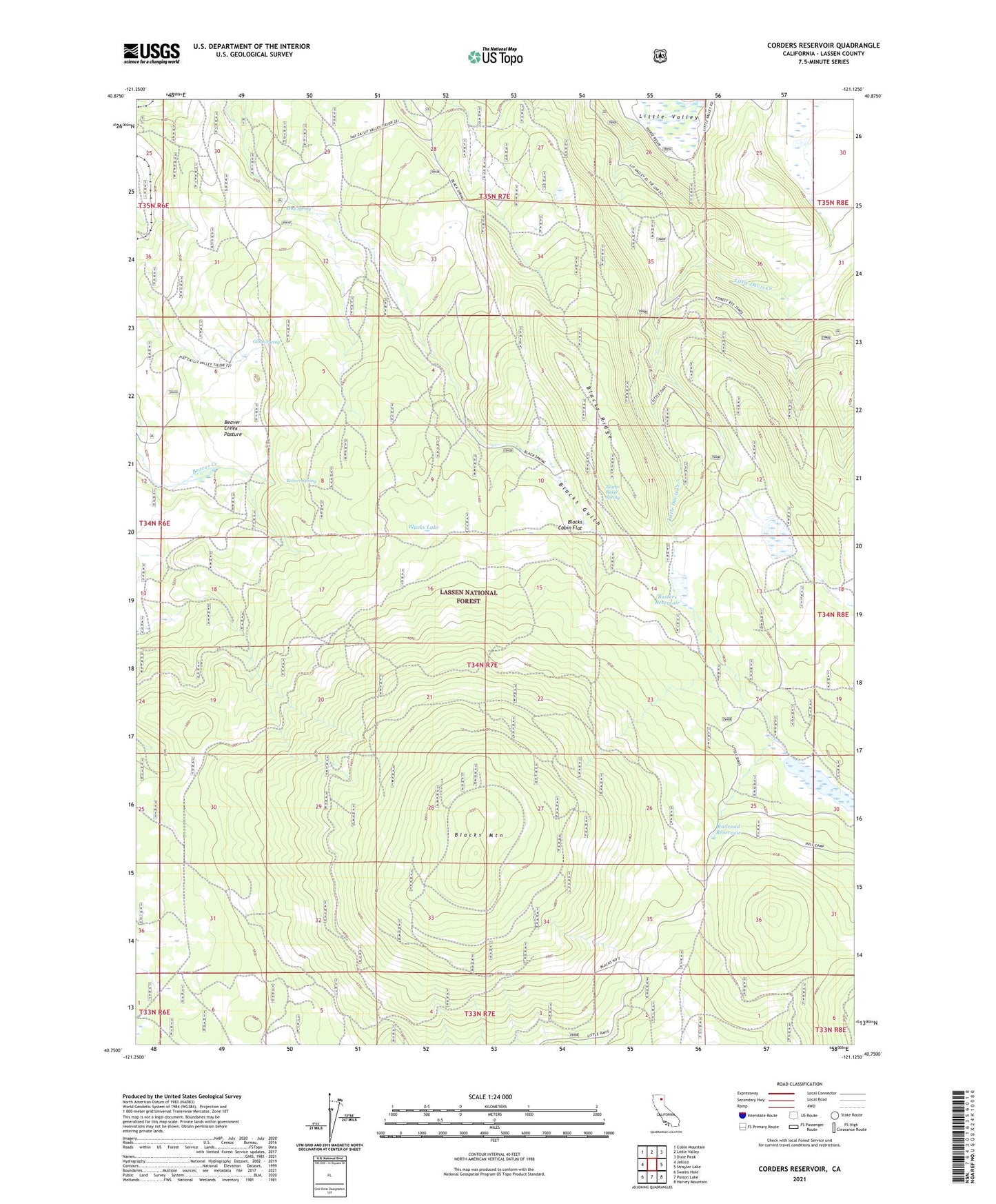
Corders Reservoir California US Topo Map
Couldn't load pickup availability
Also explore the Corders Reservoir Forest Service Topo of this same quad for updated USFS data
2021 topographic map quadrangle Corders Reservoir in the state of California. Scale: 1:24000. Based on the newly updated USGS 7.5' US Topo map series, this map is in the following counties: Lassen. The map contains contour data, water features, and other items you are used to seeing on USGS maps, but also has updated roads and other features. This is the next generation of topographic maps. Printed on high-quality waterproof paper with UV fade-resistant inks.
Quads adjacent to this one:
West: Jellico
Northwest: Coble Mountain
North: Little Valley
Northeast: Dixie Peak
East: Straylor Lake
Southeast: Harvey Mountain
South: Poison Lake
Southwest: Swains Hole
This map covers the same area as the classic USGS quad with code o40121g2.
Contains the following named places: Bear Valley Reservoir, Beaver Creek Pasture, Beaver Spring, Blacks Cabin Flat, Blacks Lake, Blacks Mountain, Blacks Ridge, Blacks Ridge Lookout, Blacks Ridge Spring, Busters Reservoir, Corders Reservoir, Eldridge Homestead, Gibbs Spring, Mud Spring