MyTopo
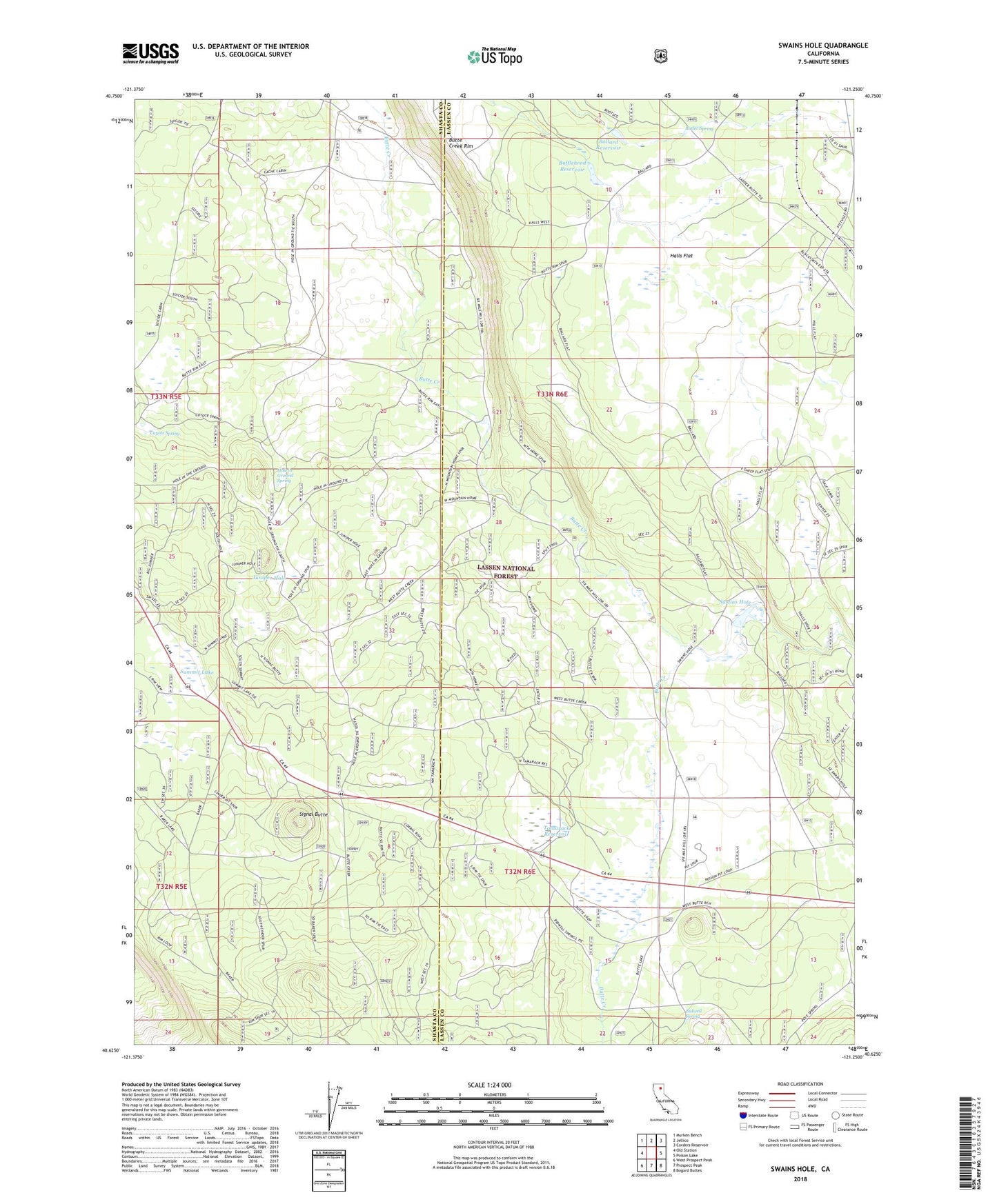
Swains Hole California US Topo Map
Couldn't load pickup availability
Also explore the Swains Hole Forest Service Topo of this same quad for updated USFS data
2022 topographic map quadrangle Swains Hole in the state of California. Scale: 1:24000. Based on the newly updated USGS 7.5' US Topo map series, this map is in the following counties: Lassen, Shasta. The map contains contour data, water features, and other items you are used to seeing on USGS maps, but also has updated roads and other features. This is the next generation of topographic maps. Printed on high-quality waterproof paper with UV fade-resistant inks.
Quads adjacent to this one:
West: Old Station
Northwest: Murken Bench
North: Jellico
Northeast: Corders Reservoir
East: Poison Lake
Southeast: Bogard Buttes
South: Prospect Peak
Southwest: West Prospect Peak
This map covers the same area as the classic USGS quad with code o40121f3.
Contains the following named places: Bidwell Spring, Blacks Mountain Experimental Station, Bufflehead Reservoir, Butler Spring, Butte Creek, Butte Creek Cabin, Butte Creek Ranch, Cache Cabin, Coyote Spring, Halls Flat, Hole in Ground Spring, Juniper Hole, Mountain Home, Signal Butte, Suicide Cabin, Summit Lake, Swains Hole, Swains Hole Dam, Tamarack Reservoir