MyTopo
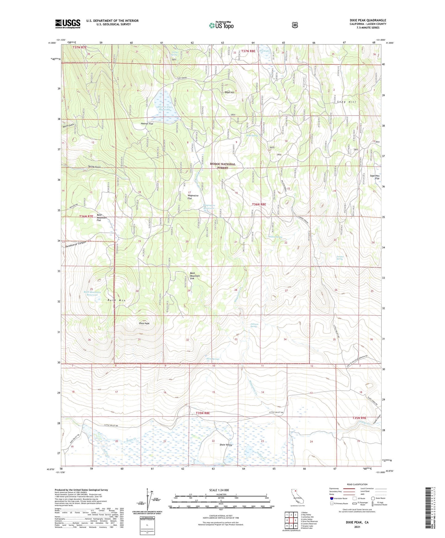
Dixie Peak California US Topo Map
Couldn't load pickup availability
Also explore the Dixie Peak Forest Service Topo of this same quad for updated USFS data
2021 topographic map quadrangle Dixie Peak in the state of California. Scale: 1:24000. Based on the newly updated USGS 7.5' US Topo map series, this map is in the following counties: Lassen. The map contains contour data, water features, and other items you are used to seeing on USGS maps, but also has updated roads and other features. This is the next generation of topographic maps. Printed on high-quality waterproof paper with UV fade-resistant inks.
Quads adjacent to this one:
West: Little Valley
Northwest: Bieber
North: Hog Valley
Northeast: Letterbox Hill
East: Silva Flat Reservoir
Southeast: Bullard Lake
South: Straylor Lake
Southwest: Corders Reservoir
This map covers the same area as the classic USGS quad with code o40121h1.
Contains the following named places: Bald Mountain, Bald Mountain Flat, Bald Mountain Reservoir, Bald Mountain Sink, Big Valley Division, Boyd Hill, Boyd Spring, Coyote Canyon, Davis Creek, Dixie Crossing, Dixie Peak, Dixie Ranch, Dixie Valley, Dry Lake, Gerig Spring, Hoover Flat, Hoover Flat Reservoir, Indian Creek, Johnson Spring, Juniper Spring, Little Davis Creek, Sage Hen Flat, Snag Hill, Three Springs, Wagontire Creek, Wagontire Flat, Wagontire Reservoir, Willow Spring