
MyTopo
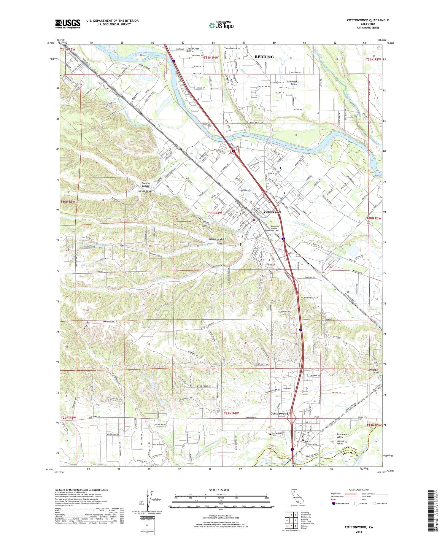
Cottonwood California US Topo Map
Couldn't load pickup availability
2022 topographic map quadrangle Cottonwood in the state of California. Scale: 1:24000. Based on the newly updated USGS 7.5' US Topo map series, this map is in the following counties: Shasta, Tehama. The map contains contour data, water features, and other items you are used to seeing on USGS maps, but also has updated roads and other features. This is the next generation of topographic maps. Printed on high-quality waterproof paper with UV fade-resistant inks.
Quads adjacent to this one:
West: Olinda
Northwest: Redding
North: Enterprise
Northeast: Palo Cedro
East: Balls Ferry
Southeast: Bend
South: Hooker
Southwest: Mitchell Gulch
This map covers the same area as the classic USGS quad with code o40122d3.
Contains the following named places: Amberwood Mobile Home Park, Anderson, Anderson Branch Shasta County Library, Anderson City Hall, Anderson Cottonwood Canal, Anderson District Cemetery, Anderson Fire Protection District, Anderson Heights Elementary School, Anderson High School, Anderson Landfill, Anderson Pioneer / Oddfellows Cemetery, Anderson Police Department, Anderson Post Office, Anderson River Park, Boyd Number 1 3222 Dam, Boyd Number 2 3222-002 Dam, California-Oregon Highway Historical Marker, Cascade Community Day School, Churn Creek, City of Anderson, Clover Creek, Cottonwood, Cottonwood Cemetery District, Cottonwood Census Designated Place, Cottonwood Creek Pit Number 2, Cottonwood Estates, Cottonwood Fire Protection District, Cottonwood Historic District, Cottonwood Post Office, Cottonwood Substation, Deluxe Mobile Park, Duncan Ranch, East Cottonwood Elementary School, El Rio Estates, Fairway Oaks Mobile Home Park, Gaines Ranch, Gilman Ranch, Griffith Park, Latona School, Lazy Landing Mobile Home Park, Meadow Lane Elementary School, Middle Stake Fish Weir, North State School, North Street Park, Olinda Creek, Prairie Elementary School, Rapid River Mobile Home Park, River Park Mobile Estates, Riverland Mobile Home Park, Riverview Ranch, Riviera Mobile Estates, Rupert Boat Ramp, Sacred Heart Elementary School, Schmeider Gulch, Shady Hill Trailer Park, Shasta Christian Day School, Shasta District Fairgrounds, Shasta Factory Outlet Shopping Center, Spanish Canyon, Spring Gulch, Telephone Gulch, Treatment Ponds 3223 Dam, Tucker Oaks Golf Course, Verde Vale Elementary School, Veterans Park, Volonte Park, West Cottonwood Junior High School, ZIP Code: 96007


