MyTopo
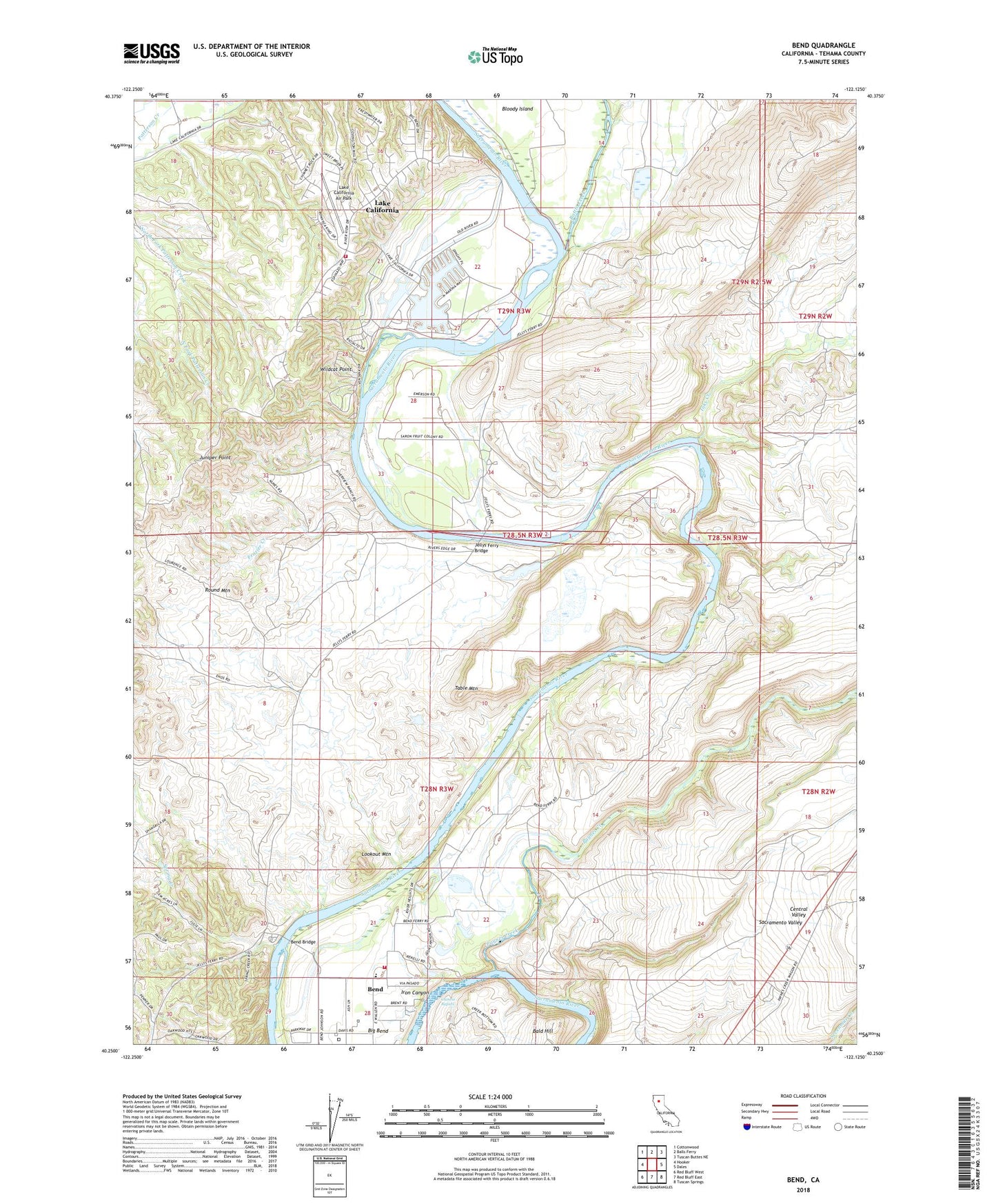
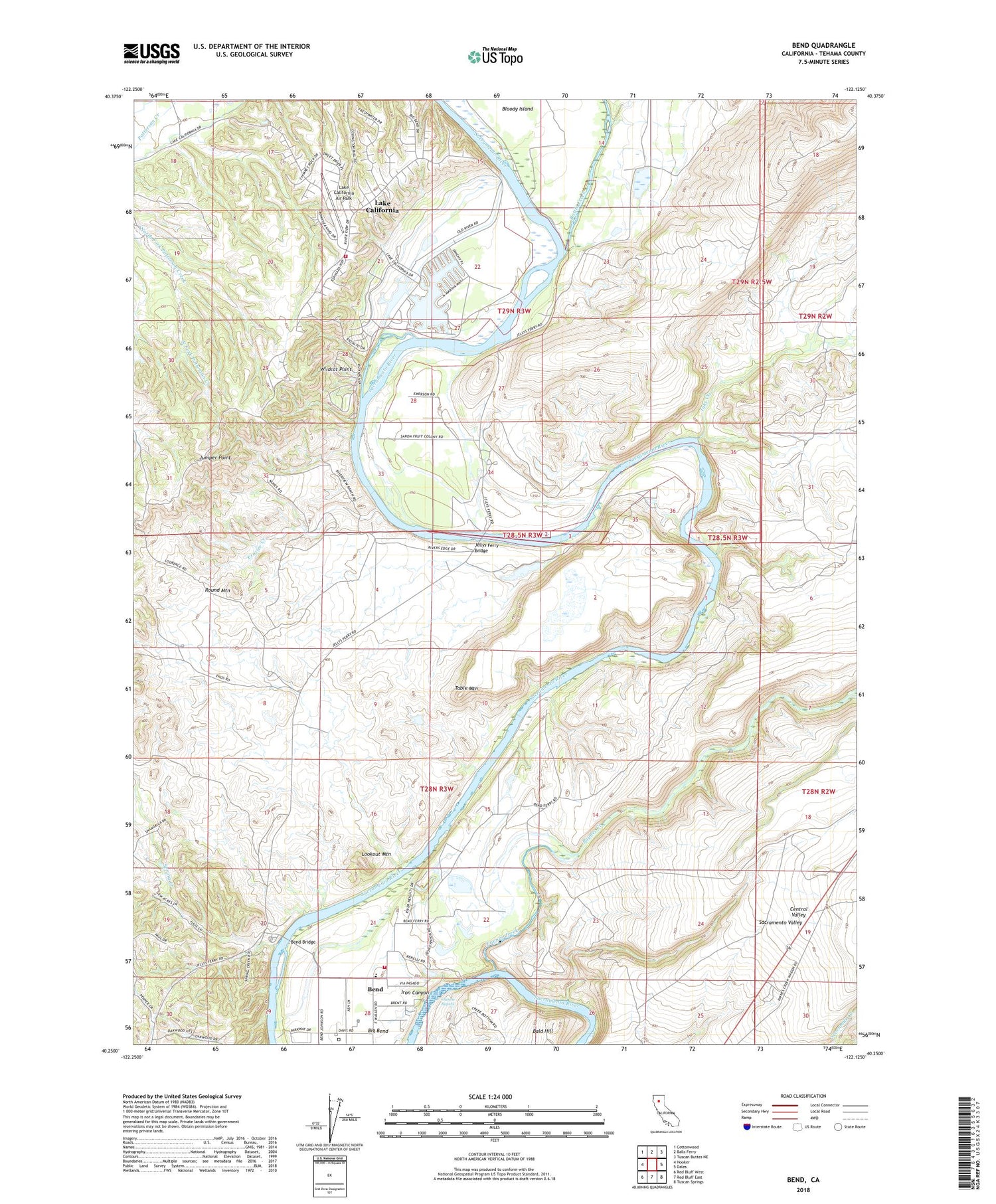
Bend California US Topo Map
Couldn't load pickup availability
2023 topographic map quadrangle Bend in the state of California. Scale: 1:24000. Based on the newly updated USGS 7.5' US Topo map series, this map is in the following counties: Tehama. The map contains contour data, water features, and other items you are used to seeing on USGS maps, but also has updated roads and other features. This is the next generation of topographic maps. Printed on high-quality waterproof paper with UV fade-resistant inks.
Quads adjacent to this one:
West: Hooker
Northwest: Cottonwood
North: Balls Ferry
Northeast: Tuscan Buttes NE
East: Dales
Southeast: Tuscan Springs
South: Red Bluff East
Southwest: Red Bluff West
This map covers the same area as the classic USGS quad with code o40122c2.
Contains the following named places: Bald Hill, Battle Creek, Battle Creek Ranch, Bend, Bend Bridge, Bend Census Designated Place, Bend Elementary School, Bloody Island, Chinese Rapids, Ekelund Ranch, Frazier Creek, Inks Creek, Inks Creek Ranch, Jelly Ranch, Jelly School, Jellys Ferry, Jellys Ferry Bridge, Juniper Point, Lake California Air Park, Lake California Census Designated Place, Lookout Mountain, Rancho Rio Alto, Round Mountain, Spring Creek, Table Mountain, Table Mountain Lake, Tehama County Fire Department Station 2 Lake California, Tehama County Fire Department Station 5 Bend, Wildcat Point