MyTopo
Covelo East California US Topo Map
Couldn't load pickup availability
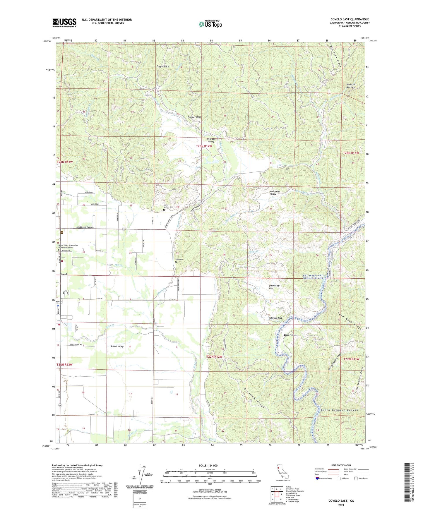
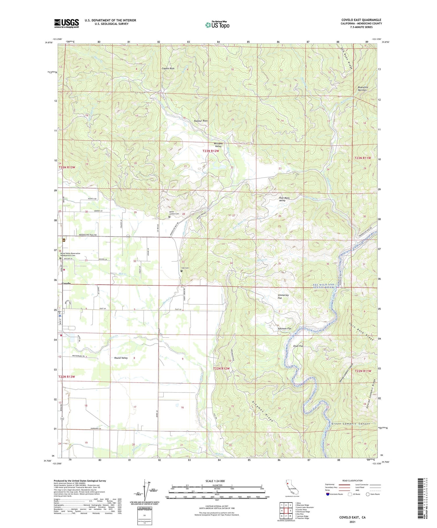
2021 topographic map quadrangle Covelo East in the state of California. Scale: 1:24000. Based on the newly updated USGS 7.5' US Topo map series, this map is in the following counties: Mendocino. The map contains contour data, water features, and other items you are used to seeing on USGS maps, but also has updated roads and other features. This is the next generation of topographic maps. Printed on high-quality waterproof paper with UV fade-resistant inks.
Quads adjacent to this one:
West: Covelo West
Northwest: Mina
North: Bluenose Ridge
Northeast: Leech Lake Mountain
East: Newhouse Ridge
Southeast: Thatcher Ridge
South: Jamison Ridge
Southwest: Dos Rios
This map covers the same area as the classic USGS quad with code o39123g2.
Contains the following named places: Atkinson Flat, Blueschist Narrows, California Department of Forestry and Fire Protection Covelo, Codding Ranch, Covelo, Covelo Census Designated Place, Covelo Division, Covelo Fire Protection District, Covelo Post Office, Covelo Ranger Station, Coyote Rock, Cubbler Place, Dingman Ridge, Eel River Charter School, Etsel Crossing, Etsel Flat, George Lambert Canyon, Green Lambert Canyon, Grist Creek, Little Salt Creek, Mendocino County Sheriff's Office, Modesto Camp, Murphy Creek, Nome Lackee Cemetery, Panther Rock, Poor Mans Creek, Poor Mans Valley, Reservation School, Round Valley, Round Valley Reservation Headquarters Cemetery, Short Creek, Silver Creek, Simmerley Flat, Spencer Ranch, Tank Creek, Town Creek, Turner Creek, Williams Creek, Williams Valley, Williams Valley 1381 Dam, Yuki Cemetery, ZIP Code: 95428