MyTopo
Dos Rios California US Topo Map
Couldn't load pickup availability
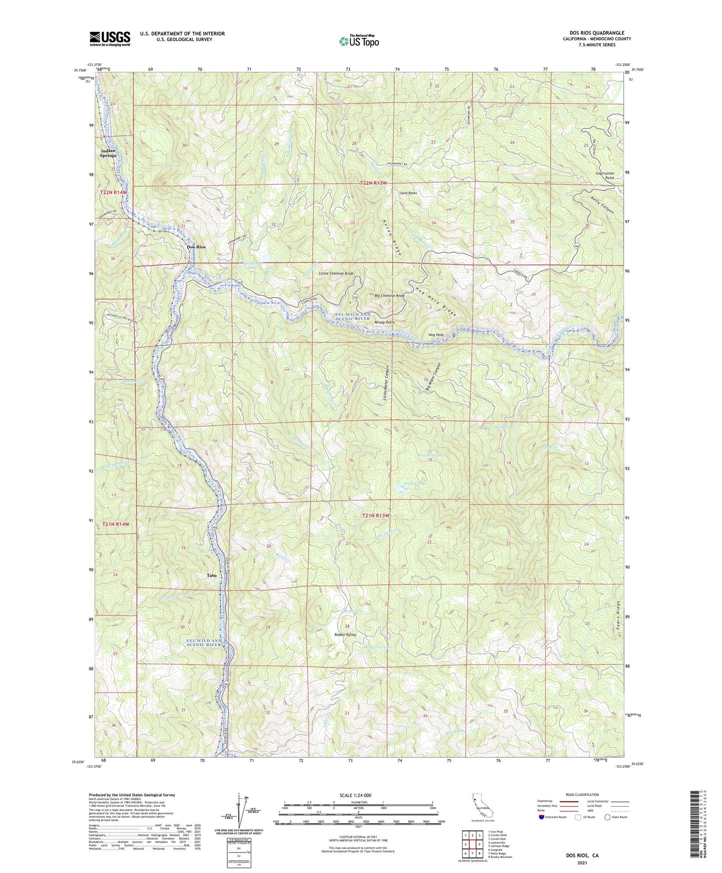
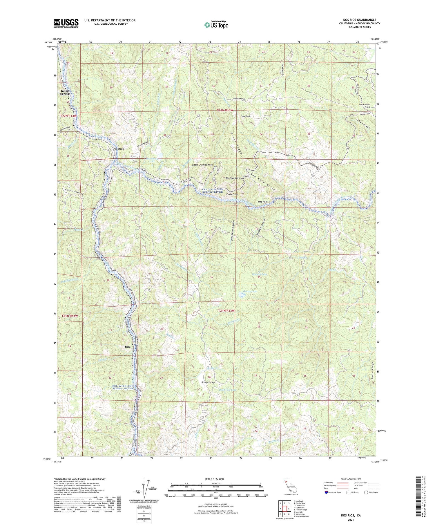
2021 topographic map quadrangle Dos Rios in the state of California. Scale: 1:24000. Based on the newly updated USGS 7.5' US Topo map series, this map is in the following counties: Mendocino. The map contains contour data, water features, and other items you are used to seeing on USGS maps, but also has updated roads and other features. This is the next generation of topographic maps. Printed on high-quality waterproof paper with UV fade-resistant inks.
Quads adjacent to this one:
West: Laytonville
Northwest: Iron Peak
North: Covelo West
Northeast: Covelo East
East: Jamison Ridge
Southeast: Brushy Mountain
South: Willis Ridge
Southwest: Longvale
This map covers the same area as the classic USGS quad with code o39123f3.
Contains the following named places: Big Chemise Knob, Big Water Canyon, Brad Turner Creek, Burger Creek, Cable Creek, Coal Creek, Dead Cow Lake, Dean Creek, Deer Lodge, Division Creek, Doghouse Creek, Dos Rios, Eastman Creek, Gamache Creek, Goforth Creek, Grassy Lake, Hog Hole, Hog Hole Ridge, Hosea Creek, Hosea Ridge, Howard Lake, Hunters Camp, Indian Springs, Inspiration Point, Little Chemise Knob, Little Water Canyon, Middle Fork Eel River, Outlet Creek, Pickrell Creek, Poonkinny Creek, Poonkinny Lake, Rock Creek, Rodeo Creek, Rodeo Valley, Salt Creek, Sand Bank Creek, Sand Banks, Tatu, Tatu Creek, Windy Point, ZIP Code: 95429