
MyTopo
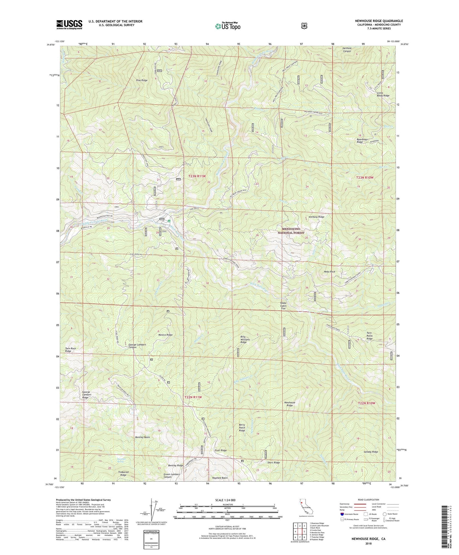
Newhouse Ridge California US Topo Map
Couldn't load pickup availability
Also explore the Newhouse Ridge Forest Service Topo of this same quad for updated USFS data
2021 topographic map quadrangle Newhouse Ridge in the state of California. Scale: 1:24000. Based on the newly updated USGS 7.5' US Topo map series, this map is in the following counties: Mendocino. The map contains contour data, water features, and other items you are used to seeing on USGS maps, but also has updated roads and other features. This is the next generation of topographic maps. Printed on high-quality waterproof paper with UV fade-resistant inks.
Quads adjacent to this one:
West: Covelo East
Northwest: Bluenose Ridge
North: Leech Lake Mountain
Northeast: Buck Rock
East: Mendocino Pass
Southeast: Plaskett Ridge
South: Thatcher Ridge
Southwest: Jamison Ridge
This map covers the same area as the classic USGS quad with code o39123g1.
Contains the following named places: Bar Creek, Bauer Ranch, Bentley Basin, Bentley Ridge, Berry Patch Ridge, Billy Williams Creek, Billy Williams Ridge, Black Butte River, Boardman Ridge, Boardman Ridge Campground, Buck Creek, Bucknell Spring, Capistran Ranch, Eel River Campground, Eel River Station, Eel River Work Center, George Lambert Ridge, Horse Camp, Johnson Corral, Jumpoff Creek, McClure Place, Mexico Ridge, Montague Ranger Station, Nebo Creek, Nebo Rock, Newhouse Creek, Newhouse Ridge, Rose Creek, Sallady Creek, Shake Cabin Flat, Sherburns, Shields Creek, Short Ridge, Tramp Creek, Twin Rock Ridge, Twin Rocks Ranger Station, Van Horn Creek


