MyTopo
Craig Canyon California US Topo Map
Couldn't load pickup availability
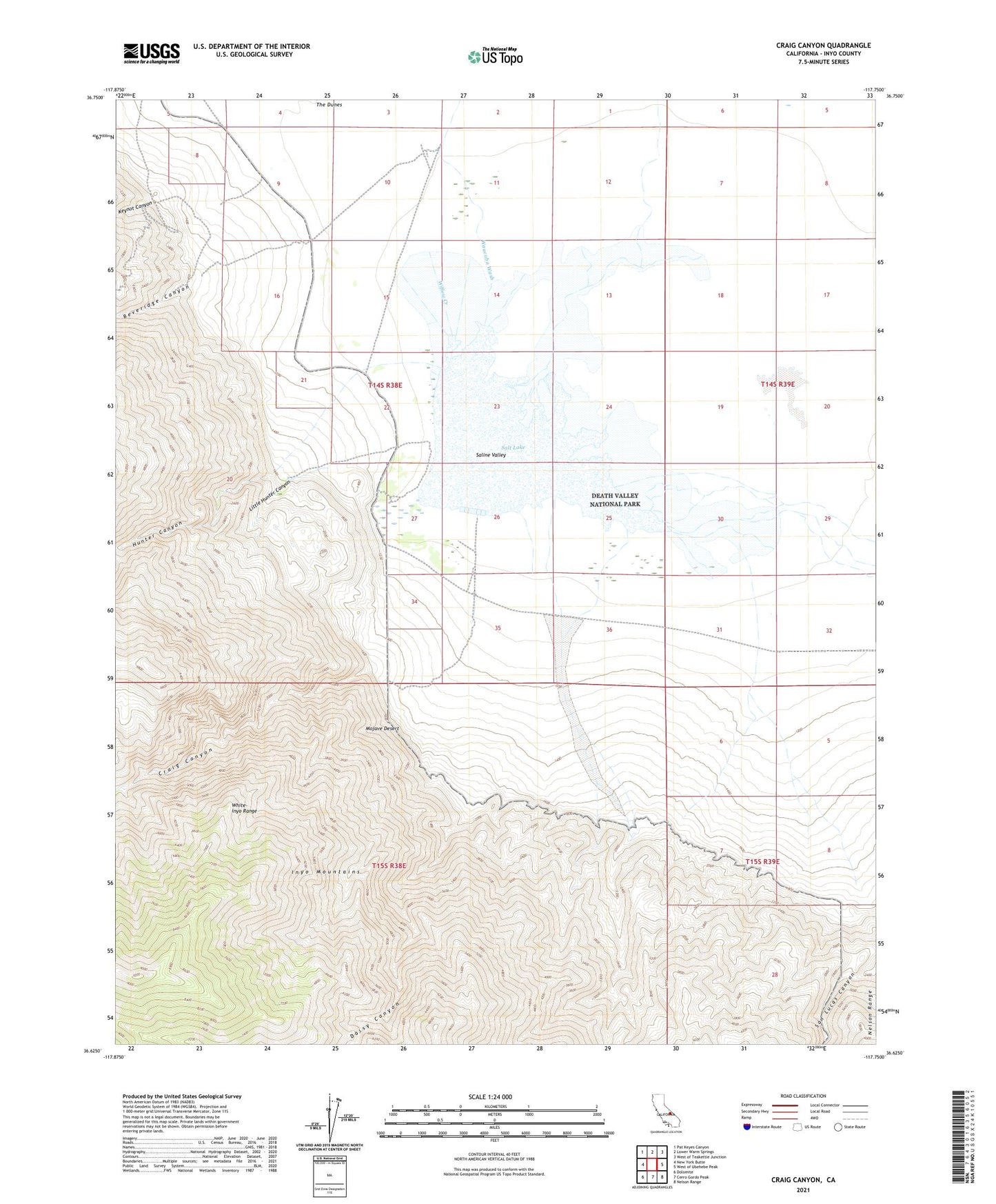
2021 topographic map quadrangle Craig Canyon in the state of California. Scale: 1:24000. Based on the newly updated USGS 7.5' US Topo map series, this map is in the following counties: Inyo. The map contains contour data, water features, and other items you are used to seeing on USGS maps, but also has updated roads and other features. This is the next generation of topographic maps. Printed on high-quality waterproof paper with UV fade-resistant inks.
Quads adjacent to this one:
West: New York Butte
Northwest: Pat Keyes Canyon
North: Lower Warm Springs
Northeast: West of Teakettle Junction
East: West of Ubehebe Peak
Southeast: Nelson Range
South: Cerro Gordo Peak
Southwest: Dolomite
This map covers the same area as the classic USGS quad with code o36117f7.
Contains the following named places: Beveridge Canyon, Big Silver Mine, Craig Canyon, Daisy Canyon, Gervias Well, Hunter Canyon, Keynot Canyon, Little Hunter Canyon, Saline Valley, Salt Lake, Trepier Mine, Vega Mine, Waucoba Wash