MyTopo
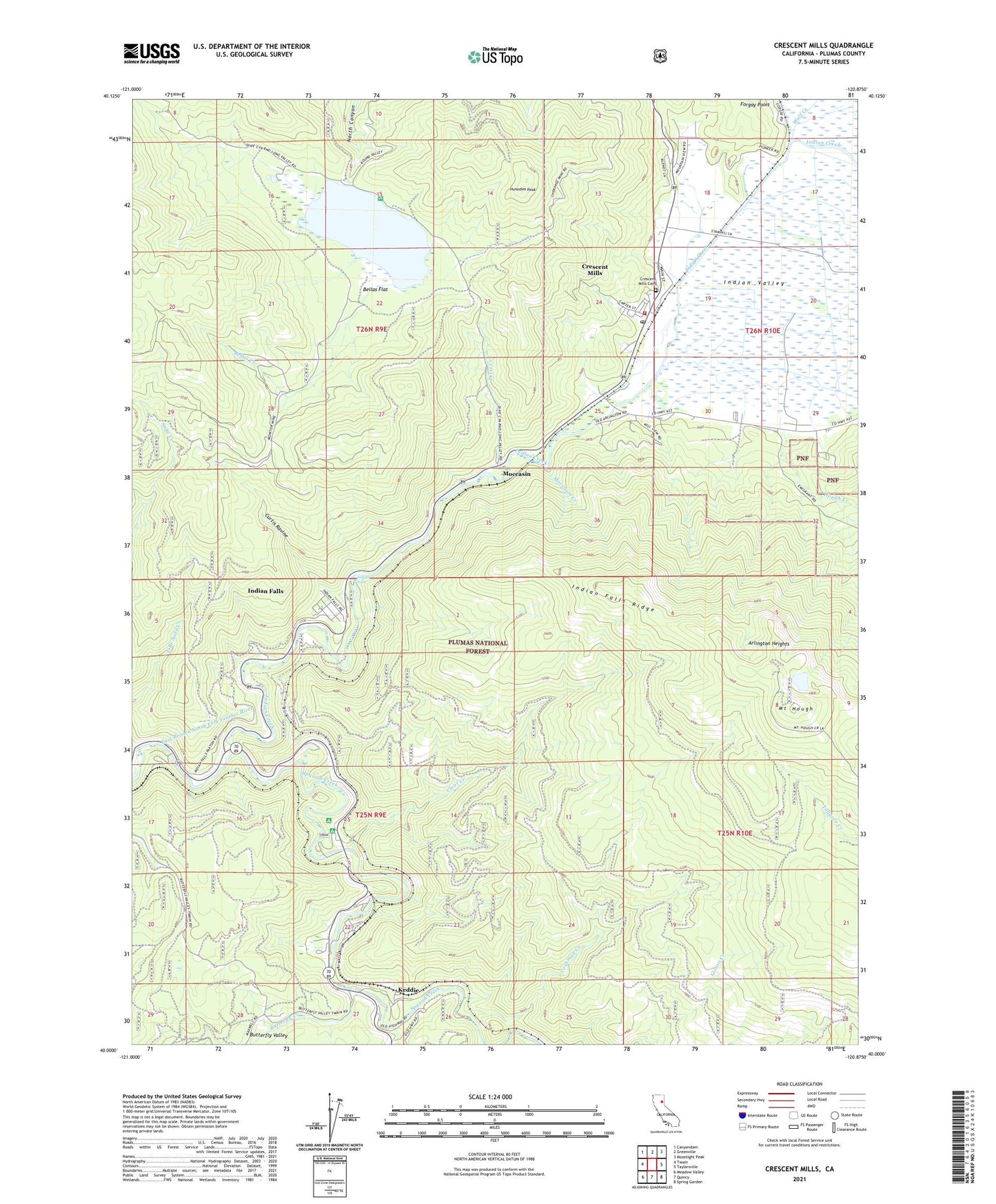
Crescent Mills California US Topo Map
Couldn't load pickup availability
Also explore the Crescent Mills Forest Service Topo of this same quad for updated USFS data
2021 topographic map quadrangle Crescent Mills in the state of California. Scale: 1:24000. Based on the newly updated USGS 7.5' US Topo map series, this map is in the following counties: Plumas. The map contains contour data, water features, and other items you are used to seeing on USGS maps, but also has updated roads and other features. This is the next generation of topographic maps. Printed on high-quality waterproof paper with UV fade-resistant inks.
Quads adjacent to this one:
West: Twain
Northwest: Canyondam
North: Greenville
Northeast: Moonlight Peak
East: Taylorsville
Southeast: Spring Garden
South: Quincy
Southwest: Meadow Valley
This map covers the same area as the classic USGS quad with code o40120a8.
Contains the following named places: Arcadia Mine, Arlington Bridge, Arlington Heights, Bellas Creek, Bellas Flat, Bidwell Lake 273 Dam, Big Blackhawk Creek, Butterfly Creek, Butterfly Valley, Butterfly Valley Botanical Area, Camp Wallace Alexander, Cashman Creek, Cherokee Mine, Clear Creek, Crescent Mills, Crescent Mills Cemetery, Crescent Mills Census Designated Place, Crescent Mills Fire Protection District, Crescent Mills Post Office, Crystal Lake, Curtis Ravine, Deer Vally Golf Links, Dixie Creek, Forgay Point, Hough Creek, Hunodim Peak, Indian Creek, Indian Falls, Indian Falls Census Designated Place, Indian Falls Ridge, Keddie, Keddie Census Designated Place, KQNC-FM (Quincy), Moccasin, Moccasin Creek, Monitor Mine, Mount Hough, Mount Hough State Game Refuge, Paxton, Round Valley, Round Valley Campground, Round Valley Reservoir, Soda Creek, Spanish Creek, Standart Mine, Tunnel Number 26, Tunnel Number 27, Tunnel Number 28, Tunnel Number 29, Tunnel Number 30, Tunnel Number 31, Tunnel Number 32, Tunnel Number 33, Wolf Creek, ZIP Code: 95934