MyTopo
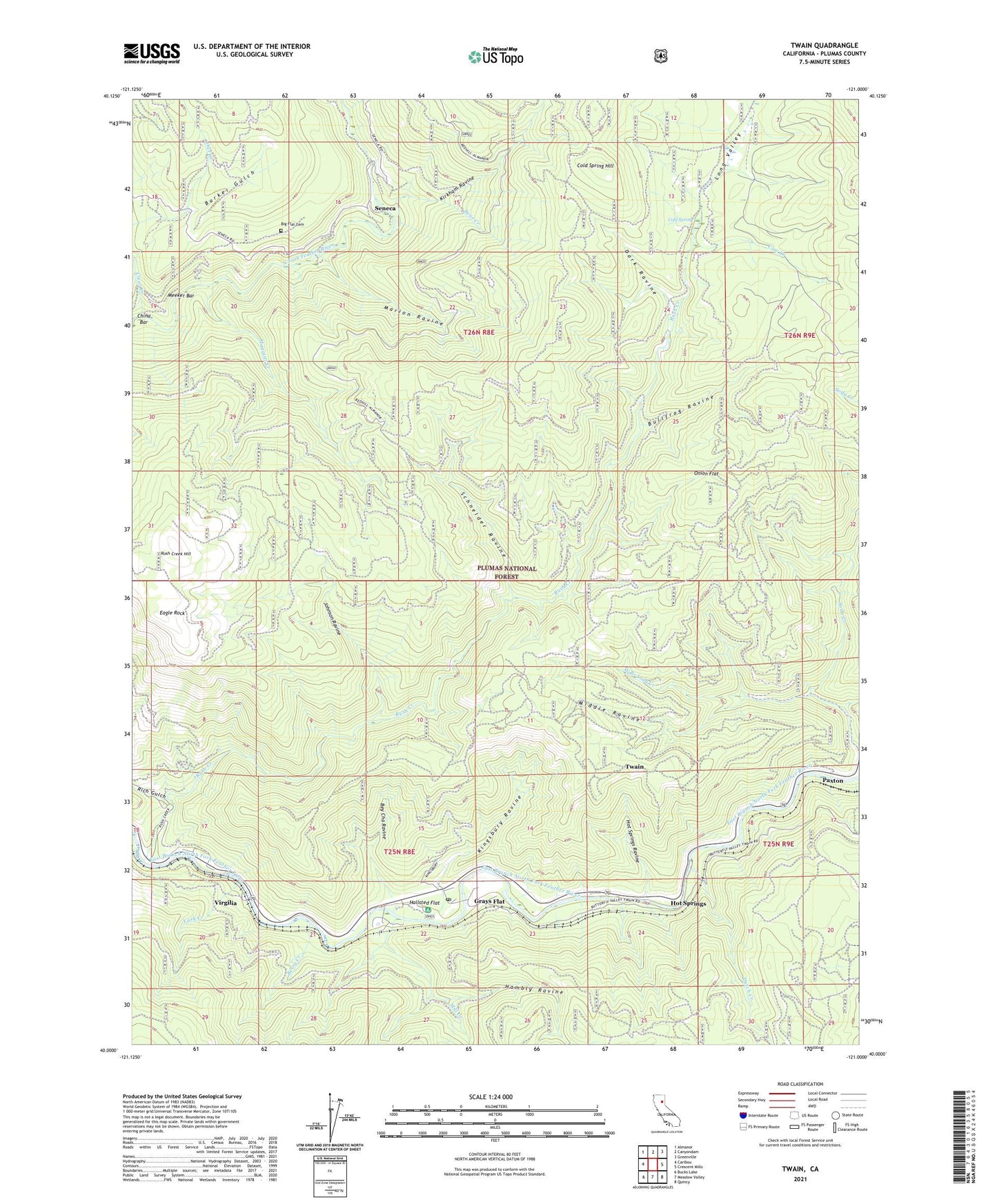
Twain California US Topo Map
Couldn't load pickup availability
Also explore the Twain Forest Service Topo of this same quad for updated USFS data
2021 topographic map quadrangle Twain in the state of California. Scale: 1:24000. Based on the newly updated USGS 7.5' US Topo map series, this map is in the following counties: Plumas. The map contains contour data, water features, and other items you are used to seeing on USGS maps, but also has updated roads and other features. This is the next generation of topographic maps. Printed on high-quality waterproof paper with UV fade-resistant inks.
Quads adjacent to this one:
West: Caribou
Northwest: Almanor
North: Canyondam
Northeast: Greenville
East: Crescent Mills
Southeast: Quincy
South: Meadow Valley
Southwest: Bucks Lake
This map covers the same area as the classic USGS quad with code o40121a1.
Contains the following named places: Barker Gulch, Bear Creek, Berry Creek, Bey Cha Ravine, Big Flat Cemetery, Bullfrog Ravine, China Bar, Clear Creek, Cold Spring, Cold Spring Hill, Comeback Mine, Cow Creek, Dark Ravine, Davis Creek, Dutch Creek, Dutch Hill Mine, Dutch Hill Tunnel, Eagle Rock, East Branch Soda Creek, Glazier Mine, Grays Flat, Hallsted Campground, Hallsted Flat, Hambly Ravine, Hazard Mine, Hot Springs, Hot Springs Ravine, Johnson Ravine, Kingsbury Ravine, Kirkham Ravine, Logan Tunnel, Long Valley, Lucky Chance Mine, Marion Ravine, Mary Cameron Mine, Meeker Bar, Middle Ravine, Mill Creek, Muggins Creek, Onion Flat, Paxton Census Designated Place, Paxton Siding, Perini Place, Providence Hill Mine, Rich Gulch, Rush Creek, Rush Creek Hill, Schneider Ravine, Seneca, Sunnyside Mine, Swiss Mine, Tunnel Number 26, Twain, Twain Census Designated Place, Twain Post Office, Twain Siding, Twelvemile Ravine, Virgilia, Virgilia Mine, West Branch Soda Creek, White Horse Mine, York Creek, ZIP Code: 95984