MyTopo
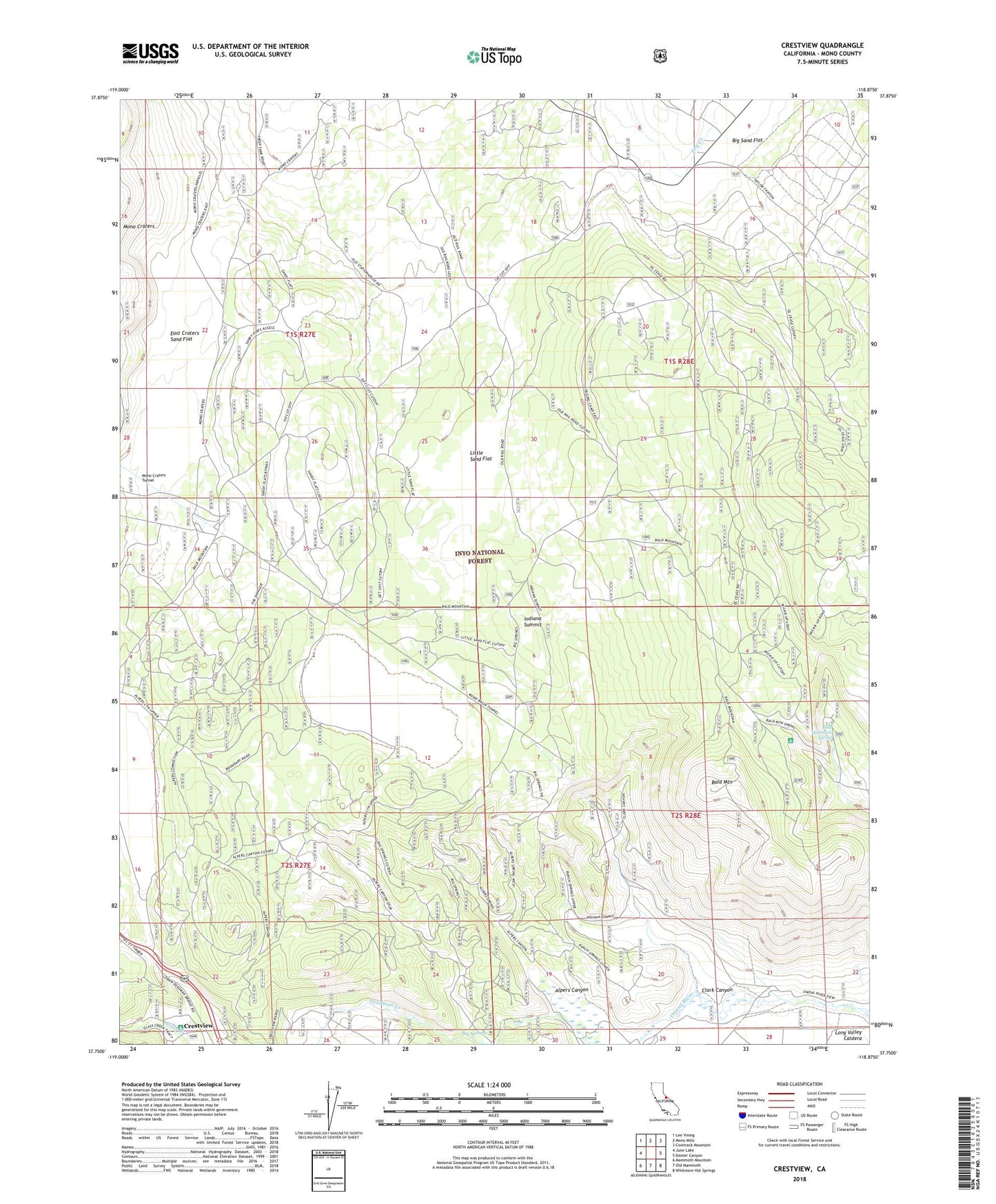
Crestview California US Topo Map
Couldn't load pickup availability
Also explore the Crestview Forest Service Topo of this same quad for updated USFS data
2021 topographic map quadrangle Crestview in the state of California. Scale: 1:24000. Based on the newly updated USGS 7.5' US Topo map series, this map is in the following counties: Mono. The map contains contour data, water features, and other items you are used to seeing on USGS maps, but also has updated roads and other features. This is the next generation of topographic maps. Printed on high-quality waterproof paper with UV fade-resistant inks.
Quads adjacent to this one:
West: June Lake
Northwest: Lee Vining
North: Mono Mills
Northeast: Cowtrack Mountain
East: Dexter Canyon
Southeast: Whitmore Hot Springs
South: Old Mammoth
Southwest: Mammoth Mountain
This map covers the same area as the classic USGS quad with code o37118g8.
Contains the following named places: Alpers Canyon, Bald Mountain, Bald Mountain Lookout, Bald Mountain Spring, Bald Mountain Springs Camping Area, Big Springs, Clark Canyon, Crestview, Deadman Creek, East Craters Sand Flat, East Portal, Glass Creek Campground, Indiana Summit, Indiana Summit Research Natural Area, Inyo National Forest, Little Sand Flat, Owens River Ranch