MyTopo
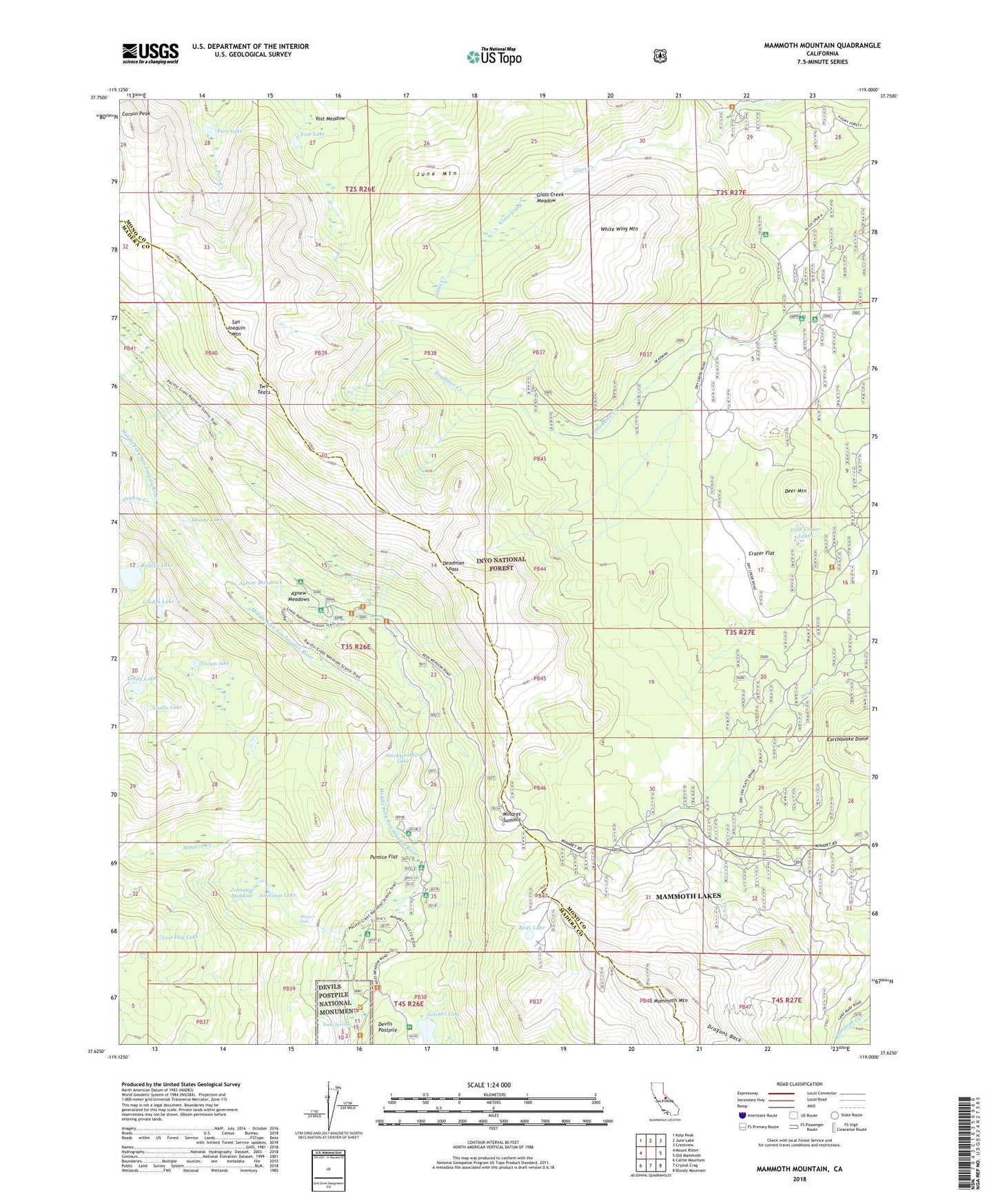
Mammoth Mountain California US Topo Map
Couldn't load pickup availability
Also explore the Mammoth Mountain Forest Service Topo of this same quad for updated USFS data
2021 topographic map quadrangle Mammoth Mountain in the state of California. Scale: 1:24000. Based on the newly updated USGS 7.5' US Topo map series, this map is in the following counties: Mono, Madera. The map contains contour data, water features, and other items you are used to seeing on USGS maps, but also has updated roads and other features. This is the next generation of topographic maps. Printed on high-quality waterproof paper with UV fade-resistant inks.
Quads adjacent to this one:
West: Mount Ritter
Northwest: Koip Peak
North: June Lake
Northeast: Crestview
East: Old Mammoth
Southeast: Bloody Mountain
South: Crystal Crag
Southwest: Cattle Mountain
This map covers the same area as the classic USGS quad with code o37119f1.
Contains the following named places: Agnew Meadows, Agnew Meadows Campground, Agnew Meadows Group Campground, Agnew Meadows Horse Camp, Canyon Lodge, Carson Peak, Castle Lake, Crater Flat, Deadman Pass, Deer Mountain, Devils Postpile Recreation Site, Dragons Back, Emily Lake, Fern Lake, Gladys Lake, Glass Creek Meadow, Glass Creek Meadow Trailhead, High Trail Trailhead, Inyo Crater Lakes, Inyo Craters Campground, Inyo Craters Interpretive Site, Inyo Craters Trailhead, John Muir Trail North Trailhead, Johnston Lake, Johnston Meadow, June Mountain, KMMT-FM (Mammoth Lakes), Lost Dog Lake, Lower Deadman Campground, Mammoth Mountain, Mammoth Mountain Main Lodge, Mammoth Mountain Ski Area, Minaret Creek, Minaret Falls, Minaret Falls Campground, Minaret Lake Trailhead, Minaret Summit, Minaret Vista Entrance Station, Minaret Vista Interpretive Site, Minaret Vista Picnic Area, Obsidian Dome Interpretive Site, Obsidian Flat Group Campground, Olaine Lake, Owens River Headwaters Wild and Scenic River, Owens River Headwaters Wilderness, Pumice Flat, Pumice Flat Campground, Pumice Flat Forest Service Station, Pumice Flat Group Campground, Reds Lake, Rosalie Lake, San Joaquin Mountain, Shadow Creek, Soda Springs, Soda Springs Campground, Sotcher Lake, Sotcher Lake Picnic Area, Sotcher Lake Trailhead, Starkweather Lake, Trinity Lakes, Two Teats, Upper Deadman Group Campground, Vivian lake, White Wing Mountain, Yost Lake, Yost Meadow