MyTopo
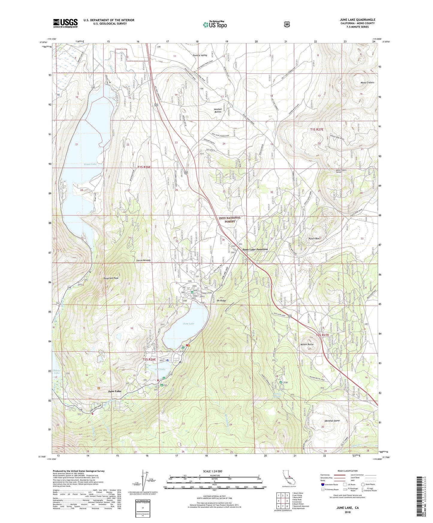
June Lake California US Topo Map
Couldn't load pickup availability
Also explore the June Lake Forest Service Topo of this same quad for updated USFS data
2021 topographic map quadrangle June Lake in the state of California. Scale: 1:24000. Based on the newly updated USGS 7.5' US Topo map series, this map is in the following counties: Mono. The map contains contour data, water features, and other items you are used to seeing on USGS maps, but also has updated roads and other features. This is the next generation of topographic maps. Printed on high-quality waterproof paper with UV fade-resistant inks.
Quads adjacent to this one:
West: Koip Peak
Northwest: Mount Dana
North: Lee Vining
Northeast: Mono Mills
East: Crestview
Southeast: Old Mammoth
South: Mammoth Mountain
Southwest: Mount Ritter
This map covers the same area as the classic USGS quad with code o37119g1.
Contains the following named places: Aeolian Buttes, Aerie Crag Campground, Fern Creek, Glass Flow, Grant Lake, Grant Lake 6-033 Dam, Grant Lake Boating Site, Grant Lake Camground, Grant Lake Overlook, Gull Lake, Gull Lake Campground, Gull Meadows Boating Site, Hartley Springs, Hartley Springs Campground, June Lake, June Lake Beach, June Lake Beach Campground, June Lake Campground, June Lake Census Designated Place, June Lake Fire Protection District Station 1 Headquarters, June Lake Fire Protection District Station 2, June Lake Junction, June Lake Junction Kiosk, June Lake Post Office, June Loop Amphitheatre, June Mountain Ski Area, June Mountain Ski Lodge, Mono County Emergency Medical Services - Station 2 June Lake, Mono Craters, Mono Craters Tunnel, Obsidian Dome, Oh Ridge, Oh! Ridge Campground, Pine Cliff Campground, Pine Cliff Trailer Park, Punch Bowl, Reversed Creek, Reversed Creek Campground, Reversed Peak, Rush Creek Recreation Site, Silver Lake Campground, Wilson Butte, Yost Creek, Yost Lake Trailhead, ZIP Code: 93529