MyTopo
Cross Mountain California US Topo Map
Couldn't load pickup availability
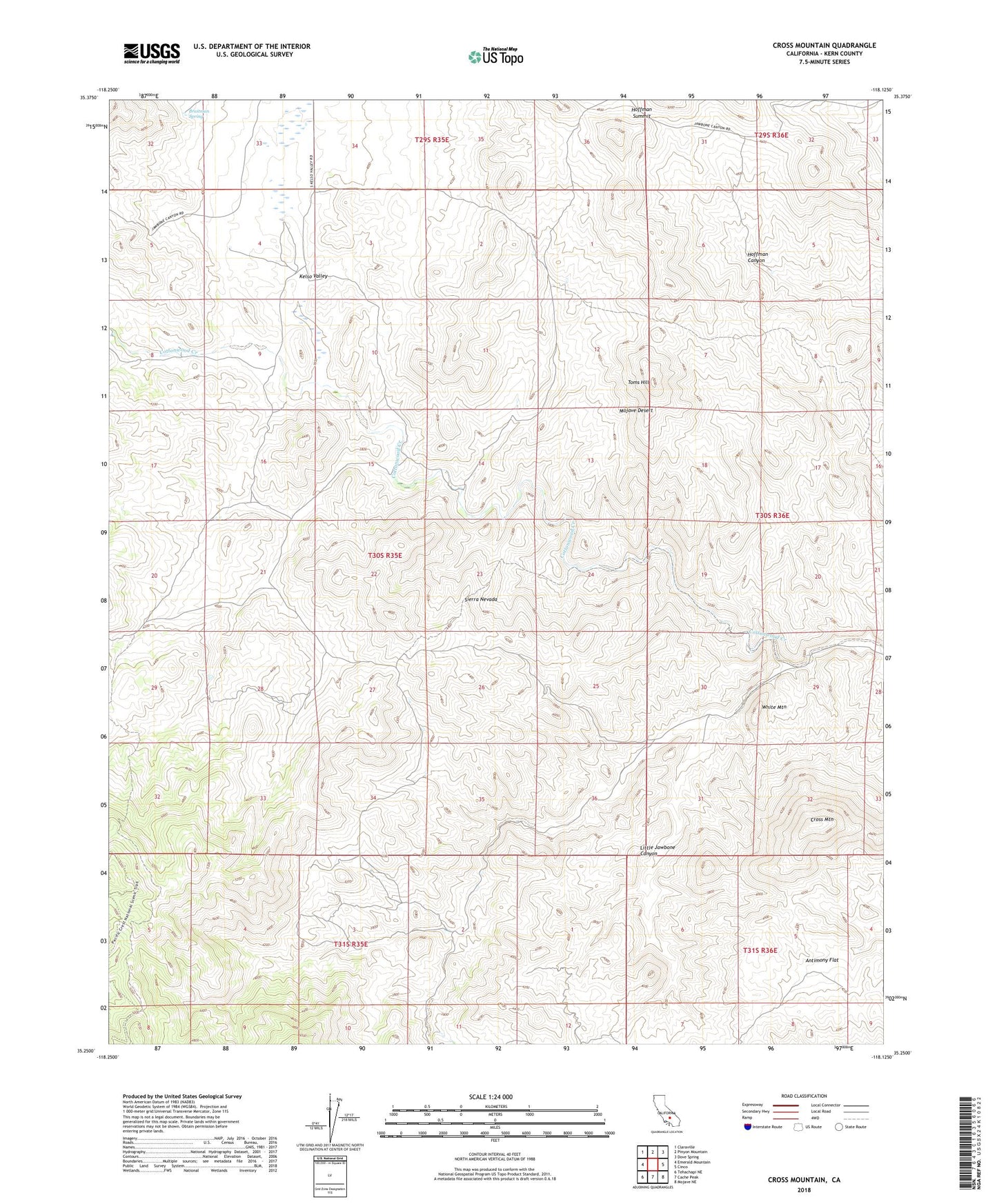
2021 topographic map quadrangle Cross Mountain in the state of California. Scale: 1:24000. Based on the newly updated USGS 7.5' US Topo map series, this map is in the following counties: Kern. The map contains contour data, water features, and other items you are used to seeing on USGS maps, but also has updated roads and other features. This is the next generation of topographic maps. Printed on high-quality waterproof paper with UV fade-resistant inks.
Quads adjacent to this one:
West: Emerald Mountain
Northwest: Claraville
North: Pinyon Mountain
Northeast: Dove Spring
East: Cinco
Southeast: Mojave NE
South: Cache Peak
Southwest: Tehachapi NE
This map covers the same area as the classic USGS quad with code o35118c2.
Contains the following named places: Amalia Mine, Antimony Flat, Braitman Spring, Cottonwood Creek, Cross Mountain, Falls Creek, Hoffman Summit, Kelso Valley, Landers School, Little Jawbone Canyon, Schoolhouse Well, Skyline Mine, Toms Hill, White Mountain