MyTopo
Pinyon Mountain California US Topo Map
Couldn't load pickup availability
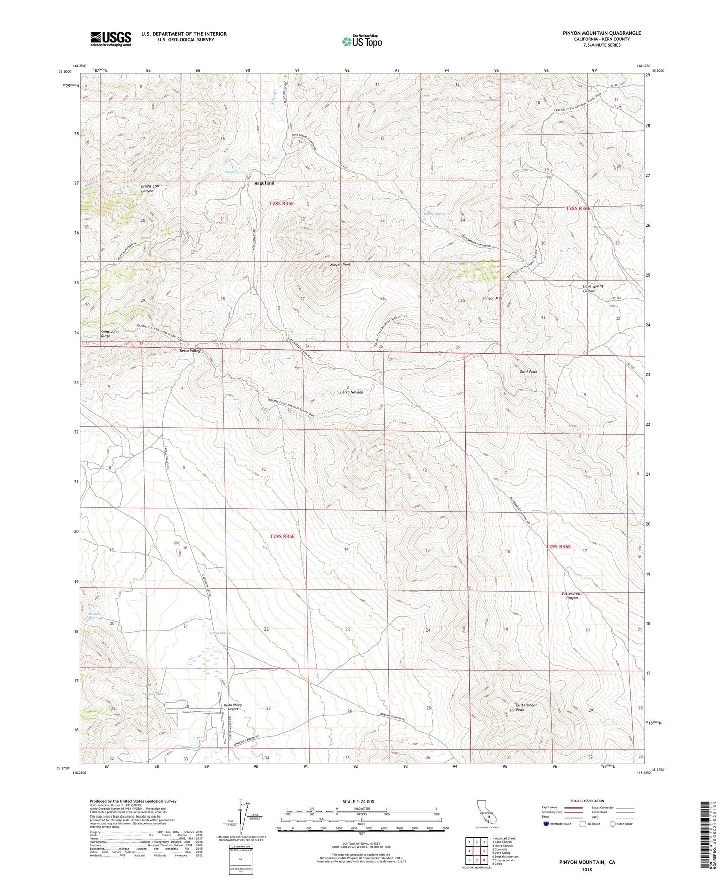
2022 topographic map quadrangle Pinyon Mountain in the state of California. Scale: 1:24000. Based on the newly updated USGS 7.5' US Topo map series, this map is in the following counties: Kern. The map contains contour data, water features, and other items you are used to seeing on USGS maps, but also has updated roads and other features. This is the next generation of topographic maps. Printed on high-quality waterproof paper with UV fade-resistant inks.
Quads adjacent to this one:
West: Claraville
Northwest: Woolstalf Creek
North: Cane Canyon
Northeast: Horse Canyon
East: Dove Spring
Southeast: Cinco
South: Cross Mountain
Southwest: Emerald Mountain
Contains the following named places: Bright Star Canyon, Butterbredt Peak, Butterbredt Well, Esperanza Canyon, Gold Peak, Green Spring, Kelso Valley Airport, Mayan Peak, Measels Spring, Ora Grande Mine, Pinyon Mountain, Quail Spring, Road Well, Sageland, Saint John Mine, Sorrells Ranch, Sunset Mine, Tunnel Spring, Whitney Well, Willow Spring