MyTopo
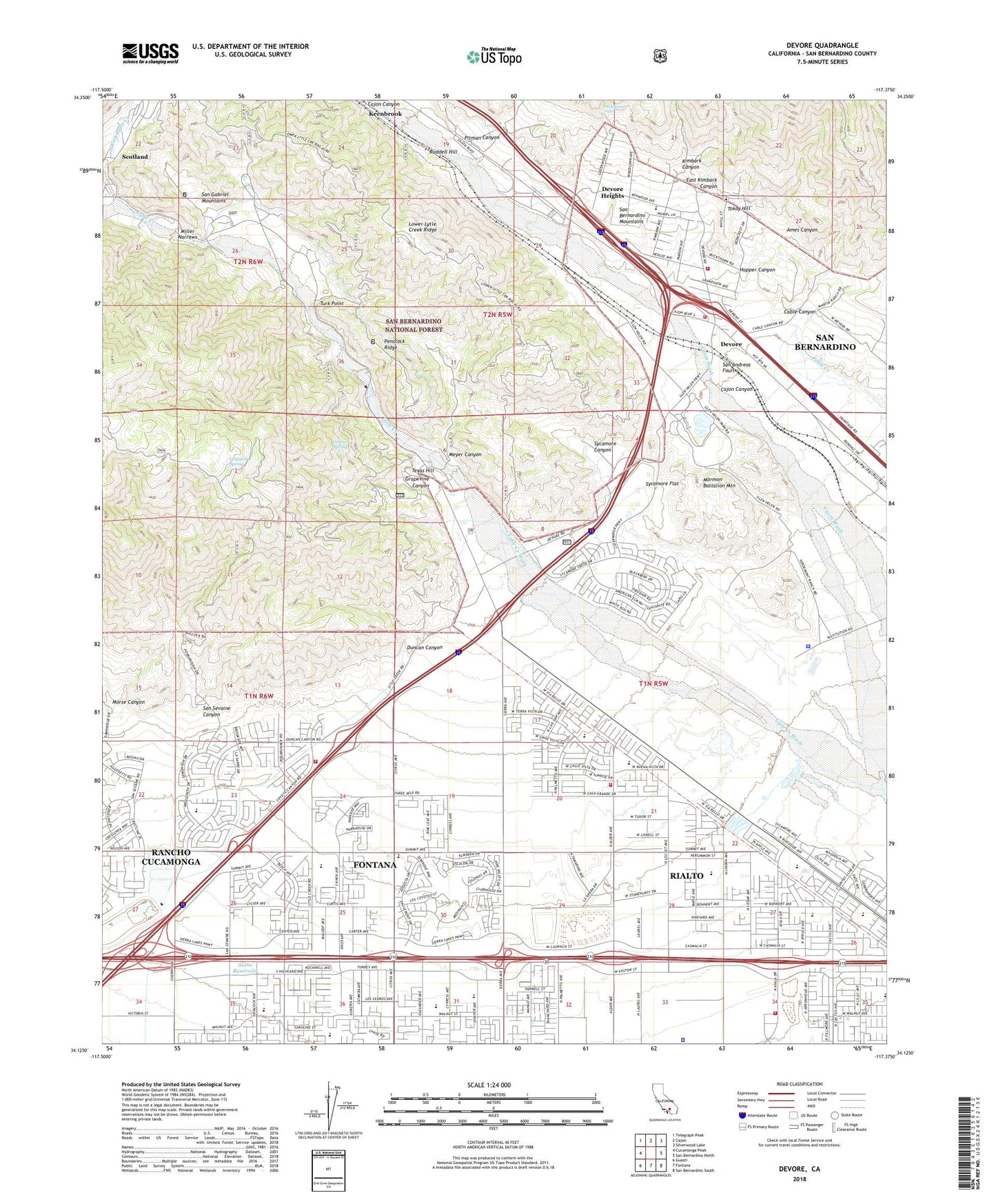
Devore California US Topo Map
Couldn't load pickup availability
Also explore the Devore Forest Service Topo of this same quad for updated USFS data
2021 topographic map quadrangle Devore in the state of California. Scale: 1:24000. Based on the newly updated USGS 7.5' US Topo map series, this map is in the following counties: San Bernardino. The map contains contour data, water features, and other items you are used to seeing on USGS maps, but also has updated roads and other features. This is the next generation of topographic maps. Printed on high-quality waterproof paper with UV fade-resistant inks.
Quads adjacent to this one:
West: Cucamonga Peak
Northwest: Telegraph Peak
North: Cajon
Northeast: Silverwood Lake
East: San Bernardino North
Southeast: San Bernardino South
South: Fontana
Southwest: Guasti
This map covers the same area as the classic USGS quad with code o34117b4.
Contains the following named places: A B Miller High School, Ames Canyon, Cable Canyon, Cable Canyon Trail, Cajon Canyon, Cajon School, California Department of Forestry and Fire Protection Fire Station 2 Devore, Convict Spring, David W Long Elementary School at Hunters Ridge, Devore, Devore Heights, Doctor Edward M Fitzgerald Elementary School, Duncan Canyon, East Kimbark Canyon, El Rancho Verde Country Club, Elizabeth T Hughbanks Elementary School, Ethel Kucera Middle School, Fontana Airport, Fontana Power Plant, Glen Helen Off Highway Vehicle Park, Glen Helen Ranch, Glen Helen Regional Park, Glen Helen Rehabilitation Correctional Center, Glen Helen Rehabilitation Facility, Glenn Helen Infirmary, Grapeland, Grapevine Canyon, Grapevine Spring, Highland Riding Academy, Hitching Ranch, Hopper Canyon, Jerry Eaves Park, Jessie Turner Community Center, Keenbrook, Kimbark Canyon, Kimbark Elementary School, Kolb Middle School, La Cuesta Fontana, Lytle Creek, Lytle Creek Post Office, Lytle Creek Ranger Station, Meyer Canyon, Middle Fork Lytle Creek, Middleman Falls, Miller Narrows, Mormon Battalion Mountain, Morse Canyon, Mountainside Private School, Nealeys Corner, North Fontana, North Fontana Community Baptist Church, North Fontana Park, North Fork Lytle Creek, North Verdemont Elementary School, Penstock Ridge, Pitman Canyon, Preston Elementary School, Rialto Fire Department Station 203, Rialto Fire Department Station 204, Rialto Municipal Airport /Miro Field/, Rialto Seventh Day Adventist Church, Ruddell Hill, San Bernardino County Fire Department Station 2, San Bernardino County Fire Department Station 79, San Bernardino County Hazardous Materials Division Business Office, San Bernardino County Office of Emergency Services Hazardous Materials Division Building, San Bernardino National Forest Cajon Ranger Station - Station 31, San Sevaine Canyon, San Sevaine Cow Camp, San Sevaine Lookout, Scotland, Sierra Heights, Simplicity A-Z Learning Center, Six-M Egg Ranch, South Fork Lytle Creek, Stone Reservoir, Sycamore Canyon, Sycamore Flat, Sycamore Station, Texas Hill, Tokay Hill, Trapp Elementary School, Turk Point, Verdemont Ranch, Walnut Ridge, Wayne Ruble Middle School, West End, ZIP Codes: 92336, 92377, 92407