MyTopo
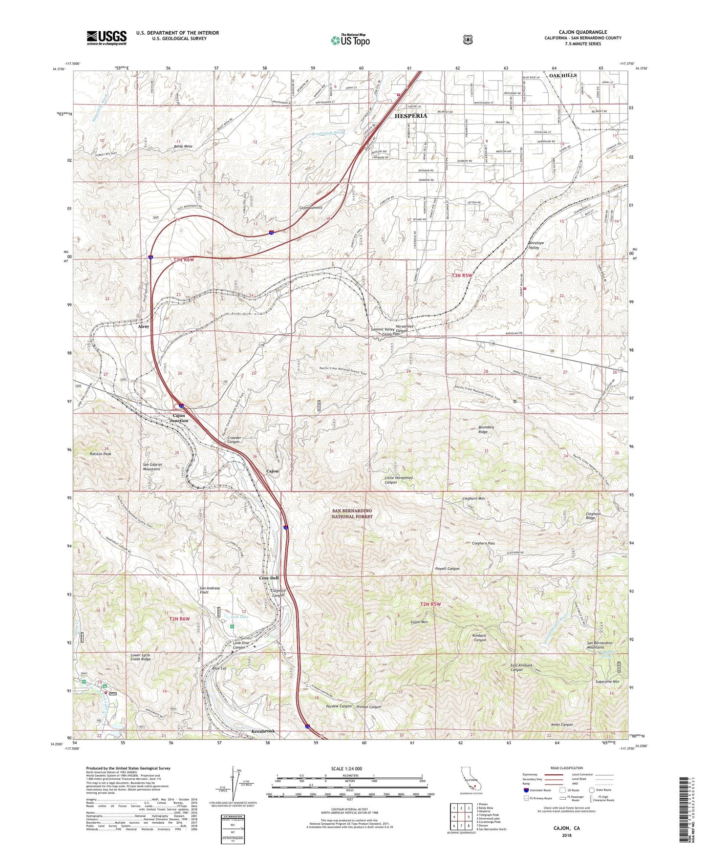
Cajon California US Topo Map
Couldn't load pickup availability
Also explore the Cajon Forest Service Topo of this same quad for updated USFS data
2021 topographic map quadrangle Cajon in the state of California. Scale: 1:24000. Based on the newly updated USGS 7.5' US Topo map series, this map is in the following counties: San Bernardino. The map contains contour data, water features, and other items you are used to seeing on USGS maps, but also has updated roads and other features. This is the next generation of topographic maps. Printed on high-quality waterproof paper with UV fade-resistant inks.
Quads adjacent to this one:
West: Telegraph Peak
Northwest: Phelan
North: Baldy Mesa
Northeast: Hesperia
East: Silverwood Lake
Southeast: San Bernardino North
South: Devore
Southwest: Cucamonga Peak
This map covers the same area as the classic USGS quad with code o34117c4.
Contains the following named places: Alderson Place, Alray, Applewhite Campground, Blue Cut, Boundary Ridge, Cajon, Cajon Campground, Cajon Junction, Cajon Mountain, Cajon Mountain Lookout, Cajon Pass, Cajon Summit, Cajon Summit Lookout, Cleghorn Canyon, Cleghorn Mountain, Cleghorn Pass, Cleghorn Ridge, Cosy Dell, Crowder Canyon, Glenn Ranch, Little Horsethief Ranch, Lone Pine Canyon, Lost Lake, Lower Lytle Creek Ridge, Mount High East Ski Area, Oak Hills Census Designated Place, Perdew Canyon, Pisgah Ranch, Powell Canyon, Ralston Peak, San Bernardino County Fire Department - Hesperia Fire Station, San Bernardino County Fire Department Station 20 - Lytle Creek, San Bernardino County Fire Department Station 40 - Oak Hills, Sells Ranch, Sheep Creek, Sugarpine Mountain, Sugarpine Spring, Summit, Summit Terrace, West Fork Camp, Whitlock Ranch