
MyTopo
Cucamonga Peak California US Topo Map
Couldn't load pickup availability
Also explore the Cucamonga Peak Forest Service Topo of this same quad for updated USFS data
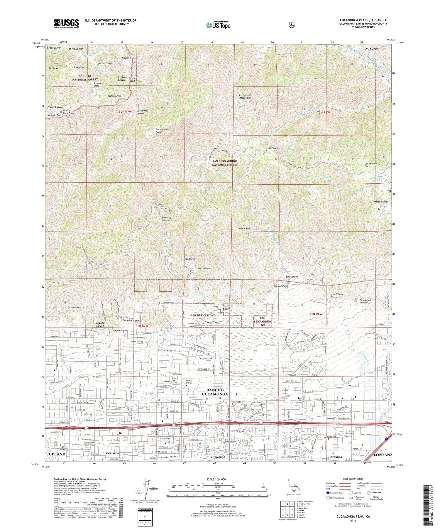
2021 topographic map quadrangle Cucamonga Peak in the state of California. Scale: 1:24000. Based on the newly updated USGS 7.5' US Topo map series, this map is in the following counties: San Bernardino. The map contains contour data, water features, and other items you are used to seeing on USGS maps, but also has updated roads and other features. This is the next generation of topographic maps. Printed on high-quality waterproof paper with UV fade-resistant inks.
Quads adjacent to this one:
West: Mount Baldy
Northwest: Mount San Antonio
North: Telegraph Peak
Northeast: Cajon
East: Devore
Southeast: Fontana
South: Guasti
Southwest: Ontario
This map covers the same area as the classic USGS quad with code o34117b5.
Contains the following named places: Alta Loma Basin Number 1 87-006 Dam, Alta Loma Basin Number 2 87-007 Dam, Alta Loma Christian School, Alta Loma Elementary School, Alta Loma Junior High School, Alta Loma Plaza Shopping Center, Alta Loma Post Office, Alta Loma School, Alta Loma Square Shopping Center, Angalls Canyon, Beryl Park East, Beryl Park West, Bighorn Peak, Bonita Falls, Buck Point, Bull Canyon, Calamity Canyon, Carleton P Lightfoot Elementary School, Carnelian Elementary School, Caryn Elementary School, Cedar Canyon, Chaffey College, Columbine Spring, Commanche Camp, Community Baptist Church, Cross and Crown Lutheran School, Cucamonga Peak, Cucamonga Peak Trail, Cucamonga Wilderness, Day Canyon, Day Canyon Station, Day Canyon Wash, Deer Canyon, Deer Canyon Elementary School, Deer Canyon Wash, Delker Canyon, Demens Canyon, Demens Channel, Dustin Spring, Earl Sicosky Gymnasium, East Avenue Special School, East Etiwanda Canyon, Etiwanda, Etiwanda Fire Station Number 37, Etiwanda Intermediate School, Etiwando High School, Fan Canyon, Floyd M Stork Elementary School, Grace Fellowship Church, Grapeland, Grigsby Field, Haven Village Shopping Center, Henderson Canyon, Heritage Community Park, Hermosa Elementary School, Hermosa Park, Highland Avenue Christian School, Icehouse Saddle, Inland Quarry, Jasper Elementary School, Joe Elliot Tree Memorial, Kelly Camp, KRZE-FM (Ontario), Las Uvas, Legacy Christian School, Lost Creek, Lowder Baseball Field, Lytle Creek Census Designated Place, North East Community Park, Ontario Peak, Ontario Peak Trail, Rancho Cucamonga Fire Department Station 175, Rancho Cucamonga Fire Protection District Station 171, Rancho Cucamonga Fire Protection District Station 176, Rancho Cucamonga High School, Rancho Heritage School, San Sevaine Flats, San Sevaine Well, Sheep Canyon, Sheep Flat, Shortcut Ridge, Smith Canyon, Smith Ridge, Stater Brothers Plaza Shopping Center, Summit Elementary School, Telegraph Wash, Thorpe Canyon, Timber Mountain, Victoria Groves Elementary School, Victoria Groves Park, Vineyard Junior High School, Vineyards Marketplace Shopping Center, Wargin Hall, Windrows Elementary School, Windrows Park, ZIP Codes: 91701, 91737, 91739


