MyTopo
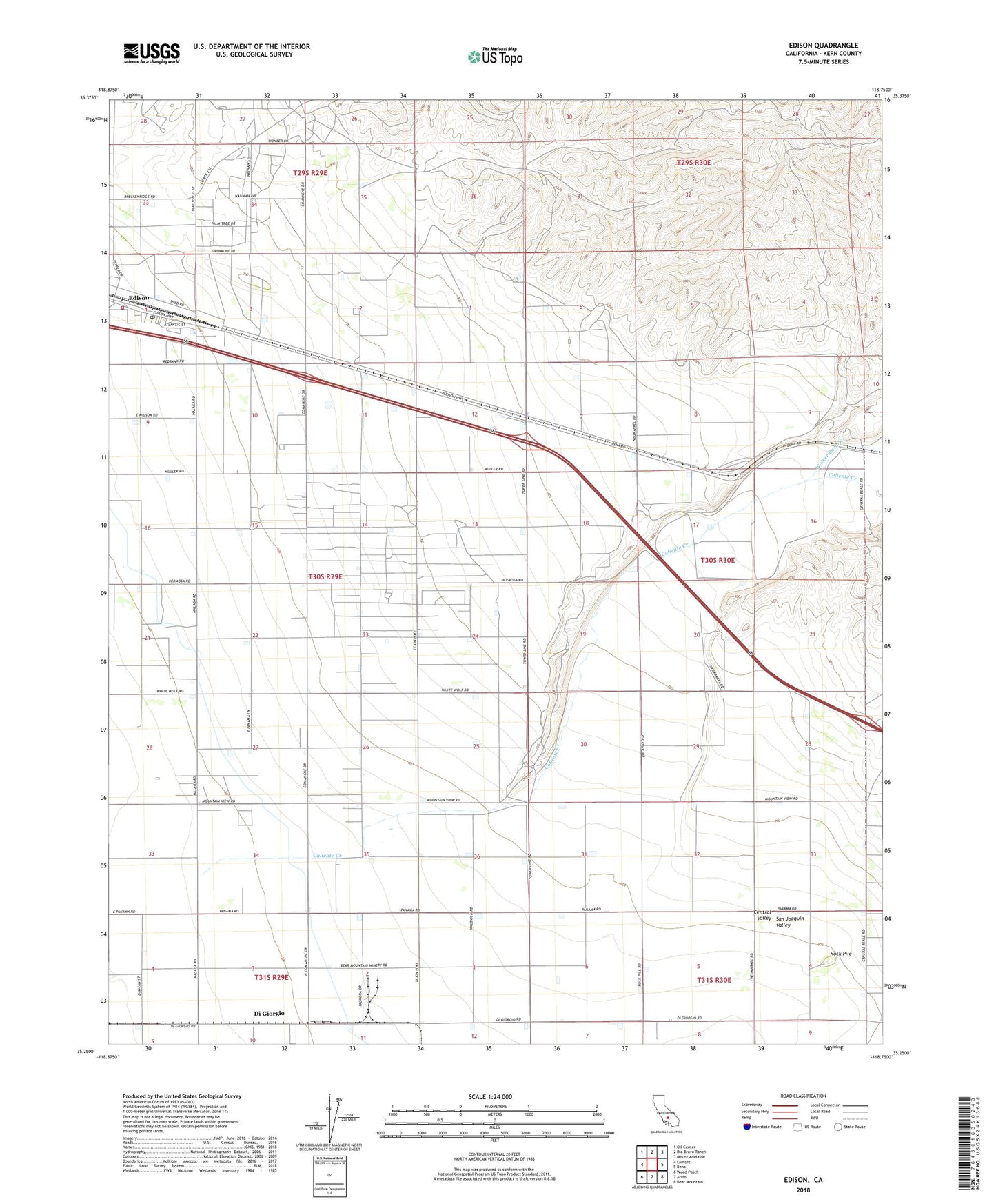
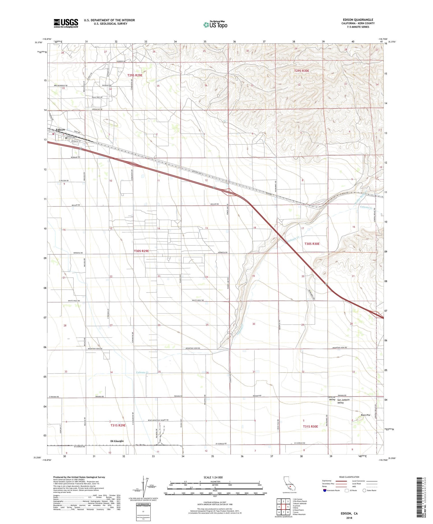
Edison California US Topo Map
Couldn't load pickup availability
2022 topographic map quadrangle Edison in the state of California. Scale: 1:24000. Based on the newly updated USGS 7.5' US Topo map series, this map is in the following counties: Kern. The map contains contour data, water features, and other items you are used to seeing on USGS maps, but also has updated roads and other features. This is the next generation of topographic maps. Printed on high-quality waterproof paper with UV fade-resistant inks.
Quads adjacent to this one:
West: Lamont
Northwest: Oil Center
North: Rio Bravo Ranch
Northeast: Mount Adelaide
East: Bena
Southeast: Bear Mountain
South: Arvin
Southwest: Weed Patch
This map covers the same area as the classic USGS quad with code o35118c7.
Contains the following named places: Caliente Creek, Camp Eight, Camp Ten A, Camp Ten B, Di Giorgio, Di Giorgio Ranch Landing Strip, Edison, Edison Census Designated Place, Edison Oil Field, Edison Post Office, Kern County Fire Department Station 45 Edison, Mountain View Oil Field, Racetrack Oil Field, Rock Pile, Treves