MyTopo
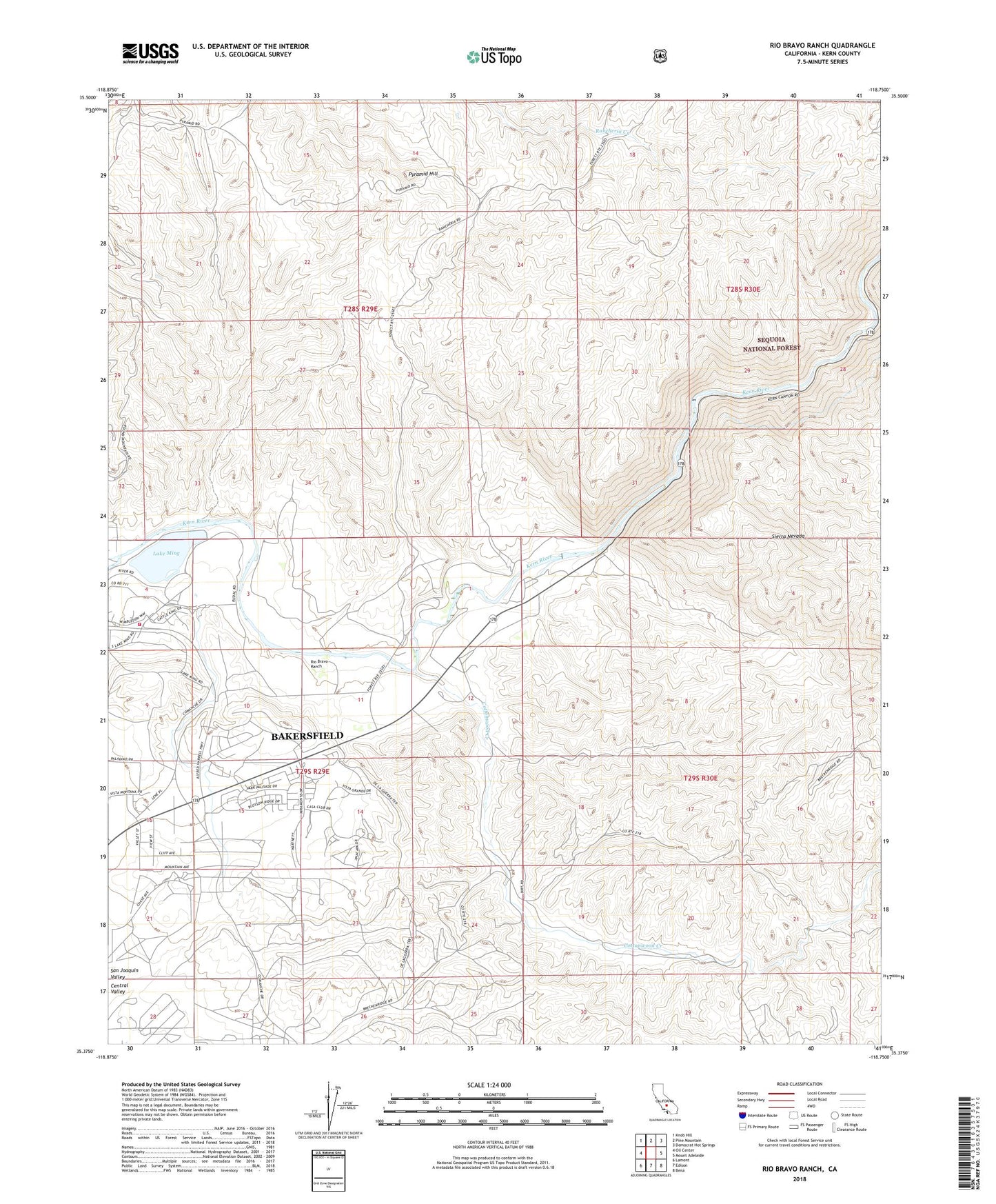
Rio Bravo Ranch California US Topo Map
Couldn't load pickup availability
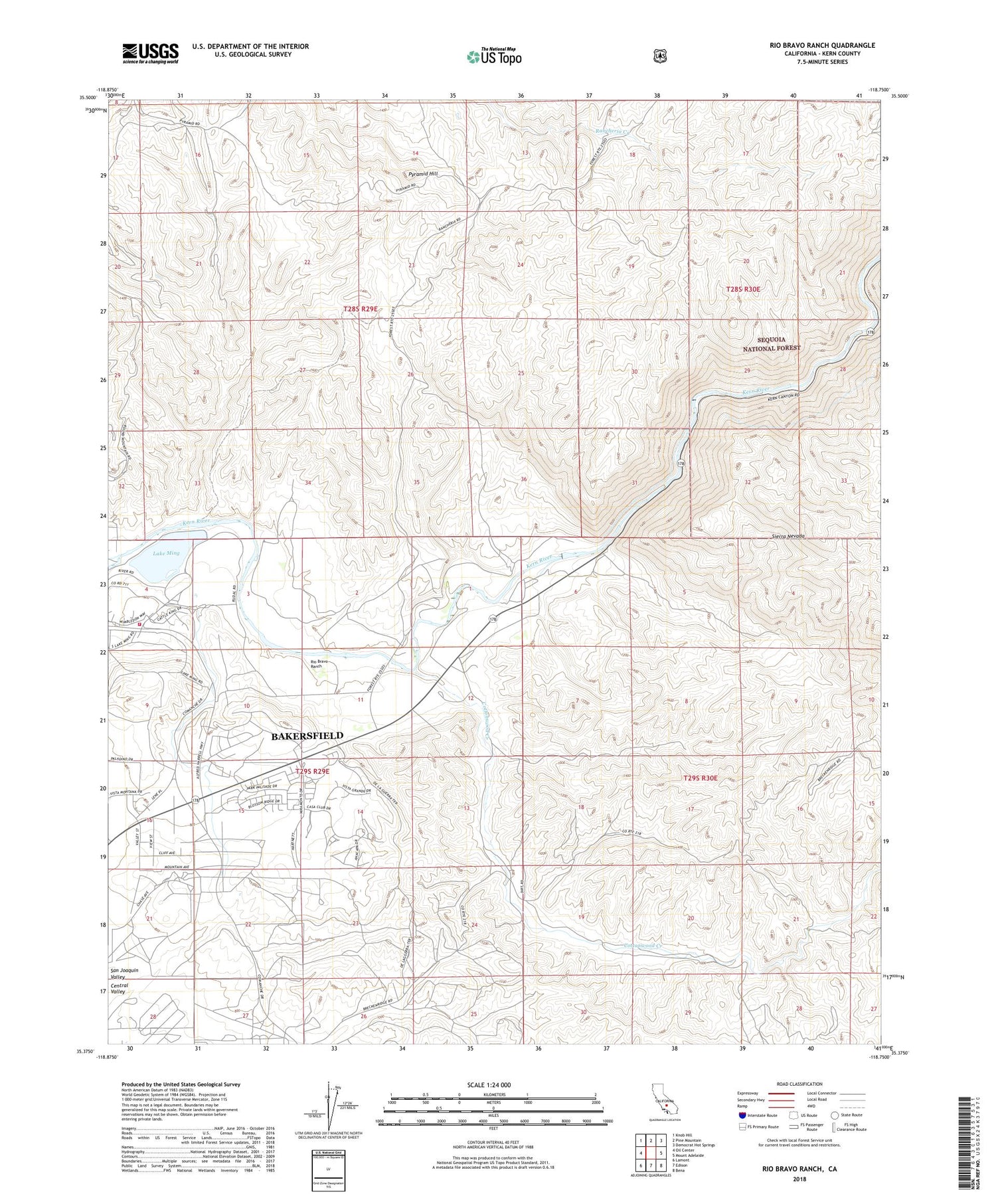
Also explore the Rio Bravo Ranch Forest Service Topo of this same quad for updated USFS data
2021 topographic map quadrangle Rio Bravo Ranch in the state of California. Scale: 1:24000. Based on the newly updated USGS 7.5' US Topo map series, this map is in the following counties: Kern. The map contains contour data, water features, and other items you are used to seeing on USGS maps, but also has updated roads and other features. This is the next generation of topographic maps. Printed on high-quality waterproof paper with UV fade-resistant inks.
Quads adjacent to this one:
West: Oil Center
Northwest: Knob Hill
North: Pine Mountain
Northeast: Democrat Hot Springs
East: Mount Adelaide
Southeast: Bena
South: Edison
Southwest: Lamont
This map covers the same area as the classic USGS quad with code o35118d7.
Contains the following named places: Ant Hill Oil Field, Bakersfield Fire Department Station 10, Cottonwood Creek, Father Garces Monument, Kern R County Pk 735 Dam, Kern River Golf Course, Lake Ming, Peachacho Creek, Pyramid Hill, Rio Bravo Airport, Rio Bravo Equestrian Center, Rio Bravo Ranch, Rio Bravo Ranch Golf and Tennis Club, Tarina, Tarina Census Designated Place, ZIP Codes: 93220, 93306