MyTopo
Firebaugh California US Topo Map
Couldn't load pickup availability
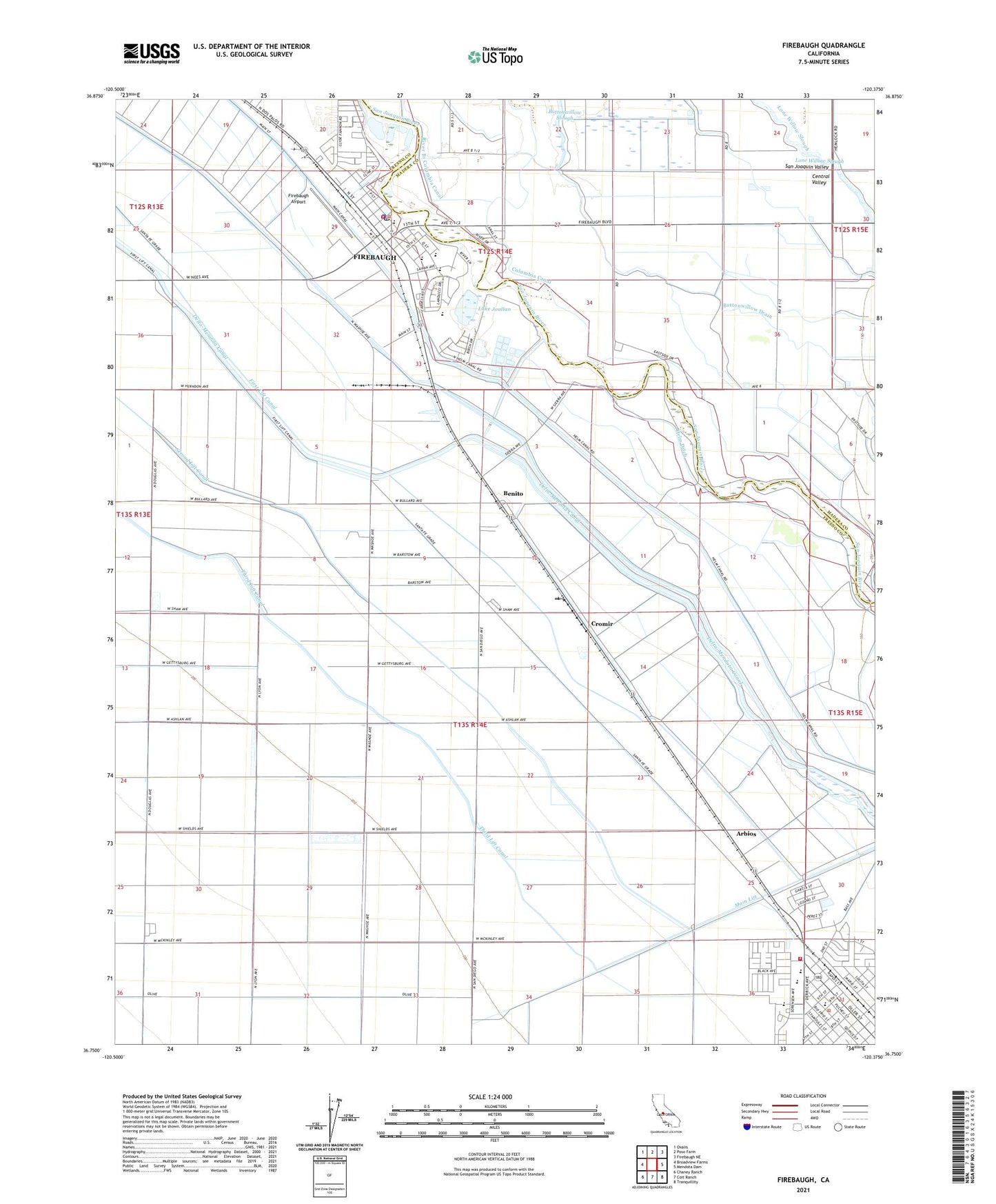
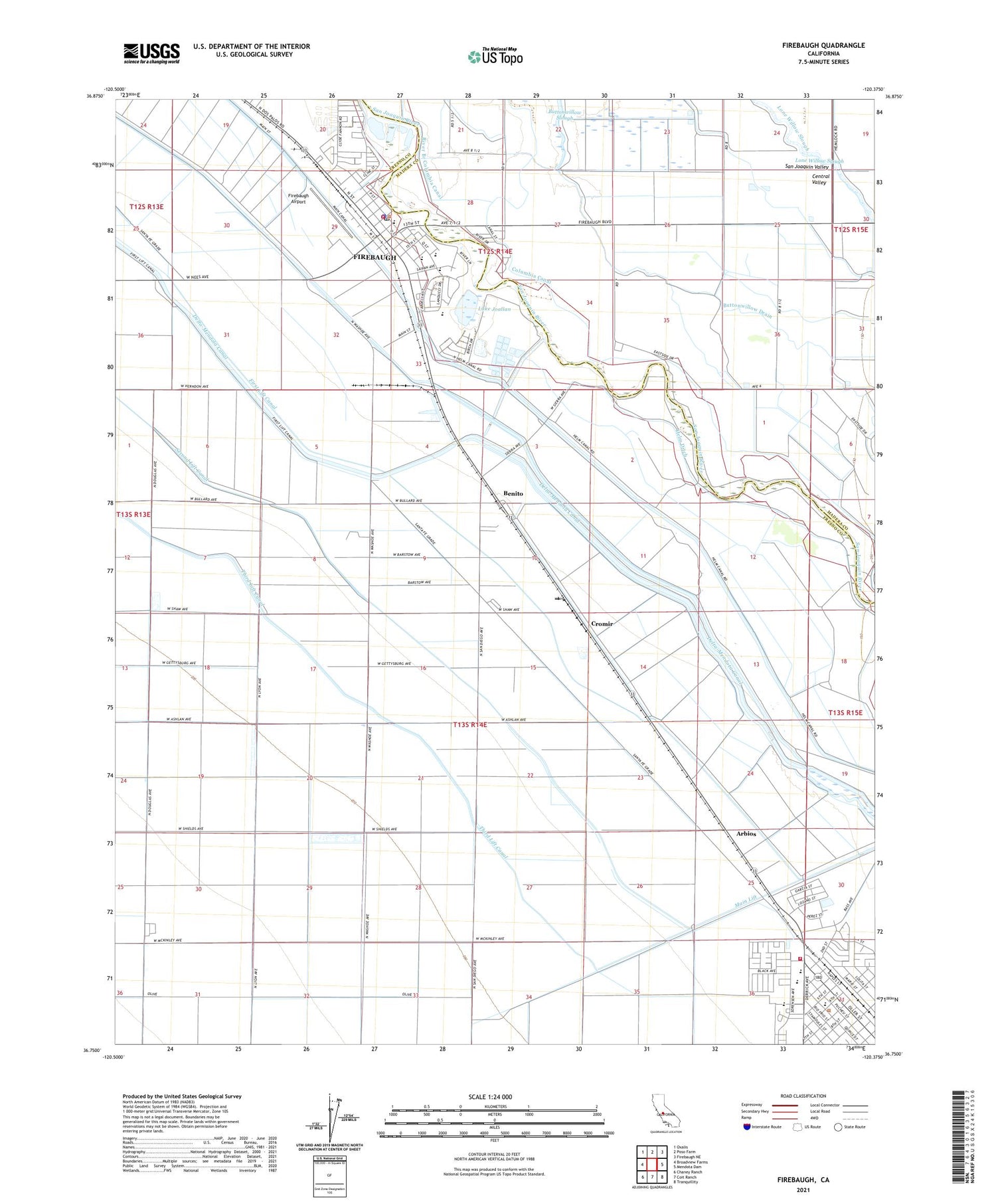
2021 topographic map quadrangle Firebaugh in the state of California. Scale: 1:24000. Based on the newly updated USGS 7.5' US Topo map series, this map is in the following counties: Fresno, Madera. The map contains contour data, water features, and other items you are used to seeing on USGS maps, but also has updated roads and other features. This is the next generation of topographic maps. Printed on high-quality waterproof paper with UV fade-resistant inks.
Quads adjacent to this one:
West: Broadview Farms
Northwest: Oxalis
North: Poso Farm
Northeast: Firebaugh NE
East: Mendota Dam
Southeast: Tranquillity
South: Coit Ranch
Southwest: Chaney Ranch
This map covers the same area as the classic USGS quad with code o36120g4.
Contains the following named places: Arbios, Arthur E Mills Intermediate School, Benito, Buttonwillow Drain, Buttonwillow Slough, City of Firebaugh, City of Mendota, Columbia Canal, Cromir, Dunkle Park, E C Borboa Gymnasium, Eastside Ranch, Firebaugh, Firebaugh Airport, Firebaugh City Fire Department, Firebaugh Community Health Center, Firebaugh High School, Firebaugh Junior High School, Firebaugh Police Department, Firebaugh Post Office, Firebaugh Wasteway, Firebaugh-Las Deltas Adult Education School, First Lift Canal, Fresno County Fire Protection District Mendota Station 96, H M Bailey Primary School, Helm Ditch, Helm Drain, Helm Ranch, Jess Gill Park, Lake Joallan, Lone Willow Slough, Los Deltos Ranch, Los Deltos School, Main Lift, Maldonado Park, McCabe Elementary School, Mendota, Mendota City Hall, Mendota Community Center, Mendota Continuation High School, Mendota Post Office, Riverview Alternative School, Rojas Pierce Park, Saint Joseph School, Washington Elementary School