
MyTopo
Tranquillity California US Topo Map
Couldn't load pickup availability
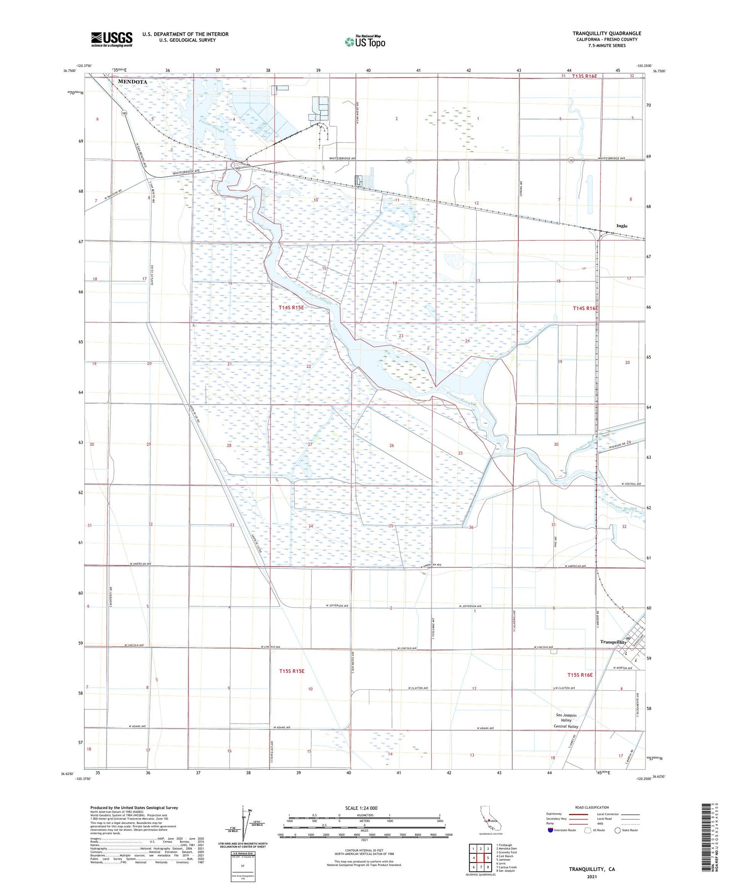
2021 topographic map quadrangle Tranquillity in the state of California. Scale: 1:24000. Based on the newly updated USGS 7.5' US Topo map series, this map is in the following counties: Fresno. The map contains contour data, water features, and other items you are used to seeing on USGS maps, but also has updated roads and other features. This is the next generation of topographic maps. Printed on high-quality waterproof paper with UV fade-resistant inks.
Quads adjacent to this one:
West: Coit Ranch
Northwest: Firebaugh
North: Mendota Dam
Northeast: Gravelly Ford
East: Jamesan
Southeast: San Joaquin
South: Cantua Creek
Southwest: Levis
This map covers the same area as the classic USGS quad with code o36120f3.
Contains the following named places: Alkali Sink Ecological Reserve, Borland Ranch, Fresno City, Fresno Slough, Ingle, Janetski Field, Mendota Waterfowl Management Area, Tranquility High School, Tranquillity, Tranquillity Census Designated Place, Tranquillity Elementary School, Tranquillity Post Office, Whites Bridge, Yearout Ranch, ZIP Code: 93668


