MyTopo
Rocky Hill California US Topo Map
Couldn't load pickup availability
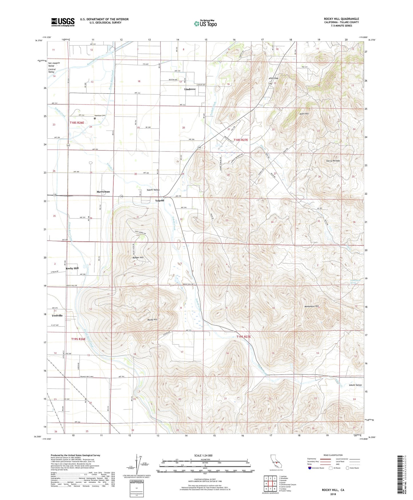
2021 topographic map quadrangle Rocky Hill in the state of California. Scale: 1:24000. Based on the newly updated USGS 7.5' US Topo map series, this map is in the following counties: Tulare. The map contains contour data, water features, and other items you are used to seeing on USGS maps, but also has updated roads and other features. This is the next generation of topographic maps. Printed on high-quality waterproof paper with UV fade-resistant inks.
Quads adjacent to this one:
West: Exeter
Northwest: Ivanhoe
North: Woodlake
Northeast: Kaweah
East: Chickencoop Canyon
Southeast: Frazier Valley
South: Lindsay
Southwest: Cairns Corner
This map covers the same area as the classic USGS quad with code o36119c1.
Contains the following named places: Allen Gap, Allen Hill, Badger Hill, Dahlem Ranch, Dry Creek, Dumtah, Foothill Ditch, Gassenberg Spring, Gill Ranch, Grey Rocks, Hamilton Cemetery, Hamilton Ranch, Kaweah School, Lind Cove School, Lindcove, Lindcove Census Designated Place, Merryman, Monument Hill, Powell Ranch, Rocky Hill, Rocky Hill School, Sides, Tooleville Census Designated Place, Toolville, Yokohl, Yokohl Valley, ZIP Code: 93221